Friday, July 27, 2012

Four Peaks road re-opens

With the occasional shower and the higher humidity of monsoon season, the forest roads are open again. I felt like getting some pictures of saguaros so I drove out Four Peaks road. There were scattered clouds that made the landscape look interesting with shadows.


Four Peaks.


The red stripes are where leftover fire retardant was dumped.

I wanted to get away from the road (even though I didn't see anybody else out there) so I wandered in a northerly direction. I came across a crested saguaro just a few feet from the road. It's a young one.


Maybe it's holding it's arms up in surrender to the knuckleheads that tried to cut it down.

I found a couple of "nests" that consist of cholla sticks and cholla balls piled into a mound. I'd sure like to know what built those.


A prickly nest.


There are a lot of nice looking saguaros out there.

The high that day was 110. It felt a little warm when I started out but it wasn't bad. By the time I started back, the sun was low enough that it didn't feel hot. I think maybe I've been hiding from the heat too much this summer.


A very strange looking saguaro. They usually aren't so thick at the bottom.

Click below to see all of the pictures.

2012_07_26

Tuesday, July 24, 2012

Cottonwood Canyon road

I went out for a drive again on Sunday. I got an earlier start than on Saturday but the monsoon rains were already well underway. I drove through a heavy shower near Superior and then doubled back to drive Mineral Mountain road again. Mineral Mountain road was dry. Shortly after I got on it, I could see some dust being kicked up far to the west.


A haboob that looks like it's headed for Queen Creek. It's about 20 miles away from me.

I drove around Dromedary Peak for a while hoping to get some good cloud or mountain pictures but the clouds were too thick, so I headed south. The road was in pretty good shape most of the way with just the occasional rough spot. I came to a fork in the road and sat there for about 5 minutes trying to decide which way to go. I probably could have saved a lot of time by flipping a coin.

I took the fork that went west, which happens to be Cottonwood Canyon road. It isn't real impressive with regards to the canyon. It had been graded recently and was in very good shape. Before too long I came to a trail register and some plaques. There was a fancy trail out in the middle of nowhere. The register was unusable. I think a kid had been hanging on the open lid and had bent the hinges. It wouldn't close and enough rain had gotten in there to mess up the paper.


An official trail.

It turns out that there are some petroglyphs there. The very short trail goes down to where they are. I felt a little silly with my big backpack on that little trail but I was the only one there. Hey, I needed it to carry water and the PN-40. I drank a lot of water on that short hike, too. It was only about 90 (very cool for July), but remember all that rain? It was humid. Sweating doesn't cool you off, so your body sweats more to try to cool off, and pretty soon you are hot and soaking wet.

I had to walk along some slick rock at the bottom. On a downhill slope, I slipped. Every time I've done that before, I landed on my butt. Somehow, I managed to fall forward this time. As I watched the rocks below me accelerating towards my face I wondered if my camera would get smashed, if I would break a wrist, or if I might even smack my head on the big rock a little further ahead (after breaking my wrist and smashing the camera). I put my hands out and stopped easily. No damage to anything. Not a bruise, not a ding. All that worry for nothing. I was pleased. I also made a mental note to be more careful on slippery rocks.


Some petroglyphs.

From down in the stream bed, I saw a bright orange rock perched on top of a boulder up the opposite bank. Somebody had put it there, so I had to go see why. From the orange rock, a faint trail went downstream, above the petroglyphs. I don't know why. I didn't see any petroglyphs up there, or anything else that looked terribly interesting. I did see a Harris's Antelope Squirrel, though, and it stayed on a rock eating while I took pictures.


Harris's Antelope Squirrel

The rest of the drive out to 79 was uneventful. It looks like that vicinity is very very popular with ATV and dirt bike riders. Large areas on both sides of the road were completely bare of vegetation. Click below for all of the pictures.

2012_07_22

Sunday, July 22, 2012

Mineral Mountain Rd

We had a pretty good chance of rain yesterday. Around 50%. By noon the sky looks as it usually does under these conditions. Clear blue sky over the Valley with clouds in the distance to the north, east, and south. Some of the clouds looked photogenic and the closest ones were to the east, so that's the direction I went.


The Superstition Mountains are in shade.

I went east far enough that I was shaded by clouds now and then, which was near Queen Valley. It was only about 100 out there, too. I might have gone for a hike but I had to get back to town by 5, so I just drove around taking pictures.


All of my pictures of Dromedary Peak seem to have clouds in them.

Before long, I could see some storms building to the south and east. That was another reason to not stay out there too long. I didn't want to get trapped by flowing washes or muddy roads.


There's a storm building back there. Right now it's mostly hidden by the fluffy clouds in the foreground.


Twelve minutes later and the top of the storm is easily visible. Looks dark and rainy beneath the cloud, too.

The weather was still nice out there by the time I left. Just a few minutes down the road, I looked in the mirror and it was mostly black behind me. The sun was shining on Picketpost Mountain and it really stood out.


Brightly lit Picketpost Mountain with a backdrop of stormy weather.

The storms that I was watching form out there pushed some dust into the Valley. It was some of the thickest dust I've seen. I made a short video.


Dust storm hits Mesa.

Click below to see all of the pictures.

2012_07_21

Wednesday, July 18, 2012

Black Canyon to First Water Creek

Sunday was a pretty day, and it wasn't very hot (probably below 100). I felt bad about not going hiking. On the other hand, with the dew point over 60, hiking didn't seem like a really good idea. Anyway, I felt so bad about being lazy that I did go for a hike on Monday, despite the mugginess. I went down Black Canyon to First Water Creek, to see if there was any water down there after Saturday's torrential rain. Well, it was torrential in some places. I could tell that there had been decent rainfall out there.


People that drive out to Canyon Lake may recognize this view.

The first thing I noticed is that millipede season is here. I saw a small one and took a picture, then saw a larger one and took a picture, then saw a larger one and quit taking pictures of them. I probably saw about 10 of them, which is a lot for such a short hike. They must have been out and about because of the recent rain.

A smallish millipede.

The sun was bright and the canyon was muggy, without much of a breeze. But it was a beautiful day. Also, wonderfully unbelievably, there were no gnats! Being hot is much more tolerable without gnats.


There were puddles, so I had to get pictures of reflections.

I was the first person to go down there since the rain. There was water trickling slowly through some puddles and spending at least half of its time underground. It seemed that I had to stand in some precarious positions to get any pictures and was wobbling around on rocks and trying not to fall in the puddles. It's tough to take pictures for HDRIs when you are having trouble standing still, but they all turned out OK. I think that's probably attributable to the ability of Photomatix to compensate for camera movement.


I like this one.

I kept having to stop to cool off on the way back up Black Canyon. Fortunately the sun was low enough by that time that I had lots of shade. Then I got sidetracked to look at some fresh pieces of a car scattered on the south side of the canyon. It must be quite disheartening to realize that you've left the road and are plummeting helplessly down a steep, rocky cliff. On the other hand, if you're as drunk as some of the people that do that must be, maybe you're just thinking about complaining to the county about the potholes in the road. Anyway, after checking out the car pieces, I didn't feel like taking the down and then back up route to get to the truck. Instead, I decided to follow the scrape marks left when the largest piece of the car was pulled out of the canyon. If a car was pulled up there, I should be able to climb up there, right? As it turns out I was able to get to the road that way, but it wasn't easy. I need to add to my list of hiking rules that I shouldn't try to follow cars out of canyons, because they have help that I don't have. Click below to see all of the pictures.

2012_07_16

Sunday, July 08, 2012

Bishop Creek treasure hunt

It was looking like it wasn't going to cool off enough for me to get some photo point pictures, so I decided to try something different. I went early. I left the house around 6, but it takes a long time to get all the way out there. The photo points I was going after were on a little-traveled road (my tracks were the only tracks on it) that was very rough, so it was slow going the last couple of miles.


A funny looking cloud on the way out there. This was taken on Bloody Basin Road, which is in very good condition.

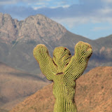
The rough road was at an elevation of almost 5000 feet and I went through some pine and juniper forests. It was just 84 degrees in the shade. The places I took pictures was much sunnier and warmer, though.

At the first place I stopped to take pictures, I decided to back the truck off the road. I know, why bother when mine are the only tracks out there. Well, experience has taught me that the quickest way to find other people out in the middle of nowhere when you haven't seen anybody for hours is to block the road. You will immediately find people and they will be in a big hurry to get somewhere. Anyway, I was on a slight incline. Barely enough to think about. I started backing up and the tires started spinning. I went forward a little and the tires spun. I tried to go back and the tires spun. It was ridiculous. I couldn't go forward or backward. I did manage to rock the truck a little and it backed off the road. I took the pictures and drove back up the incline without any trouble.

I couldn't see the road to the next place I needed to go. That's because it crossed Bishop Creek and nobody had been on it since the last time the creek flowed, which looked like it was weeks ago. Even if I had known where the road was, I wouldn't have driven on it. Lots of soft sand. I did know where it was when I hiked to the photo point. It was only about a quarter of a mile away. The temperature wasn't too bad. It might have even been comfortable if you could stay out of the sun. Except for one thing.

Actually, lots of things. Not gnats this time, but flies. Small, striped flies. They were noisy and kept buzzing around my head and landing on my hands. One eerily quiet one kept landing in the center of my sunglasses. They didn't bite or sting or anything like that. They just drove me nuts. I know, it's a short drive. I should have put my gnat net on. I did spray insect repellent on my ears and hands and arms. Didn't seem to have much effect.


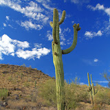
The road to the second photo point. Not much shade.

I had to drive past the place where I almost got stuck to get to the third photo point. The sticky spot isn't very steep, but it's like it's covered in marbles. As I drove up in on my way out, I kept having to back up a little and try again. Took a while.

I didn't make it to a couple of photo points for a couple of reasons. One of them requires a half mile hike in a creek bed. I'm not going to try that in the middle of a sunny day. Also, there were some potential storm clouds starting to form. That area would be a bad place to be if it started raining. If I didn't get trapped by flowing creeks, I probably wouldn't have enough traction to drive on muddy roads. I had enough food and water to spend the night but Sweetums would have been worried, especially since a hiker younger than me just died in the Superstition Wilderness. I was thinking I might get some good cloud pictures, but they didn't get very big before I left.


I've been playing around with making clouds really stand out in pictures. It looks interesting but if you use these pictures as desktops, they get annoying after a while.

Click below to see all of the pictures.

2012_07_07

Monday, July 02, 2012

Too hot, and it's not just me

I went for a drive on Sunday afternoon, thinking that I might take off on some dirt road along the Beeline Highway that I haven't been on before. I thought I might even go for a short hike, though it would be short since the temperature was over 105. The first side road that I came to was closed. So was the next. And the next. I pulled into the Ballantine trailhead parking lot. The trail was closed. You know the fire danger is extreme when even the hiking trails are closed.


Trail closed. It's so hot and dry, your legs rubbing together might start a fire. Actually, it's probably closed because some people like to smoke as they hike.

I'm hoping there will be some interesting clouds to photograph soon. There was one last week but I was in town and didn't have my camera with me. There will be more.

I've been messing around around with some pictures that are a year or two or three old, playing with Photomatix settings. I usually try to keep my pictures looking mostly realistic, but I completely abandoned that. Some of the results are interesting.


These are extreme clouds.


I don't usually like my pictures as black and white, but I like the way this one looks.

Seems like there were some more, but I can't remember where I put them. If I turn out some really good ones, I'll put them on here. If I don't, I'll probably put them on here, too.