Hiking in the Sonoran desert, with photographs of saguaros, lizards, birds, scorpions, flowers, other desert flora and fauna, mountains, rocks, sunsets, etc.
I went back out to the spot near Canyon Lake that I had explored for the first time last week. I was thinking that I would hike down to First Water Creek. Silly me. When I got to the point where I started descending to the creek, it was much steeper and much further than it looked from the top of that mountain / big hill.
It's a scenic area.
Instead of going down to the creek, I wound up going around the mountain. I prefer to call it a mountain because it sounds more impressive to say that I climbed a mountain after work. If you tell somebody you climbed a hill, what are they going to say besides "Big whoop"? Anyway, I was hoping that I would be able to make it all the way round and not have to backtrack.
A stick and a saguaro.
I thought I smelled cigar smoke when I was about 3/4 of the way around. I smelled it all the way back to the truck. On the drive home it seemed that Phoenix had a thick brown cloud that evening despite the breeze. Then I saw the smoke rising from the ground. Turns out the fire is in Laveen, which is southwest of downtown Phoenix. It started in some mulch so it's called the Mulch fire. It's filling the valley with smoke. Visibility was bad today. You can smell the smoke just about everywhere. No, I didn't take any pictures of the smoke. I hope they get it under control soon.
The area around Canyon Lake is quick and easy to get to (for me) and there's plenty of spots I haven't seen there yet. In less than a quarter mile, you can go from someplace familiar to someplace completely new. I parked where I've parked several times before but this time I went to the other side of the road. I've been thinking I need to go over there for a while but just never got around to it.
I'm going in that direction. Could be interesting.
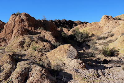
It's kind of a rocky area.
It turned out to be a pretty area. There was a nice view of Canyon Lake. I didn't intend to climb to the top of anything but that's where I wound up.
A view of Canyon Lake.
I could see First Water Creek to the east. I've followed it from Canyon Lake upstream to a spot where a large tinaja blocked my progress. Based on what I had seen there, I didn't think it would be easy to get down to the creek in that area except through Black Canyon. It looked like it would be easy to get to it from where I was, though. I'll have to see if I can follow it downstream to that tinaja some day.
I think this is a chipmunk but I can't figure out what kind.
When I was close to the top, I thought it looked like I was in a good place to take a 360 degree panorama. Well, the view was good. The footing wasn't. It was rocky and slanted and was right next to a 50 foot vertical drop. I didn't have the tripod (of course), so I had to keep an eye through the view finder to keep each shot lined up with the previous ones. Rotating slowly while looking straight ahead through a view finder or rough ground next to a cliff is a little scary. The panorama came out perfect, though. The top of the hill had a nice, large flat spot on top. I took another panorama from there and it was much easier. I put that one on Panoramio.
Does this look familiar? I seem to take a lot of pictures of it.
I almost forgot to mention the gnats. That's because there weren't any. Well, I might have seen 2. The wind was blowing about 15-20 mph and I think all the gnats were grounded. I didn't even see any when I was behind rocks that blocked the wind. That was really nice. The wind also kept me cool. It was in the low 90's but I was very comfortable even when going uphill. The only downside to the wind was the dust in the air, but visibility was only a little lower than normal.
I did a few things differently for this hike. I studied Google Earth carefully around the area I intended to explore. I noted possible routes to my destination. I picked 3 potential parking spots. I ate a good lunch (thank you, Sweetums!). I packed plenty of water. I carried backup GPS batteries (for geotagging pictures; I never rely on it to get me somewhere). I wore my gaiters and had my gnat net (but it wasn't necessary). I got an early start so I wouldn't be racing sunset. The only thing I didn't have that would have been nice to have was my walking stick. I keep forgetting that I want to bring it along to poke around in tall grass before I walk through, to flush out the rattlers. I rarely come across rattlers, but it only takes one to spoil your day.
My destination was the tributary I had been to on May thirteenth. This time I wanted to enter the tributary further upstream, above the tinaja that had stopped my progress last time. I started my hike at some roads in what must have been part of an old mine or quarry right next to Apache Trail.
Old road at the beginning.
As I walked along the chalky road, I noticed some clumps of fur laying around that reminded me of the clumps of fur I find around the house when the cats transition from "I'm just playing" mode to "I'm going to rip you to shreds" mode (and they go screeching through the house knocking over furniture and people). A few feet further along, I found most of Fido. The fur matched. I wondered if somebody had gotten tired of him and left him out there to fend for himself. I don't think domesticated animals can last more than a few days on their own in the desert.
What's left of Fido.
My planned path would take me down to Willow Creek and then up a small wash on the other side. There was a trail of sorts on the way down. It was hidden by grass in lots of places. It was mostly easy walking. It goes by a mildly interesting stone arch.
Short video of the stone arch. It's hard to get pictures of these things.
Then I started up the other side. It wasn't very steep, but it was rocky, with lots of cat claw and cholla in the way. The sun was still high in the sky and it was uphill, so I made lots of stops. Finally, I got to the saddle and had a view of an area that probably very few people have beheld before. That's always exciting. It looked mostly ordinary. I know that not many people go there because there were no trails, no shotgun shells, and no cairns.
A sight that few have seen. I guess folks don't consider it to be worth the effort to come out here for this.
The descent to the wash that was my destination was quick and easy and painless except for something poking me in the back of my foot. Right away I saw something that made the hike worthwhile for me.
Well, I thought it was cool.
There was a stick near the balanced rock and a dragonfly on the stick. I sat down to get pictures of the dragonfly. It flew off after a couple of pictures so I looked down at my shoe and saw that the gaiter had crept up, leaving my sock exposed. My sock and the lining of my shoe were full of grass seeds. Dad gummit.
Dragonfly and rock.
After I got home and was looking through pictures I realized that this rock looked like a guy riding a horse. Well, rocks are sort of like clouds; light and fluffy. Wait, no, that's not it. If you stare at them long enough you will think you see something you recognize in their randomness. There are lots of hoodoos in the Superstition Mountains that resemble people from the right angle at the right time of day. There's an Indian legend that the first people to live in this area were too haughty so the gods turned them to stone, hence the hoodoos. Anyway, this balanced rock reminds me of a guy on a horse, so I have named it "The Rider" so I don't have to keep saying, "You know that rock that looks like a guy on a horse...?"
The Rider. His right arm is hanging down by his side. He has a bedroll tied behind the saddle. His head is turned slightly to the right. He's sick and tired of eating canned pork and beans for three meals a day.
I walked slowly down the wash because there was so much to see all around. I came across a lizard with a stubby tail. Every time I see one of these I remember an article that showed a strong correlation between the ease with which lizards shed and regrow their tales and the density of venomous reptiles. Lots of rattlers means lots of lizards re-growing their tails, and vice versa.
There are lots of stone arches in this area, or maybe they should just be called "holes through rock".
This is the first tinaja with water (well, they dry up) that I came across. It took a little clambering to get around it.
Rocky landscape.
This looks like an alien wearing a 3 piece suit as he contemplates the extermination of ... something.
The landscape in this area reminds me of Crematoria. Maybe I've watched that movie too many times. I hadn't gone down the wash very far before I came to the tinaja that had stopped my upstream progress on 5/13.
Too risky to try to get past this.
Short video of the area.
Have you noticed that most of my videos are about 36 seconds long? Matches my attention span. Anyway, I sat in the shade enjoying the breeze until I got bored (36 seconds) and started back. I thought about taking an alternate route I had planned to get in there, to get out. They all looked like they would involve too much climbing, though. As I was going past the spot where I had seen the tailless lizard, I heard a buzzing noise. I thought it was a cicada. That's a dangerous thing to think when it's actually a rattler. Wow, the second one I've seen this summer. It was dark in that area and there were lots of twigs in the way and the snake was backing away fast so I didn't get one single decent picture. I really wanted a picture, too, because it had kind of a yellowish tint that I haven't seen before. I thanked him for the song as he continued to buzz under the rocks and moved on.
Short video of the rattler. You can hear it, but can't see much of it.
When I got back to The Rider (you know, that rock that looks like a guy riding a horse), I noticed some holes in rocks there that I hadn't notice when going the other direction. Well, you can't be looking at everything all the time. Anyway, I stopped to rest a while there because I felt strangely tired. I hadn't gone that far but I felt like I'd gone 3 or 4 miles. I thought about going up the slope by The Rider and getting pictures from different angles but decided that would be too much work and I already had pictures from the best angles. Then I proceeded to climb the slope. Well, I had to do some climbing some time to get out of there. I did a lot more than I had planned, though. The view was worth it.
The Rider looks like some rocks from this angle. Fancy that.
You almost can't go anywhere without seeing Four Peaks.
I like this picture because of all the places down there that I've visited in the past few weeks.
Since I was way above my route in, I decided to stay up there hoping the walking would be easier. It was, but then I started worrying about when I would be able to get down. It was pretty steep where I was. If it was that steep when I got to Willow Creek I would have to backtrack, and I was too tired to backtrack. I found a way down and when I got to Willow Creek I saw that it would have been easier to get down there. I'll have to remember that next time.
I know I'm getting too tired when I look at something interesting or pretty and don't take a picture. I couldn't resist this cholla skeleton, so I was OK.
Just after I passed Fido's bones on the way back, I found a dog collar. I also found a belt. Maybe Fido's owner tangled with the same cat. I would say that I don't remember reading about somebody being missing in that area, but that would be silly since I only read the paper on weekends. It was good to get back to the truck. I don't know why I was so tired. I only hiked 2.2 miles. My GPS track says I climbed and descended about 1000 feet, which would make me tired, but I don't think that's accurate. The bad satellite view from the canyon probably caused a lot of that supposed up and down. Click below for all of the pictures.
In looking along Willow Creek on Google Earth, I saw an area that looked like it had to be interesting. It's actually a tributary of Willow Creek and it looks like there is a narrow canyon there. I wasn't exactly sure how I would get to it, but that's what makes this interesting.
I had to cross Willow Creek. This is looking back over Willow Creek, but if you don't know where it is you can't tell where it is. This is part of how people get "lost" in the desert.
The sun sets about 7:20 these days. That's enough time for a decent hike close to home. By the time the sun is setting later, it will be too hot to hike immediately after work so there won't be any more daylight to use for hikes. But I digress. I got out there as quick as I could and headed for the hill I knew I had to climb. I had to climb further than I though I would but the scenery was fantastic. At one point I decided that I needed a 360 degree panorama. I should really carry a tripod along for those. I didn't hold the camera at quite the same level all the way around and the stitching software got confused. It produced an interesting result.
This is what Microsoft ICE thought my panorama should look like. I like it better than the correctly stitched panorama produced by the Canon software.
There were gnarly rocks all over the place.
It was fairly easy to get to the canyon that was my destination. It was more interesting than I had thought it would be. I could only explore a short section of it, though. I was blocked in both directions by sudden drops and tinajas.
Just entering the creek bed.
I felt a little claustrophobic here. Maybe it was the humidity. Sunset was approaching and the breeze had stopped blowing.
Rock climbing would be required to get around this. Nothing requiring equipment or great skill, but one little slip could spell disaster.
A short video at the tinaja.
I'll have to see if I can find a way around that tinaja at the upstream end. I'll probably have to descend to the stream bed further up stream. Much further up stream. It's too steep on the right bank for a long way. Maybe. It's hard to tell on Google Earth and my DeLorme topo maps don't have enough resolution. Well, you probably can't get a topo map with 4 foot intervals. Anyway, after being stopped going upstream, I headed downstream. I hadn't gone far before another steep drop and tinaja blocked my progress.
Short video of the downstream tinaja. I need to figure out how to do a better job of this. The videos are shaky so I let YouTube smooth them out, but then they have strange distortions.
I started climbing out of the wash then, thinking I would head back to the truck. Instead I found a way around the downstream tinaja. I could see that I would be stopped again soon by a much larger drop and so I headed back to the truck from there. Pictures of things like that usually can't show what it's really like and that's why I've been making videos of them. The video of that last drop was terrible (and you thought the other two were bad!) so I didn't upload it.
May 2 was one of those bad gnat days. Not only that, but I didn't put my gaiters on because I didn't think there was much grass where I was going. (I was wrong about that.) The gnats still have a preference for my right forearm so I killed at least a couple of dozen there. It was a beautiful late afternoon but it was hard to enjoy with bugs in my eyes. Every time I bent down to pick grass seeds out of my socks, I could see 30 or 40 gnats hanging around my legs. They aren't annoying there, but they were just working their way up to my head.
Several of the pictures I took have gnats in them. They're out of focus, of course, since they were right in front of the camera.
OK, no more BMWing. I went for a short hike over to the location of the tinajas I had seen from across Willow Creek a few weeks ago. At that time, I thought they were in a tributary of Willow Creek. According to DeLorme maps, they are in Willow Creek. Anyway, I got close to where the tinajas were and wanted to hike down to them, but I just couldn't stand the gnats anymore.
There's a tinaja there that I hadn't seen before.
I found this as I hurried back to the truck.
We had some company over the weekend and the weather had cooled off a little by the time I got back out there. It was an absolutely gorgeous day. I carried my gnat net in my pocket but the gnats weren't bad enough to put it on.
Someone was using the corral.
I made some HDRIs from single RAW photos. I like the way they turned out.
The bed of Willow Creek was mostly solid rock where I entered it.
I didn't go very far down Willow Creek before I got to tinajas I had seen from the cliff a couple of weeks ago. There was no way around one of them and even if there had been, there was a large drop right after it. I couldn't go any further in that direction.
Sometimes it's hard to take pictures of these things, so here's a video.
In Willow Creek.
I went up on a cliff above the tinajas next. This is a view of them from above.
There were some nice fluffy clouds around. The rocks look kind of extreme in some of the HDRIs but I was mostly interested in getting nice looking clouds.
Nice view of Four Peaks.
Here's a view of the tinaja by which I had been sitting a couple of weeks ago.
I couldn't remember exploring Willow Creek upstream of this area, so that's what I did next. I started out in a familiar area and before very long I got to a spot where I could remember turning back because it looked like the scenery was getting boring.
I've been here before.
I think this is a pretty area.
This is close to where I had turned back before.
The scenery soon got very interesting again. There were several tinajas, too. I spent a few minutes at one of them figuring out how to get around it and how to get back. I didn't want to drop down somewhere that I wouldn't be able to climb back up.
It was almost too dark for pictures in parts of the creek bed.
Tinaja from upstream.
Same tinaja from downstream.
A short video of one of the spots where I almost had to turn back.
I bet there are lots of animals along here at night.
I kept thinking that I should turn back because the sun was getting low and there were several places where a wrong turn could mean spending a lot of time wandering around in the dark. Well, I could follow GPS breadcrumbs back, but relying on high tech stuff is risky. It breaks too often. I decided to go around just one more bend in the creek and when I did, I realized I was in the spot I had been in a couple of days earlier. Rather than take a chance of making all the right turns on the way back, I took the easy route to the road and then it was an easy stroll back to the truck.
You can see that I move a lot faster when I'm on pavement and it's too dark for pictures.