Sunday, March 22, 2009

Second Water Trail

Ever since that long hike many years ago, I've thought about going back to some of those trails, especially the second water trail. That was the last leg of my journey and I was pretty tired by then. I wanted to get a look at it when I wasn't exhausted. So Saturday I hiked down to Boulder Meadow. According to my Superstition Wilderness map, it would be 7.4 miles round trip. That's a long way for me, but I remembered that there was not a lot of elevation change involved.


I was a little surprised at how many people I encountered along the trail. I saw over 40 during the day. Most were within a mile of the trailhead. The last 3 that I saw were camping at Boulder Meadow. I did not see anybody from there all the way back to the trailhead, probably because it was so late and most people know better than to hike then.


Hikers near the trailhead.


I put 133 pictures on the web album for this hike. However, I will probably never see the first picture I took on the trail. Can anybody figure out why?


I saw a lot of lizards and got pictures of a few of them.


There are two lizards on this rock.


Blue polka dots.


This one must be standing on a hot rock.


This one has some colorful markings. It's a shame he wouldn't pose out in the open.


I also got pictures of a red tailed hawk.


Some parts of the trail looked a little different than I remembered them.

I remember this area as being covered with giant chollas. I don't remember the mesquites and palo verdes.


There are a lot of chollas.


There were lots of flowers all over the place.


I was just thinking how nice it was to be able to walk along and not have to watch where I put every single footstep when I got to the rocky part of the trail.


I think this is why my feet hurt today.


Magnets stick to these rocks.


I eventually got to a spot where there were puddles of water in the creek bed. As I approached the water I heard splashing noises, but I couldn't see anything. Not even ripples. I did finally see what was making the splashing noises, though.


Can you find the frog in this picture?


Frog eggs.


There were toads, too.


I finally got a picture of one of the frogs.


Here's an unusual looking animal.


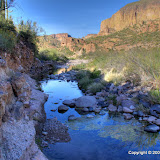
The intersecting creek at Boulder Meadow had lots of water flowing through it.


I had a snack as I listened to this "waterfall".


I got several more pictures of the shy frogs here.


I was in a hurry on the way back, so I didn't take quite as many pictures. I did get some nice sunset pictures.


At the trailhead, there is a log book for visitors. One purpose of the log book is so rangers can tell if somebody went out but didn't come back. I don't know if it's really used for that, though. Anyway, when I got back to the trailhead, I saw that somebody had signed me out at 2:30. Good thing nothing happened to me.

2009_03_21

Thursday, March 19, 2009

First Water Creek trailhead

Several years ago (it seems like a long time ago, but it has to be less than 5 years), I went for a long hike on some trails in the Superstition Wilderness. I think I covered 14 miles that day. I remember that I was really happy when I got back to the trailhead. I haven't hiked out there since then, except for a very short hike today. The reason is that you had to pay $4 to park at the trailhead and I'm a tightwad. Why pay money to hike when there are beautiful places to hike for free everywhere you turn out here?


I learned recently that there is no longer a fee to park there. I decided to take a short hike down the trail to see if it looked like I remembered. The rocks I trudged over for the last quarter mile back to the truck looked exactly like I remembered them. The rest of the scenery was much prettier than I remember, though. Maybe the late afternoon sun and the fact that it was much cooler this time made it prettier. I'm going to have to go back there some more.


The trailhead. The parking lot is pretty big.


The beginning of the trail. That's nice.


I saw lots of flowers.


I climbed a hill near the trail to get a better view of my surroundings.


Click below to see all of the pictures.


2009_03_19

Wednesday, March 18, 2009

A quiet place

The days are getting long enough that it's possible to go for a short hike after work. The past two hikes I went on, near Canyon Lake, were near a road (Apache Trail) that is very popular with bikers. There's the constant thumping of Harley's and the whine of crotch rockets. After work on Wednesday I needed to go someplace quiet, so I drove out to the middle of Bulldog Canyon and went for a short hike there. On the way in, a guy passed me on his way out. That was the only other person I saw there. Boy, it's nice to have several hundred (or maybe it's several thousand) acres of desert to yourself to help you unwind after a stressful day.


I didn't hike far, because there wasn't much light left. I just wandered a little ways and took a few pictures.


I see lots of these beside roads, but this is the first time I remember seeing them where I could get a picture.


The first hedgehog cactus flower of the season.


My truck is the only vehicle out there.


Stewart Mountain, but you should know that by now.


On the way back to the truck I spotted an unbroken Michelob bottle. I reached down to pick it up and hurl it against a rock to smash it to smithereens. Just kidding. I took it home and put it in the recycling bin, but that doesn't make a very interesting story. Oh, but there was something that made it mildly interesting. When I reached down to pick it up, I got a cactus thorn under the fingernail of my middle finger. Yes, hiking in the desert is dangerous. I refrained from pushing the 911 button on my SPOT, though. The thorn is still there. I figured it would turn red and swell up today and then I'd be able to get it out just by squeezing it, but it didn't. Must not be very deep. It would do more damage to dig it out so I'm going to leave it there unless it gets too painful to type.


BC_2009_03_17

Saturday, March 14, 2009

Near Canyon Lake, again

This morning I was thinking about how, when I drive by the lake, I mostly look at the lake and not in the other direction. I suppose one reason for that is that when you look away from the lake, you are frequently looking at a rock wall. Anyway, I decided to go explore what I seldom look at. Also, I figured that if I wanted to get some pictures of the lake, the sun would be behind me.


First, though, let me backtrack a little. When Kyle and I were on our way back from Piestewa Peak yesterday, I pointed out how the clouds to the north and east reminded me of monsoon clouds. Monsoon season isn't for another 4 months, though. There were more clouds today, and they looked even more like monsoon clouds. There were some big clouds over the Superstitions, and I could see a little rain far to the north and east. I was glad I was headed towards Canyon Lake; I should have some nice clouds for my pictures.


I stopped near Goldfield Ghost Town to get some pictures of the Supes on the way out there. I haven't done that for a while.


The Supes with puffy clouds!


As I started uphill, I wondered if the humidity would be high enough to be bothersome, but it didn't seem to be. Either that, or I was moving too slow to work up much of a sweat. It seemed to take a long time to get high enough that pictures of the lake would not be dominated by power lines.


I saw a lot of lizards. That made me a little nervous. If there are lots of lizards out, there are probably lots of snakes out, too. Since I was off-trail, I sometimes had to go through plants that hid the ground. Well, if I passed by any rattlers, they ignored me.


This lizard came out of hiding to pose for a picture.


There were some nice clouds around. I took some pictures just to get the clouds.


There were a lot of flowers. I finally got a picture of globe mallow with lots of flowers that wasn't next to a road.


I found a stone arch. I probably pass by stuff like this (and rattle snakes) all the time without seeing them because I'm so intent on watching where I'm going.


Finally, a good use for stereo images.


I took a slightly different route down than up. I was grumbling about all the plants I was having to push through when I spotted some pretty pink flowers. Well, all the catclaw scratches might be worth it. I had to crawl under a tree to get to a spot where I could get decent pictures. It turns out that the flowers are on a very strange (to me, anyway) plant. Look at the leaves.


The stem goes through the center of the leaves.


I saw a plant like that once before, up on top of the Superstitions. I sure would like to know what it is.


I continued pushing through bushes and weeds and bleeding from catclaw acacia scratches and not too much further down that wash I spotted another plant with stems through the center of it's leaves.


One leaf per stem, I think.


The clouds were great. I like how they make the pictures look and when I got to the top of the ridge I was climbing, I had some shade and a nice breeze to cool me off.


Canyon_Lake_2009_03_14

Friday, March 13, 2009

Piestewa Peak, sort of

Kyle wanted to try to get pictures of downtown Phoenix with the sunset in the background again today. He thought Piestewa Peak might be a good place from which to do that. We went out there and found out that it's almost due north of downtown. Oops. Still, it was good to go out there. I've never been there before.


We were just starting up a trail and Kyle said something about not getting to the top before sunset if I kept walking like a girl, so I sped up. It wasn't too long, though, before he said we were high enough. I guess he's gotten a little out of shape playing those computer games.


The mountains there are pretty, but I didn't get any good pictures of them. We both took a lot of pictures of downtown.


I took some pictures of creosote flowers.


Kyle drove, so on the way home I was taking pictures of people driving. I like the way this one turned out.


2009_03_13

Sunday, March 08, 2009

Mesquite Flat

As you travel west on Apache Trail towards Tortilla Flat, you can see a dirt road going up the side of a mesa just north of Tortilla Flat. For years I've wondered where that road goes. Once or twice I had tried to follow it, but it can't be seen when you get down to where it joins Apache Trail, and I couldn't figure out how to get the truck across Mesquite Creek (because of cliffs, not water). I finally figured out how to get to that road, though. I hiked up it, though I think I could have driven it. I finally know where it goes. And I'm not going to make you skip ahead to the end of the blog to find out. It goes up a hill and stops. I didn't stop, though. I continued on to the top of the mesa and spent the afternoon wandering around up there.


Crossing Mesquite Creek


For once I had left the house early enough that I had plenty of time to do what I wanted to do. I brought lots of water so I wouldn't have to turn back when I ran low. I brought snacks for when I got hungry. Wow, for once I did it right. Maybe.


The road on the way up.


It was easy to get to the top. No climbing required. No tiptoeing along cliff edges. There was a slightly worn trail all the way up, with the occasional cairn. The trail looked like about 15 people had used it on one day, and some of them had shoes that didn't have very good traction. The scree gave me a little trouble on the way down.


The trail beyond the end of the road.


The route to the top follows a "gentle" slope to the base of some cliffs, then goes left almost horizontally to get to a spot where it's easy to get to the top. That little jog to the left is important.


I stopped here to rest and take in the view for a while.


I was sitting at a high point along the cliffs when some people camping down at Mesquite Flat started shooting a gun. They could have been shooting at a target, or a saguaro, or a cliff. I have seen bullet marks on cliff faces and found flattened bullets at the base of cliffs. I couldn't tell exactly where the shots were coming from and didn't hear them hitting nearby. It made me a little nervous though. I've seen people shooting in the desert, and some of them spray bullets in all directions. So I decided to say something. I yelled, "HEY!", which was immediately followed by another shot. Well, that shot was probably fired before I yelled. We were probably more than half a mile apart. Then there were two more shots fired in quick succession. Was that their way of saying "hey" back? Were they trying to tell me to take cover? I was a little annoyed, then I heard someone yell, "Sorry". Not another shot was fired the rest of the afternoon. That was nice.


Were the shots coming from there?


I found a skull.


I enjoyed being able to take my time exploring up there. I went from one end of the mesa to the other. I took over 300 pictures of mountains, flowers, cacti, and Tortilla Flat. According to my i-gotU I covered less than 4 miles, but it felt like more.


Tortilla Flat from above.


Zoomed in on Tortilla Flat.


The ground up there was covered with fist sized rocks. They made it difficult to walk. After a couple of hours I felt like I needed boots with stiffer soles.


After almost 4 hours up there I decided it was time to head down. My feet hurt and the snacks were not very filling. I walked back to the place where the hill came up the side. Remember that comment earlier about the path taking a jog to the left? Well, I had been up there for so long, I had forgotten about that. When I got to the spot that I thought I needed to be, I saw cliffs. I was standing there trying to remember how I had gotten up there when I looked to my right and saw light from the setting sun on a slope away from the mesa. For there to be sunshine there, there had to be a break in the cliff face there. Woohoo! I went back to the sunny spot and easily found my way down. I'm going to have to pay more attention to where I'm going in the future. It would be really embarrassing to have to push the 911 button on my SPOT.


Mesquite_Flat_2009_03_07