The speed limit on much of the Catalina Highway is 35 mph, with many 30 mph curves as it winds its way to the top of
Mt. Lemmon. It's a scenic drive, with lots of places to pull over and enjoy the view. I've tried to take pictures from those viewpoints a few times in the past, but had difficulties for one reason or another. This past Sunday, I packed a lunch and all my gear and set out alone for Mt. Lemmon, determined to get all the pictures I wanted. I didn't quite get all I wanted, but I got enough to last a while.
When I started out, my plan was to stop and take pictures at every opportunity. That was a silly idea. There are places to stop about every two tenths of a mile. That makes for a lot of stops on a drive of over 20 miles.

One of the first pictures I took was of a trail that seemed to go straight up.
It was about 94 degrees when I left the suburbs and started up the mountain. The temperature usually drops about 30 degrees on the way to the top. I had a flannel shirt handy. Hey, the mid 60's is cold to us Valley residents.

There are some fancy houses up against the mountain.

That road is the Catalina Highway before it starts winding its way up the mountain.
The first few places I stopped to take pictures were pullouts for people that can't or won't go as fast as everybody else wants to. You know, tourists like me. At the first scenic view pullout I saw some bear-proof trash cans and realized I had forgotten bear repellant. I was just in Walgreen's in Tucson getting some chewing gum, too.

I'm in bear country. Still low enough for saguaros, though.
The scenic viewpoints have plaques with descriptions of the area's geology, biology, and history. I was taking pictures of them until I started to worry about my battery running down. It turns out I only took about 277 pictures, but I don't think the battery was fully charged. It got pretty low while I was downloading all those pictures. There were some fluffy clouds around, so a lot of the pictures are HDRIs. An HDRI is about the only way to have the landscape and clouds look good in the same picture (that I know of, but I'm just an amateur).

Some fluffy clouds.

The Seven Cataracts were dry.
At one of my stops, I looked down in a creek bed and saw several plants with yellow leaves. It seemed strange when it was so warm, but I guess it is mid October. Some trees in the Valley start putting out their spring leaves when they are about halfway through dropping their fall leaves.

It really is fall. In some places at least.

This is a very popular spot.

Looking back towards the parking area from the popular spot.

This is a popular view for pictures.
After a while I started feeling pretty hungry. I had driven by a nice looking picnic area not too long before, but I didn't want to backtrack. I saw a turn off that said something about a lake and decided to try that. Not too far ahead on that road, I could see a line of cars. Forget that. I stopped at the parking area for the Green Mountain Trail and walked along that trail until I was far enough from the road for some quiet. I found a comfortable rock and enjoyed my PB&J.

The view from my lunch rock.
There's a gift shop partway up the mountain. I stopped there to see if there was anything I needed. As I walked towards the door, an SUV full of screeching kids pulled up. I decided to get back on the road.
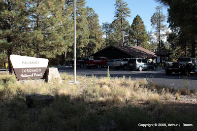
A gift shop along the way.
Every other time that I've been on this road, I was in a minivan. I would see dirt roads going off this way and that, but I didn't dare take a minivan on them. This time I was in my truck, though. I followed one of the side roads around for a while. There were some really nice camping spots out there. Most were taken, though.

Woodsy camping spot.

The road to the woodsy camping spot.
I also hiked a few feet along the Butterfly trail. I was enjoying the scenery and listening to a hawk screeching as it flew nearby. I couldn't see it through the trees, though. Then I heard some loud cracking noises and wondered if some birds were engaged in aerial combat and the sound was their wings hitting each other. As I tried the find the hawk through the trees I noticed that the sound had become a continuous crunching noise, and it was behind me. As I turned, I finally recognized the sound as that of a tree falling. I looked uphill and could see some trees swaying up there where one had just fallen. There are a lot of dead trees on the mountain from a forest fire a few years ago. I've read that dead pines can fall unexpectedly and so you shouldn't put anything (car, tent) where a tree could hit it if it fell. There was only a very light breeze when this tree fell, so don't think they won't fall on your tent if the wind is calm.

More fall colors.
By the time I got to Summerhaven, most of the tourists had left for the day. The cookie shop was open, but I wasn't in the mood for a cookie (they're very good, BTW). I drove around town a little and then headed down. I figured I would get to the windy viewpoint near sunset and get some pictures of Tucson at night. I've been wanting to do that for a few years.

A rare sight; an empty parking lot in Summerhaven.

This is a great spot from which to watch the sunset.

Tucson as night falls.
Click below to see all of the pictures. There are a lot.







 Posts
Posts


