Showing posts with label petroglyphs. Show all posts

Sunday, August 12, 2012

More of Mineral Mountain Road, and fun with Photomatix

I went a little further south on Mineral Mountain road yesterday than I had the last time I was out there. There was a big storm far to the south, but I was hoping I might get into some rain. I was pretty sure that I would at least see some dust.


I went by the petroglyphs on the way out to Mineral Mountain Road. There were puddles full of tadpoles.

There were very few people out there. Too hot, I guess. It was around 108 when I left the pavement.


Tadpoles.

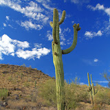
The further south I went on Mineral Mountain Road, the rougher it got. I figured it was OK, though, because it was mostly uphill. If I could go uphill over the rough spots, I would be able to go back downhill. I kept going until I got to a peak. The area looked vaguely familiar. If I was where I thought I was, the road would soon be so bad that it would be difficult to traverse on foot. There was a nice view of a small mountain and I got out of the truck to get some pictures. By the time I got out, though, dust was moving in front of the mountain.


Dust moving in to obscure the view.

I took my time turning around to get pictures of the Superstition Mountains in the other direction because I figured I had plenty of time to do that before the dust got in the way. The dust was sneaking by behind some hills to the east, though. When I turned around, the Supes were about to be hidden by dust. I quickly took some HDRI's.


HDRI made with typical settings. Ho-hum, and the dust hardly shows up.


Playing around with the settings. Now the dust stands out.


Zoomed in some.

I played around with Photomatix settings last night and got some interesting looking pictures.


It's hard to tell that there is dust in this picture, but I like the way it looks.


This is 20 or 30 minutes after the leading edge of the dust storm had gone by. The orange air is dust.

Click below to see all of the pictures.

2012_08_11

Tuesday, July 24, 2012

Cottonwood Canyon road

I went out for a drive again on Sunday. I got an earlier start than on Saturday but the monsoon rains were already well underway. I drove through a heavy shower near Superior and then doubled back to drive Mineral Mountain road again. Mineral Mountain road was dry. Shortly after I got on it, I could see some dust being kicked up far to the west.


A haboob that looks like it's headed for Queen Creek. It's about 20 miles away from me.

I drove around Dromedary Peak for a while hoping to get some good cloud or mountain pictures but the clouds were too thick, so I headed south. The road was in pretty good shape most of the way with just the occasional rough spot. I came to a fork in the road and sat there for about 5 minutes trying to decide which way to go. I probably could have saved a lot of time by flipping a coin.

I took the fork that went west, which happens to be Cottonwood Canyon road. It isn't real impressive with regards to the canyon. It had been graded recently and was in very good shape. Before too long I came to a trail register and some plaques. There was a fancy trail out in the middle of nowhere. The register was unusable. I think a kid had been hanging on the open lid and had bent the hinges. It wouldn't close and enough rain had gotten in there to mess up the paper.


An official trail.

It turns out that there are some petroglyphs there. The very short trail goes down to where they are. I felt a little silly with my big backpack on that little trail but I was the only one there. Hey, I needed it to carry water and the PN-40. I drank a lot of water on that short hike, too. It was only about 90 (very cool for July), but remember all that rain? It was humid. Sweating doesn't cool you off, so your body sweats more to try to cool off, and pretty soon you are hot and soaking wet.

I had to walk along some slick rock at the bottom. On a downhill slope, I slipped. Every time I've done that before, I landed on my butt. Somehow, I managed to fall forward this time. As I watched the rocks below me accelerating towards my face I wondered if my camera would get smashed, if I would break a wrist, or if I might even smack my head on the big rock a little further ahead (after breaking my wrist and smashing the camera). I put my hands out and stopped easily. No damage to anything. Not a bruise, not a ding. All that worry for nothing. I was pleased. I also made a mental note to be more careful on slippery rocks.


Some petroglyphs.

From down in the stream bed, I saw a bright orange rock perched on top of a boulder up the opposite bank. Somebody had put it there, so I had to go see why. From the orange rock, a faint trail went downstream, above the petroglyphs. I don't know why. I didn't see any petroglyphs up there, or anything else that looked terribly interesting. I did see a Harris's Antelope Squirrel, though, and it stayed on a rock eating while I took pictures.


Harris's Antelope Squirrel

The rest of the drive out to 79 was uneventful. It looks like that vicinity is very very popular with ATV and dirt bike riders. Large areas on both sides of the road were completely bare of vegetation. Click below for all of the pictures.

2012_07_22