Sunday, August 07, 2011

Exploring roads

I wanted to go for a hike yesterday, but couldn't decide where. I eventually wound up exploring roads branching off of Kelvin Florence road. I went down several roads where my progress was stopped by gates (there are several ranches out there) or by terrain. Often, I couldn't turn the truck around when I needed to, so I had to back up a long way. My neck still hurts.


Barrel cacti have yellow flowers near where I live. This is a nice change.

It seems that Cochran road and Whitlow Ranch road are about the only roads that go all the way up to the Gila River. Whitlow Ranch road goes up to where all the water is taken from the Gila River and put in a canal. I didn't make it to the end of the road, though, so I couldn't see that.


I came across a very strange looking saguaro.

I uploaded the full size panoramas to my web album this time, instead of all the individual pictures. If you zoom all the way in and then wait a few seconds, you should be able to zoom in a lot more. Click below to see all of the pictures.

2011_08_06

Sunday, July 31, 2011

To the Cochran coke ovens, almost

In August of last year, I had gone a short distance north of the Florence Kelvin Highway before it got dark and I turned back. I've been meaning to check out that road in the daytime and since it was too hot to do much else yesterday, I went out there. There was a chance of storms, and I thought I might be able to get some nice pictures of storms too, but I usually manage to be in the wrong place to do that.


On Cochran Road, with rugged mountains in the distance.


I drove through that light shower on the way through Florence.

I made lots of stops along the way to take pictures. There are some pretty mountains on the other side of the Gila river. I think the only way to get back there would be to walk. Some roads get near them, but I don't think any go through them. I stitched together several panoramas and will put something close to the full size versions of those on Panoramio.

I think Skid and I had been on Cochran road several years ago. The river looked very familiar when I got down there. In spots, the river looked like it might be shallow enough to wade across, but the water was muddy so I don't know for sure. Also, it looked like it was moving fast enough that even if it didn't come up to your knees, it could knock you off your feet. I don't think I'll be trying to cross it.


The Gila river.

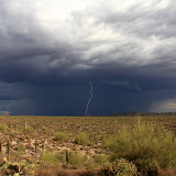
There were some nice clouds around, so almost all of the pictures are HDRIs. I think I got some nice pictures of rain showers, too. As I was driving out, I came to the top of a hill with a thunderstorm right in front of me. The lightning flashes were lasting a long time, at least half a second. I figured I should be able to get a picture of that. I caught a lightning bolt on my second attempt. Encouraged, I tried 10 or 15 more times and missed every one.


A slow lightning bolt.

With all the rain around, I was a little worried that I would get caught at a wash crossing. They were all dry, though. Click below to see all of the pictures.

2011_07_30

Monday, July 25, 2011

Sultry

The weather, that is.

I took half a day off Friday. Spent the time getting the bathroom ready to wallpaper. Spent Saturday wallpapering it. Lindsey's help shaved a day or two off the task. Anyway, by Sunday afternoon I was ready to get out to the desert.

As Sweetums and I ran an errand after lunch, there were some cute puffy clouds around. I didn't want to go hiking right then, though. Too sunny and hot. I finally left the house around 3:30, and by then the pretty clouds were gone. The gray sheet overhead kept me a little cooler, but when the dew point is over 50, it's going to be a tough hike.


Blah sky. I hardly took any pictures.

I was going to hike a short distance to a secluded spot, but after a couple of hundred feet I felt like I was pushing through molasses. Hot molasses. I could feel a slight breeze but it did very little to cool me off. This is a tough time of year to be out in the desert; for me at least.


I had planned to go back there but never made it.

As I plodded along, I kept looking at all the bare rock to my right and before I knew it, I just sort of started wandering up that way. I think some part of my subconscious didn't want to get too far away from the truck air conditioner.

Some people go hiking early in the morning during hot weather. I've tried that a couple of times but I start feeling panicky as the temperature rises and the sun grows more intense. I prefer knowing that as I get tired during a hike, the weather will be less taxing on me.

By the time I got back to the house, the clouds and the setting sun were doing very strange things to the lighting. I think I was out there during the worst lighting of the day. Oh, well, maybe I'll time it right next time. Click below to see all six pictures.

2011_07_24

Monday, July 18, 2011

Barnhardt Trailhead

How many of you noticed that the title of this blog is NOT "Barnhardt Trail"? How many of you also know that I'm going to put off telling you why until later? Good job.

Sunday was another one of those excessively warm days. About 110 F as I left the valley. There were storm clouds to the east but a hot wind was blowing. Starting at about 4000 feet, I thought the temperature on the Barnhardt trail might be tolerable.


Ominous clouds east of the trailhead.

The dirt road up to the trailhead was in very good shape. It was only about 100 when I got to the large parking area at the end of the road. There was also a lot of shade because of all the clouds. Large, dark clouds.


The trail starts out going that direction (west). A storm is building to the left of this picture.

On the drive up, there was a long, almost level stretch of road that had some ruts from the last time it rained up there. It reminded me of that time I was sliding around in the mud up on the rim about a year ago, though it was dry now. I didn't want to get stuck in mud; Skid is in Texas and couldn't rescue me. I decided to walk along the trail for a short distance so I could leave quickly if it looked like it was going to get wet.


The trail starts out winding through junipers.


Some parts of the trail are rocky.


Some parts are not rocky. There was a huge fire in this area a few years ago, which explains the sticks in this picture.

The trail has a gentle slope and is easy walking, but the air was dead calm and the humidity was probably over 40%. I had sweat trickling down my face in no time. I was glad when it started sprinkling and gave me an excuse to turn around.

As I drove back down to the highway, admiring the clouds all around, I saw something out of the corner of my eye that seemed to be shaped like a lizard but was the wrong color. Well, it wasn't a lizard color that I am used to seeing. It was a collared lizard and it let me take a lot of pictures before it ran under a bush.


Collared lizard.

Shortly after I saw the lizard, I decided to stop and see how steep the drop-off was to the right of the road. I wandered around a little enjoying the view and spotted something else odd out of the corner of my eye. I've come across a few crested saguaros on my hikes and I have read that other cacti can have that same type of deformity. I finally found another cactus like that. It was a hedgehog cactus.


Crested hedgehog cactus.

It was a pleasant and relaxing trip. I'l be back to that trailhead when it cools off. Click below to see all of the pictures.

2011_07_17

Sunday, July 03, 2011

NF 25

I went outside early yesterday morning to rearrange some stuff in the garage. It already felt very hot. I knew I'd have to go someplace high if I was going to hike. Turns out Phoenix had a record high yesterday; 118. That's just crazy.


Iron Dike doesn't look climbable from this side, but I think the north side is.

I had to take forest closures into account when deciding where to go. I decided to check out the view from the top of Iron Dike. It looks like a person should be able to walk up the north side of it, though I would be approaching from the south to reduce how much climbing I would have to do. When I left the house at 2 in the afternoon, it felt ridiculously hot outside. It was only about 98 when I got out of the truck near Iron Dike about an hour later. Being able to see a 20 degree drop in just an hour drive is nice.

The wind was blowing pretty good, too. It might have been stirred up by rain showers. I drove through the beginning of a dust storm as I left the valley. It's weird how much wind is created by these piddly little showers that barely get the ground damp. Anyway, one of those piddly little showers was south of me, and I could hear thunder. I wasn't worried about getting wet, but lightning could hurt. I decided that I would drive around out there rather than hike. I wasn't too disappointed, though. I didn't like the looks of all the bushy oak I would have had to push through on my chosen route.


NF 25. I've never been down there. It's labeled NF 201 on Google Earth, but the sign at the road says "25".

NF 25 is pretty smooth for a seldom-used forest road. It goes up the side of some almost vertical canyon walls. It's kind of nerve-wracking to look at the precipitous drop on your left as you drive along. The road ends at an old stock pen at the border of the Mazatzal Wilderness.


View of Mt. Ord. The forest on that side of the Beeline Highway is closed.


There are agave flowers all over the place.

I was hoping to get some nice cloud pictures, but the clouds weren't very photogenic. Click below to see all of the pictures.

2011_07_02

Thursday, June 02, 2011

A gloomy day

It wasn't very hot on Wednesday so I went for a hike. It wasn't hot because it was very cloudy. The wind had also calmed down, which wasn't such a good thing.


I'm going that way, because I've never been over there.

I didn't stay out there too long because Lauren texted me while I was out there and said she was cooking dinner. Didn't want to miss that.


I've followed that road to its end a couple of times.

I found what looks like a salt lick. I suppose somebody put it out there to attract deer. I wonder if that's legal in a national forest.


Salt lick?

I went to the top of a small hill and enjoyed the breeze up there for a few minutes before heading home. It was really gnatty. There was barely enough of a breeze to keep them out of my face. They kept doing kamikaze's into my eyes. That's really annoying. I think I'll carry the electric fly swatter next time I'm out there. Click below to see all of the pictures.

2011_06_01

Monday, May 30, 2011

Someplace new

The weather was beautiful yesterday, and I hadn't been hiking for a couple of weeks. Still, I had trouble thinking of a place to go. You would think I'd be ready to go anywhere, but if I couldn't think of someplace new, I didn't want to go. Well, there's certainly a lot of territory I haven't covered near here. I finally decided to walk along a ridge near Fish Creek Hill. I thought that I might be able to get some nice canyon pictures from there.


I'm headed in that general direction.

I went by Canyon Lake on the way and that place was packed. There were vehicles parked in any available spot along the road. I started to worry that I would be caught in a huge traffic jam on the way home. I kept going, though. There were even more people than usual at the rest stop at the top of Fish Creek Hill. The road is dirt out there and the washboard was pretty bad and it was full of pits but that didn't seem to be keeping anybody away. When I started walking out along the ridge, I could see a couple sitting in lawn chairs overlooking the side canyon between me and them. At first I thought that seemed a little strange, but the more I thought about it, the more it seemed like a good idea. You could enjoy the beautiful scenery and watch buzzards and hawks. It would be kind of like sitting on the beach, but without the water.


At the beach, without the beach.

I didn't quite get the view of the canyon that I had hoped for, but it was still a nice view. I made a panorama of the view from the end of the ridge and put a scaled down version on Panoramio. Click here to see that picture. Click on the picture there to see it full size. I'm thinking that maybe I should have made that picture an HDRI. If you look in the right spot in that picture, you can see the couple in their lawn chairs.

Most of the cars were still parked at the lake when I went by there on the way home, so traffic wasn't bad. I've decided I don't want to get on the roads today and tangle with the crowds coming home from Memorial Day trips, though. Click below to see all of the pictures.

2011_05_29

Monday, May 16, 2011

On a treasure hunt

I was wandering around somewhere on the web a few months ago and ran across a short blurb about the Forest Service looking for some volunteers with cameras to help with a research project. I sent an email to the person in charge and kind of forgot about it because she was too busy to respond for a couple of months. I finally met with her a couple of weeks ago and she gave me my first assignment. She gave me a notebook with maps and descriptions and sample photos, and my task was to go to the exact locations at which the initial pictures had been taken and take updated pictures from exactly the same spots covering exactly the same scenes. Sounds simple. I should have listened more carefully to the description of where to turn off of Cherry Creek road, though. I spent an hour on the wrong road. I enjoyed being on the wrong road, but by the time I got to the right place it was too late to get good pictures.


I came across this while I was on the wrong road.

It probably wouldn't have helped much if I had gotten to the right place an hour sooner, though. The maps are called treasure maps for a reason. The reference pictures were taken in 1997 or 2003. For that reason, I didn't think I could rely on trees looking the same, or even being there any more. I looked for large boulders in the pictures to use as a reference. I walked slowly down the creek (Oak Creek, BTW) trying to follow descriptions and looking for recognizable boulders. I went beyond where the last one should have been without finding any of the 5 that were there.


Much of the hike was easy walking like this, but there was also some scrambling over boulders.

Some reference pictures seem to have nothing but vegetation in them. They're going to be hard to find. I looked for big boulders, thinking that they shouldn't have changed much in 14 years. I continued to look as I headed back to the truck. At one point I saw a stack of rocks that looked a little familiar. I moved to the left and recognized a view from Photo Point #5. Finally. I knew it was the right spot, but some things still didn't look right. As I looked at the pictures last night, I saw that a large boulder that I was looking for on the ground was now half buried and had another large boulder in front of it. Wow, some big stuff has been moved around in the past few years. It was too dark in the canyon to get good pictures, but now I have a reference point. From there I'm pretty sure I'll be able to find the rest of the Photo Points the next time I'm out there.


I also found this. It was nice of him to pose for pictures. I saw another, lighter colored one but it hid under a rock.

Click below to see all of the pictures.

2011_05_15

Monday, May 09, 2011

203A

I was talking to a forest ranger last week who told me that I ought to check out 203A. It's on the east side of Roosevelt Lake (where I've been spending a lot of time lately) and goes to the southern border of the Sierra Ancha Wilderness. I was just planning to drive out there. I've been putting some medicine on my face that makes it sensitive to the sun, so I can't be out in the sun much. I tried wearing my hat, but that doesn't provide enough shade, and it hurts my forehead. A lot of the pictures I took out there were very crooked because it hurts my nose to take pictures. I was in a bad mood all day because the medicine makes me irritable. I'm so glad I'm done with that medicine now. But I digress.

As I got on the freeway leaving the house, I could see what looked like smoke near Picketpost Mountain. As I got closer, I could see that there was definitely a fire. There was a dry 20 mph wind from the south, so it was going to spread. It was on the south side of the highway so I was a little concerned about thick smoke over the road. The smoke was not very thick, though. The fire was not very far from from the road. It didn't look like it could get bad enough to force the road to be closed later. Turns out I'm not very good at guessing what fires are going to do.


Smoke from the Picket fire. I couldn't take pictures from the freeway, so I didn't get the actual fire.

203A is in pretty good shape and is not very steep; I never had to lock the axle. There's one narrow stretch with rock on one side and a vertical drop on the other that made me a little nervous, but I didn't encounter any traffic. It looked like I was the only person on that road yesterday.


A narrow stretch of road up ahead. The downhill side doesn't look as steep from back here.


The views were great from up there. That green strip is Coon Creek.


The road ends at the Sierra Ancha Wilderness boundary.

I thought about hanging around until the sun got lower and maybe going for a short hike, but I wasn't feeling too good. Another round of an intestinal virus was going through everybody in the house and it was probably my turn to get it. I thought it might be nice to get to the house before I started having ... well, I won't go into details.


This look fantastic when you're standing there, but the pictures are ho-hum.


Somebody put several piles of rocks here.

There was a line of cars where US 60 leaves the Globe/Miami area. The road was closed near Superior because of the fire. I couldn't go home that way. In Arizona, if a major road is closed, the alternate routes involve a lot of driving. It took me about an hour longer than it should have to get home. I got there just in time, too. Click below to see all of the pictures.

2011_05_08

Sunday, May 01, 2011

Cherry Creek Road

It wasn't hot in the valley on Saturday but I wanted to see something different, so I went east of Roosevelt Lake again. I wanted to check out Cherry Creek Road, and see how far along it I could drive. I was hoping to go hiking in someplace called Devil's Chasm, if I could find it, but that was a low priority.


Cherry Creek Road wanders into the distance.

Cherry Creek Road is a dirt road. Most of it that I drove on yesterday was in very good condition. Towards my turn-around point it got a little bumpy. Near the beginning were a couple a spots to unload ATVs. I'll have to bring the Ranger out there some time. Also, the road is in Tonto National Forest (I checked the map), but there are a lot of cows out there. I passed several corrals, and there are cattle guards across the road in several places. Maybe you can get away from the cows if you hike into the wilderness areas near there.

There are a lot of side roads. They are official roads with signs and numbers, but they don't show up on my maps. I'm guessing they go short distances to camp sites or something. I'll have to check some of them out in the future.


One of many side roads.


Some side roads go to ranch houses.

There were a few ATVs on the road. I think I saw about 4, which doesn't seem like many considering how nice the weather was.


A typical Arizona story; somebody was flying down the road at too high of a speed for the distance they could see ahead. They came around a corner, saw all this water, and slammed on the brakes. At least they stayed on the road.


Cherry Creek seems to have a lot of water flowing.

As the sun got lower, it got harder to see through all the bug guts on my windshield. I had been avoiding trying to clean them off because I was afraid they would just get smeared around and make a bigger mess. I finally decided that I had to try it, though. After a few squirts, the window was actually cleaner. Just then, a truck came hurrying up the hill towards me. The road was narrow and I moved over as far as I could. I glanced over as the truck zoomed past. Not only did the driver look perturbed at having to share his road, but his windshield was wet. At first, I thought that it was an amazing coincidence that we had decided to clean our windshields at the same time. Then I rounded the corner and saw that the road crossed Cherry Creek again. His windshield was wet because he had hit the water going at least 25 mph. I wish I had been there a few seconds earlier.

On the other side of that crossing, the condition of the road deteriorated. I had to slow down quite a bit. The road also climbed quite a bit above Cherry Creek. This area reminded me of being in the Chisos Mountains of Big Bend National Park. That is, until the cows mooed.


Reminds me of the Chisos Mountains.

Not too far beyond that last picture, the road heads a short distance up a side canyon. It enters a beautiful, dark, wooded area. It looked like the ideal campsite, if you're going to camp right next to a road. I wanted to take pictures but there were people camped there. I was moving slowly along and when I glanced ahead, I saw that I was headed down a steep section of road that got steeper before it crossed a creek. If I had to come back this way, I didn't think I could make it up that steep part with wet tires. I tried to back up but a tire spun. I locked the axle and made a little progress, but the road curved and the truck doesn't like to turn with the axle locked. I spun the tires some more. What a noob. By now the campers were talking about what was happening down on the road. A young man stood on a rock and offered some advice. He said his Taco would easily make it up that slope with the axle locked, so I didn't have anything to worry about and I should go for it. I told him I would try it some other time. I should have asked it they minded if I took pictures of the campsite while we were talking, but I was too embarrassed about spinning my tires to think of that. Only noobs and teenagers spin their tires.

The good thing about having turned back is that it's going to bug me until I go back, so I'll go back sooner rather than later. I'll start at the other end of Cherry Creek Road next time.

On the way back, I decided to check out one of the side roads. It was rough, so it was slow-going. Also, it slowly got steeper until I just couldn't make forward progress. I had to back up a long way before I could turn around. My neck still hurts. Sometimes I think about getting a 4-wheel drive truck, but my Taco is just getting broken in. It doesn't even have 150,000 miles on it yet.


This is 2906.


I was driving back at sunset, again.

Click below to see all of the pictures.

2011_04_30