 |
| 2008_12_30 |
Wednesday, December 31, 2008
A hike near Canyon Lake
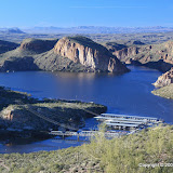
Normally, I only go on one hike a day. Maybe I'm lazy. Steve didn't see enough of the desert on our morning hike, though, so we headed out again after lunch. We went to the Boulder Canyon trail near Canyon Lake. I was there in the spring (March 30) and have wanted to go back. We got a late start, though, and couldn't go as far as I did last time before we had to turn back. We didn't see near as many animals in this cool weather. I was looking at the pictures when I got home and discovered that part of the Canyon Lake dam can be seen from the trail.


Horse Shoe Mountain
Steve stopped by for a short visit on his way to LA. He wanted to do some hiking in the desert, so on Tuesday morning we went up Horse Shoe Mountain. It was a beautiful day and I like the pictures I got.
I chose a moderately difficult hike since I wasn't sure what kind of shape Steve was in. He was breathing a little harder than me, but he was eager to do some exploring and I think he would have followed me to the top of the Superstitions (if I could have made it up there myself).
Steve also wanted to try out his new Toyota Highlander on some rough roads. We discovered that it does not have real high ground clearance. The side rails scraped rocks a couple of times. Other than that, it performed very nicely. It didn't have any trouble at all getting through the soft "sand" in the bottom of washes. I think my next vehicle is going to have to have four wheel drive. It may be a long time before I can get that, though. I think my Tacoma is going to last forever (and that's a good thing).
 |
| BC_2008_12_30 |
Saturday, December 27, 2008
Back to First Water Creek
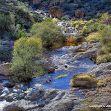
For some reason, Kyle thought anything but flowing water would be boring today, so we went back to First Water Creek. More rain has fallen since the last time we were there and there was a lot more water flowing. Here's a short video to illustrate.
The last time we were down there was an exhausting trip. We had to do a lot of scrambling around to go upstream. This time, Kyle wanted to see what was in the downstream direction, and neither one of us was too enthusiastic about struggling upstream again. We went a little ways upstream, to a part where we had to do a lot of climbing and pushing through bushes the last time, and decided that was far enough.
It was nice that the sun was shining this time. I think the air was a little dryer, too. It was cooler (mid 40's). I was wearing a long sleeve shirt, but it was almost too much with all the scrambling around.
 |
| 2008_12_27 |
Friday, December 26, 2008
No snow
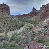
I thought there might be some snow on the Superstitions today, but I was wrong. I could see a light dusting on Four Peaks. There was also a little snow on some mountains far off to the east. I drove east, out to Hewitt Canyon Road, thinking I would get some pictures of the mountains and clouds out there. Didn't get any good pictures of the clouds, though. Gee, two strikes so far.
I can't find the name of the creek that winds through there, but the road crosses it several times. There was water flowing in it today. I came to a spot where I decided it might be too deep for me to cross and stopped. Then an ATV went across and I could see it wasn't very deep, so I crossed again. About 100 feet later I came to another spot I didn't want to cross, and saw other potentially troublesome spots further up stream. I decided to not push my luck.
I got out and scrambled around on the rocks some, and took a few pictures. While I was up there, this guy on a bike stopped in the middle of the stream. I don't know why. He stayed there at least a minute. I wonder if his boots were waterproof.
 |
| From Hewitt_Cnyn_rd_2008_12_26 |
He didn't have any trouble crossing the stream in other places. Another guy did. First, though, take a look at him in this picture. Notice that he is wearing tennis shoes (or something similar) that he is trying to keep out of the water.
 |
| From Hewitt_Cnyn_rd_2008_12_26 |
Now here he is, stuck. He's still making some effort to keep his feet dry.
 |
| From Hewitt_Cnyn_rd_2008_12_26 |
Here you can see that he has abandoned all hope of keeping his feet dry.
 |
| From Hewitt_Cnyn_rd_2008_12_26 |
The air was in the mid 40's. I doubt that the water was any warmer. I don't see how his ride after that could have been any fun at all. I would have had only two things on my mind after something like that. A hot shower and dry clothes. OK, I'm a wimp, I admit it. But I like to be a warm, dry wimp. I'll tolerate cold, but not wet and cold.
 |
| Hewitt_Cnyn_rd_2008_12_26 |
Thursday, December 25, 2008
Clouds on the mountains
It was a cloudy, wet day today. I didn't even get out of the house until about 5 pm. I took a few pictures of the clouds on the Superstitions.


There may be snow on the Superstitions tomorrow. I'll have to remember to get out and look early tomorrow.

Tuesday, December 23, 2008
The Christmas Tree
I made an HDRI of the Christmas tree. I think this is probably one of those cases where more is not necessarily better.


Tiburon for sale
Lindsey is selling her Tiburon. Less than 60,000 miles. Well maintained. Six speed manual. A blast to drive.
I was supposed to take pictures for her to use in an ad, but I got carried away. The HDRIs give it a grayish color.
Monday, December 22, 2008
First Water Creek, with water!
Kyle and I went down to First Water Creek today. It was overcast and gloomy and cold. Well, about 50, which is cold to me. I was still soaked with sweat, though. It was very humid. In fact, it's raining pretty hard as I write this.
We were hoping to see some waterfalls. There wasn't enough flowing water, though. We hiked to the bottom of the 90 foot waterfall. There was water dribbling over it, but it wasn't much of a waterfall.
I made a video so you could hear the water flowing.
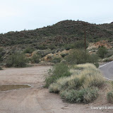
And here's the map. Since we were in a canyon, we didn't have very good GPS coverage. If you look at the altitude vs. distance graph, it looks like we took an elevator up and down a tall buidling in the middle of the hike. We didn't. I think there were altitude errors due to the poor GPS coverage. It also looks like we didn't have good coverage for the SPOT (don't know if that was a GPS problem or communication satellite problem). It didn't report location for over an hour, and it should have been doing it every 10 minutes. I'll have to remember to not have any disasters in a canyon ;-)
We were halfway thinking about hanging around at the base of the falls until some water started flowing. Yep, in a desert. Could be there for months. Actually it started to rain while we were there. We had umbrellas. I was thinking about what it would be like if a wall of water came roaring down that narrow canyon. I was starting to get cool, too. Fortunately Kyle was getting cold, too, so he didn't mind heading back. It sprinkled off and on all the way back and started to rain hard just after we got in the truck.
 |
| 2008_12_22 |
Saturday, December 20, 2008
Mapping the Massacre Grounds trail
I've always had trouble geotagging pictures that I take along the Massacre Grounds trail. It's in a low resolution area of Google Maps, so I can't see the trail. The only way to map pictures is with GPS, and it's a hassle to mark your position every time you stop to take pictures. The i-gotU made all that simple, though, and now I have a map to show exactly where the trail goes.
The day started out with high thin clouds (which are bad for landscape photography), but they cleared away in the afternoon. It was cool. I forgot to check the temperature but it must have been around 60 when I started out. I was trying to hurry because I wanted to get back before sunset. I expected the temperature to drop a lot as soon as the sun was gone. Since I was hurrying, I was dripping sweat all the way up and most of the way down.
By the time I was on the way down, most of the trail was in the shadow of the Superstitions. It felt like it must have been in the 40's, but there was no breeze at all. I was still sweating, but my forearms and hands were so cold I could hardly get the lens cap on and off.
The pictures turned out OK, but I've gotten much better ones out there. I'll blame it on the time of year.
The waterfall at the end of the trail had water pouring over it. I made a short video. If you turn the sound up you will be able to hear the water splashing on the rock.
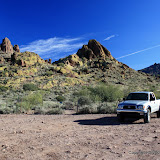
The map and pictures:
 |
| Massacre_Grounds_2008_12_20 |
Wednesday, December 17, 2008
Hazardous area, and SPOT
I just read an interesting article about the risk of dieing of natural hazards in various regions of the U.S. The county in which I live is colored red, which is one of the worst areas. It's probably the heat that kills them here. The red goes on up into northern Arizona. It's probably the cold that gets them there. I don't think falling or driving off of cliffs is included in this map.
I think I mentioned a few weeks ago that I had bought a SPOT satellite messenger. It uses GPS for navigation, which works most places that I go. It also uses satellite communication to relay status information. I can send an "I'm OK" signal, or a "I'm broke down in the middle of nowhere. Send help" or an "I'm injured. HELP!" message. I also signed up for the tracking service, which allows people to go to a web page and see where I am, almost real time (location is transmitted every 10 minutes). That was handy the last time I drove to Texas. Instead of people trying to talk to me as I was loosing my cell signal, they just checked the web page and knew where I was.
Many of the places I hike, even "close" to town, don't have cell service. I've gotten home an hour or more after sunset a couple of times and Sweetums says, "Oh, there you are. I was worried." I always wondered how much she would worry before she tried to call and decided that I must be in trouble. Sometimes I tell her to start worrying if I'm not home by a certain time, but then I feel like I have to watch the clock to be sure I'm back to a cell phone service area so I can check in with her before my time is up. I don't want to be rescued if I don't need it.
Anyway, this satellite messenger is the perfect solution. Sweetums can tell where I am and if I'm moving, so she doesn't have to worry. I don't have to worry, either, because if I get in trouble all I have to do is push the "911" button. Unlike my cell phone or camera, the SPOT works at temperatures much higher than I can stand, it floats, and so far I've dropped it on the garage floor once with no apparent damage. Now, if I ever have trouble, I have to remember to do it in such a way that I don't smack my head or drop my SPOT in a river or fall on it and smash it or something like that. You know what they say; try to make something idiot proof, and somebody will come along with a better idiot.
I'll have a link to my tracking page on the right side of my blog so anybody can check it. Maybe you'll catch me on a hike. Right now it still has the data from my last hike on it.
Tuesday, December 16, 2008
Low clouds
The clouds have been very low today. I tried to get some pictures of them on the mountains, but they were mostly too low.


Sunday, December 14, 2008
Spooky Hill, after a rain
I was planning to get pictures of some waterfalls today, but it wasn't raining. So I decided to use my i-gotU to make a map of the route I take to Spooky Hill. It was overcast and really gloomy looking again today. I think I got some good pictures anyway.
On the way out to the hill, I was following a faint trail that I always thought had been made by deer. Today I saw two sets of footprints. They had been made earlier today, because any others would have been erased by last night's rain. Oh, yeah, it rained last night. So maybe a lot more people go out there than I had realized.
It was in the low 50's today. Still, I worked up a little sweat on the way up the hill. There was a slight breeze at the top, so I had to stay off of the top to keep from freezing. I took a lot of AEB pictures while up there to make HDR images. In one of them, I accidentally got two wild horses. I wish I had known the horses were there so I could have gotten a better picture. They are in this picture. Find them! The first to locate them wins an autographed print of the picture (if I can get my stupid printer to work). I doubt that you will be able to find them by looking at this small version of the picture, so click on it and then magnify the image on the page it takes you to.
 |
| From BC_2008_12_14 |
While I was on my way down the hill, I heard water dripping in Spooky Canyon. I could see a place that there might be a waterfall. I hiked over there and sure enough, there was a tiny waterfall. I made a movie and if I can get it to upload to YouTube, I'll put it here. My first attempt to upload failed.
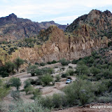
Here's the map and pictures. Note that I didn't put exactly the same group of pictures on the map and on the album. It's late, and I'm tired.
 |
| BC_2008_12_14 |
Sunday, December 07, 2008
Estrella Mountain Park
Kyle wanted to go hiking someplace different today. That's a little funny, because he has only gone on about half a dozen hikes. Anyway, after I vetoed the Grand Canyon and Meteor Crater (too far to drive, and you can't hike into Meteor Crater anymore), he decided on Estrella Mountain Park, which is on the west side of Phoenix. It was a long drive. There were lots of photo enforcement locations along the way. I think I got my picture taken while going 54 in a 55. I'm going to be really mad if I did.
Anyway, it was an overcast and gloomy day. I was afraid that pictures wouldn't come out very good, and they didn't. Also, I was not very impressed with the scenery. It was kind of blah. On the other hand, it was a very nice and well-maintained park. Trail intersections are marked with signs. If you carry the map given to you at the entrance, it would be darn difficult to get lost (but I have run across people that could do that).
Once we got into the park a little ways, we could no longer hear the cars in Phoenix International Raceway. We couldn't hear cars on nearby roads. We couldn't hear birds. The covey of quail we stirred up even flew away silently. It was eerily quiet, except for the occasional plane flying over.
I tried to create a photosynth of one of the mountains. I don't like the way it turned out. I don't think I picked a good subject, and I certainly didn't have enough pictures. Photosynth was happy with the pictures (it was 100% "synthy"!) and did a good job of putting them together, though. Click here to see it.
If you look at the @trip representation of the hike, you can tell where I was when I took the pictures for the photosynth.
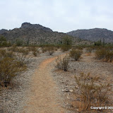
Finally, here are the pictures. These are the same ones that are on @trip. Nothing spectacular, or even very interesting.
 |
| 2008_12_07 |
Saturday, December 06, 2008
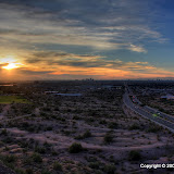
Sunset from Papago Park
Kyle thinks I should get pictures of a sunset that have the buildings of downtown Phoenix in them. I checked a map and found some hills that looked like they might be in the right place in Papago park. We went there today to check it out, even though there were heavy clouds on the western horizon. There was a place to park right next to one of the hills. We scrambled up and started taking pictures. It was surprisingly pleasant, despite being in the middle of town.
The only pictures that look halfway decent are HDRIs, except for one picture of a helicopter that Kyle took.
It wasn't much of a hike, but I used the i-gotU anyway.
 |
| 2008_12_06 |
I ran across something the other day that I thought might be great for documenting hikes, but after reading about it some more I decided it wouldn't be good for that because I would be taking pictures 90% of the time and hiking 10%. I'm still going to experiment with it to see what I can create. It's called Photosynth and it's free software from Microsoft. It takes a bunch (a big bunch) of pictures of something and synthesizes a "3D" view from the pictures. At first I thought it would be cool to create photosynth's of mountains or canyons, but it would probably take months to get all the pictures necessary for something of that scale. I'll think of something easier to use it on, though.
Tuesday, December 02, 2008

Monday, December 01, 2008
Sunset
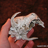
I got some nice sunset pictures tonight. I also got pictures of an animal skull. Can anybody tell me what kind of animal it belongs to?
 |
| Sunset_2008_12_01 |
Sunday, November 30, 2008
Return to the desert
I just spent a week in Texas. It's nice to spend some time on the farm and to visit with family. I had to go in to Houston a couple of times, though, and that isn't fun.
I always tell people in Texas about how nice and dry it is out here. I hear that it rained here almost the whole time I was gone, though. It was pretty humid today. I could see evidence of all the rain on the hike. Looked like lots of grass was sprouting.
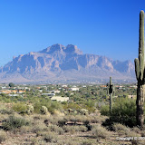
I hiked on a trail at the end of Idaho road that I haven't been on for a couple of years. The scenery is pretty along the way. There's a mysterious radio transmitter at the end.
@trip has a new feature. You can view the hike in 3D. It's really cool. Today's hike looks a little boring in 3D, but the hike to the top of Lone Mountain looks good.
 |
| 2008_11_30 |
Friday, November 21, 2008
Yesterday's hike
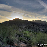
On yesterday's hike, I had the GPS data logger set to 6 second intervals. The track looks much better. I'm not sure if the logging interval is the only factor, though. I was also on a mountain instead of in a canyon, so more of the sky was visible.
As I was standing on the peak, a plane flew by, far below me. The pictures of it aren't very good for several reasons but mostly because I grabbed the wrong camera. I guess that's the problem with carrying so many. Anyway, I don't think that plane should have been that low.
As usual, it's late and I'm tired. Here's the map and pictures. I think some of the pictures turned out pretty nice.
 |
| 2008_11_20 |
Thursday, November 20, 2008
Sunset from Lone Mountain
Wow, it's been a busy week. So much going on. I got a Spot Satellite Messenger for me for Suzanne's early Christmas present. It's a GPS receiver that uses communications satellites to relay your position. Works when cell phones don't. Great for solitary hikers. I'll get into more details later. Anyway, I wanted to try it out in tracking mode, and I really had to go for a hike today (long story), so I raced the sunset up Lone Mountain. (I won, and the sunset even had a head start!)


I have lots of pictures to process and tracks to generate, etc., etc., but I'm too tired now. Maybe I'll have a chance tomorrow. In the mean time, here are a few pictures. The first is a view of the Fountain Hills fountain from near the peak of Lone Mountain.

Next, a couple of pictures of the Superstition Mountains.


And finally, the setting sun.

One quick story about something funny that happened on the way down the mountain. I was getting close to the bottom of the mountain. It was pretty dark by then. I was having a little trouble seeing the trail even though it's well worn (almost got a flashlight out). I was mostly watching where I was putting my feet (didn't want to step on a rattler in the dark) but would glance ahead now and then. Once when I looked up, there was a teddy bear cholla just to the side of the trail, at a spot where the trail curved, so with a quick glance it looked like the cholla was on the trail. Under certain lighting conditions (twilight, stormy weather), the needles of teddy bear chollas almost seem to glow. Their trunks are usually dark brown or black. So I glanced up and saw this thing on the trail. It's shape made it look like a man wearing a white shirt dark pants. I was slightly surprised to see somebody coming up the trail in the dark.
Have you ever noticed how, if you don't get a very good look at something, your brain will try to help you out by filling in the details? My brain had already filled in a lot of details by turning this indistinct, almost glowing shape into a hiker, but it didn't stop there. Nope, it's got more imagination than that. I also believed that I saw the hiker's left leg moving forward, and his right arm swinging forward. Wow, such detail from just a glance in the dark. Well, my brain must have been so busy filling in visual details that it neglected to do anything about sound. Here's a hiker walking up a rocky trail (crunch, crunch, crunch), uphill (pant, pant), lots of movement in baggy clothes (swish, swish), but I heard absolutely nothing. Nothing * at * all. That's what freaked me out. As soon as I had moved my eyes back to the trail, my brain had filled in loads of visual detail but left out the sound. I immediately looked up to figure out how he could be so utterly and completely silent and saw the cholla. Whew! I don't have to run back up the mountain.
Sunday, November 16, 2008
Guess where ...
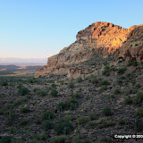
Yep, Bulldog Canyon. This morning I was looking at some pictures from yesterday and it looked like it would be easy to get up on a ridge to the northeast. Well, I just proved that you can't tell how hard it will be to go somewhere from so far away. I didn't get on top of the ridge, but my legs were tired from yesterday. Maybe I could have done it if I'd been fresh. I was standing there looking across a ravine and thinking "I should have gone that way", but I was too tired to do it.
I sat at the base of a cliff taking pictures for several minutes. During that time, my GPS data logger seems to have wandered around by itself. Suzanne said that maybe one of the hawks took it for a ride. The trip statistics say that my average speed was 8 kph and my maximum speed was 5 kph. I don't know how that's possible. Maybe because I was moving so much when I wasn't moving. Also, my minimum altitude was 91 meters below sea level. Blub, blub. Maybe being next to a cliff in a canyon blocked most of the GPS satellite signals.
I used to have the data logger set up to log my position every 6 seconds. I bumped it up to 10 seconds and that seemed to double how long the battery should last. I was thinking that might be because it doesn't write to EEPROM as often, but maybe it's because it shuts down the receiver for longer logging intervals and doesn't get as good of a fix when it comes back on. Anyway, I set it back to 6 seconds and we'll see how it does on my next adventure.
 |
| BC_2008_11_16 |
Subscribe to:
Posts (Atom)

 Posts
Posts


