
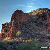
This picture is from a previous hike. I was looking in this area and thinking I should go explore over there some time. That's where I headed today.
I decided to make a halfhearted attempt to get on top of a ridge I was looking at a couple of days before. Amazingly, my semi-random decisions about which way to go resulted in getting to the top fairly easily. The view was great from up there.

I was on a north-facing slope, so there were natural terraces.

Terrace building plants.

A view from the top. I was so high up, I could see the curvature of the Earth. Just kidding.
My i-gotU GPS data logger didn't log much data on this hike. My SPOT didn't seem to perform too well in the same places, so maybe the mountains didn't permit visibility of enough GPS satellites. My program discarded 90% of the track points. A lot of pictures could not be correctly geotagged by the @trip software and I wound up re-positioning them using Picasa. I had to kind of guess, but at least I knew which side of a mountain I was on.

I was on top of that. Unfortunately, there is nothing for scale so you have no idea how big it is.
As you can see in the previous picture, there are cliffs on 2 or 3 sides when you get to the top. From up there, they seem like very tall cliffs. I wanted to peek over the edge, but I just could not make myself get closer than about 6 feet from the edge. Since I couldn't stand on the edge, I wanted to lay down and slither up to the edge and peek over and get some pictures, but there weren't any spots at the edge with patches of bare rock that were big enough. A patch of bare rock big enough to lay on is necessary. Have I ever mentioned that it seems that most plants in the desert have thorns? Those thorns fall off the plants all the time. They are all over the ground. You don't spit into the wind, you don't tug on Superman's cape, and you don't allow your body (or backpack) to come into contact with the desert ground. The two exceptions are 1) if the ground is bare rock that is obviously free of thorns (and cracks that could be hiding scorpions, but that's another subject) and 2) loss of consciousness.

This makes nice wallpaper.
On an unrelated subject, it has been a little over 13 months since I bought my SPOT satellite messenger. I've been pleased with it. Actually, I've been more pleased that I haven't had to use the 911 button on it. When I first got it I was kind of bummed to see that it requires the use of those expensive lithium batteries, because they're expensive and I'm cheap. My first use of the SPOT was a trip to Texas. I had the SPOT on in tracking mode (transmitting to a communication satellite 3 times every 10 minutes) for about 40 hours that week. I was sure that would drain the (expensive) batteries, but it didn't. I've used the spot on every hike I've taken since then, so it's been on and in tracking mode for from 3 to 10+ hours a week, ever since I bought it. I carry spare batteries in my backpack, but I haven't had to replace them yet.

My SPOT in its usual position on my backpack.
The SPOT has a single belt clip thingy for attachment to whatever (sorry about all the technical terms). I clip it on a loop at the top of my backpack. The first time that I lifted my back pack out of the truck after a getting back from a hike, the SPOT came unclipped and went clattering across the garage floor. It's very rugged, though, and that didn't bother it at all. It did bother me, and not just because my fancy new electronic gizmo that cost a lot more than the expensive batteries it contained was clattering across the garage floor. If it can come unclipped so easily in the garage, I could lose it in the desert. In the picture, you will see that I've added a lanyard that clips to another location on the backpack (in case the strap the SPOT is clipped to fails; I'm a belt and suspenders kind of guy). There have been several occasions when I've found the SPOT swinging by the lanyard. It's a darn good thing I put that on there.
This is a perfect illustration of one of those "that's good / that's bad" things they used to do on Laff In or Hee Haw or something years ago. It seemed bad when I dropped my SPOT, but it was actually good because it kept me from losing it later. That also applies to my La Barge Canyon misadventure. I got careless, I made some bad decisions, and I put myself in a sticky situation. Fortunately, I just got a little wet from sitting in the lake (hey, I got a new wallet that is much smaller and doesn't hurt my hip!). I'm now careful to observe all of my hiking-by-yourself-in-the-desert rules so I don't find myself in a similar or worse situation again. My backpack sure is heavy from all the water I carry, though.
Yes, the La Barge Canyon misadventure was a good thing, though it was not much fun at the time. Some hikers are not so fortunate. There was an article in the paper this weekend about one of those less fortunate hikers. Though Bryce Gillies was just 20 years old, he had a lot more hiking training than me and had youth on his side. He wasn't a brash young kid doing stupid things, though. He did made a series of bad decisions, and there was no way out for him.
Click here for the EveryTrail map and below for all of the pictures.
 |
| BC_2010_01_03 |


 Posts
Posts


