Showing posts with label Oak Flat area. Show all posts

Sunday, March 04, 2012

Oak Flat

When I was trying to decide where to go hiking yesterday, one of the main considerations was that I didn't want to do a lot of walking on level ground. It's easy to find lots of places that satisfy that requirement. I wound up in the area near Oak Flat that's going to be a copper mine soon.


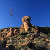
There are lots of interesting rock formations in the area. This one looks sort of like a duck to me.

I wandered slowly around the rocks, with no particular destination in mind. I was wondering how many people might have been where I was and thinking that it couldn't have been many because there aren't a lot of reasons to go there. As is usually the case whenever I think that, I find evidence of people having been there. In this case, it was survey markers for the future mine.


These are all over the place out there.


There's a drilling rig site near the center of this photo.

It can be difficult to hike off-trail in this area. Sometimes the only way to get over all the jumbled boulders is by crawling. In places where it's flat enough to walk, the ground is often covered in chest-high oak bushes and catclaw. The bushes are sturdy and difficult to push through, and you do NOT want to push through catclaw. I was wondering if leather hiking clothes would be comfortable. Probably too hot.


There might have been some interesting views up there, but it would have been too much of a struggle to get up there.

A military jet roared by pretty close to the ground. Haven't see that before out there. Looked like it might have been an F-4. Click below to see all of the pictures.

2012_03_03

Sunday, July 18, 2010

Near Oak Flat

I'm not sure what the name of the area is, or if it even has a name. I think its name may soon be "open pit mine" though, if McCain has his way.


Exploratory well. I don't think they're looking for petroleum. I saw 2 rigs drilling and evidence of previously drilled wells.

It was too hot in the valley (over 110) to do anything close to home. The altitude where I was going is only around 4000 feet but that's enough to reduce the temperature to a tolerable level. It was in the upper 90's where I started my hike. The humidity is way up, though. I had sweat trickling down my temples after a short leisurely stroll down a mild incline, and I was looking for places to get out of the sun.

Before I got out of the truck, I was driving down the road that goes past the Apache Leap trail. I got to an uphill stretch that I hadn't been able to drive up in the past. The tires just spun. I was able to drive up it without any trouble this time, though. Hooray for Michelin tires! It's always cool to finally go over the top of a ridge that you've only looked up at several times before, and finally see what's on the other side.


Finally, at the top of the next ridge. The road in the background was too rough for my liking, so I didn't go that way.

I decided to continue along the road as far as I could. The road split near the stock tank in the previous picture. I took the left fork because the right fork looked rougher that what I wanted to drive on. Well, the left fork was just as rough, but I couldn't see that part at first. It was one vehicle wide. It would be impossible to turn around. It kept getting steeper and rougher. I was afraid I might have to back all the way down. I was just hoping that I would find a place to turn around and get out of there before I encountered somebody going the other direction. It turns out that that section of road is only a quarter mile long, is a dead end with a lot of room to turn around, and I was the only person to drive on it since the last rain (maybe a day or two earlier). When I got to the top, I decided that would be a good place to hike around a little and get some pictures.


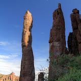
If you like hoodoos, this is your place.


This looks like it's a popular spot for people to visit.


It's the time of year for agave flowers.

I was wandering along mostly aimlessly taking pictures of rocks and plants when I noticed a faint trail and a cairn. It headed into the canyon to the east. There were large trees at the bottom of the canyon and I thought I could hear a waterfall. Maybe the trail ends at a pool of cool water and I can go swimming.


Rock columns visible from the trail.


Looking across the canyon. Notice how green the bottom is.


Rocks.

As the trail descended, it also headed towards a stone column. At first I thought that was coincidental.


The trail is heading towards the base of the column on the left


The view above me.


At the stone column. I'm guessing that it's about 50 feet tall.

When I got to the base of the stone column, the trail just ended. That seemed really strange. Why come out here and just stop? It looked like a fair amount of people had been out here since spring. They had trampled the grass. They had hacked through bushes. They had built cairns. I looked more closely at the column and thought I could see why they had been there. I zoomed in with the camera and confirmed my suspicion.


I don't know the technical names of climbing gear, but there's a metal ring attached to the rock. People come out here to climb this column.


An HDRI of the columns and the moon.

I guess the rock climbers don't climb this time of year. That column would not be a good place to be during a thunderstorm. Click below to see all of the pictures.

2010_07_17

Sunday, June 14, 2009

East of Superior again

There are a lot of places I haven't seen in the Oak Flat area (east of Superior), so I went out there again on Saturday. I could see another stock tank on Google Earth, near Apache Leap, so I went to check it out. Well, mostly I went to check out the view from there.


I thought I could see a trail on Google Earth, and when I got there I found a wide path heading up the canyon. It looked like I could have driven up there. It wasn't too long before I got to some large boulders that my truck could not have gotten over, though. It seemed that somebody must have driven a bulldozer up there at some time, though. The construction of the stock tank involved moving a lot of dirt and rock. I doubt that was done by hand. I did see some large rocks along the way that had been broken into several pieces, probably from a bulldozer going over them. At one point I also saw a tire track in the sand. Somebody had driven a jeep up there not too long ago. Mine were the only human footprints I saw, though.


At first, it looked like it would be an easy trail to follow.


This area seemed to be more overgrown than the trail to Apache Leap. Also, there were very few cairns and they were widely space. Most trail markers seemed to consist of green tape tied in bush branches. I think that was put there by jeep drivers.


The trail splits here. I went to the right.


There was a strong breeze blowing down the canyon for most of the hike. And, like last time, I knew I was close to the cliff edge when the wind really picked up. When I got to the stock tank, there were a few cows hanging around there. By the time I pushed through the brush to get down there, I had scared the cows off.


Skittish cows.


Between the stock tank and the drop off (it isn't as much of a cliff here), somebody had built a wall by stacking up rocks. It must have taken a lot of work. Seems like it would have been easier to string barbed wire. There was a barbed wired gate in the middle of it.


Rock wall.


I felt energetic enough to take a different route back to the truck. Also, I wasn't as worried about being out here after sunset. All I had to do was go downhill until I hit the road. The route down started out easier than the route up, but it didn't stay that way. It was very overgrown. I would either have to climb over rocks or push through bushes. Climbing could lead to falling, so I pushed. Oh, there are lots of catclaw acacias out there. I was a bloody mess when I got to the truck. It's not that I got big cuts, or a lot of them. You just don't want to stop and mess with tiny scratches. I don't carry enough water to wash the blood off. So the blood trickles down my arms. When I stop to take pictures, it seems I put my arms against my body, so that gets my shirt bloody. I wanted to get a beer on the way home, but I didn't want to walk into a store looking like I did.


There was an unexpected benefit to taking the other route back. A couple of weeks ago I was thinking that I needed one of those geologist's pick things. You know, the hammer type thing they use for breaking rocks. I found one half buried in the sand. Nifty.


Just what I needed.


Click below to see all of the pictures.


2009_06_13