Showing posts with label Superior. Show all posts

Tuesday, March 01, 2011

More snow

I had been reading the weather forecasts last week. I knew there was going to be snow. Some forecasts said it would be as low as 2500 feet. Still, on Sunday, after listing to rain all night, I didn't think about going to look for snow. Just before noon, though, I got a call from somebody saying that I should take a look at the Superstition Mountains. So I grabbed my backpack and my camera bag and headed out the door. Forgot to eat lunch. Sure enough, there was quite a bit of snow on the Superstitions. There was also a very large, very dark, very ominous looking cloud coming from the northwest that was dumping something (maybe more snow) on the Flatiron, at the western end of the mountains. I probably should have taken a picture, but I don't like taking pictures in town. Power lines and light poles in my pictures really annoy me, so I try to avoid them.

I drove all the way out to the Hieroglyphic Canyon trailhead, even though I knew I would be too close to the mountains to get good pictures. I figured that I probably had enough pictures of the Superstitions with snow on them and I just wanted to look around. Of course, I took pictures, too.


The view from the Hieroglyphic Canyon trailhead. The Flatiron, and the black cloud over it, are out of view to the left. It's getting dark here, though. Damp snowflakes were hitting me before I left.

It looked a little sunnier to the east, and I could see a lot of snow on the mountains in that direction, so that's where I went. D**n the Renaissance Fair traffic and full speed ahead. Actually, I think a lot of people decided that it wasn't a good day to go to the fair. There wasn't much traffic at all.

I've always wanted to get a good picture of Picketpost Mountain from the west. With snow on it and the sun peeking through the clouds now and then, it would make a nice picture. The trouble is, there isn't any place to park with a good view of the mountain. I don't like the idea of parking on freeway shoulders unless it is absolutely necessary. I found a place to get a hundred feet or so off the road (and almost got stuck in the mud) but couldn't see the mountain. I was hoping I could after climbing a small hill, though. Before I started out, I looked back at the storm. I had gotten a little ahead of it, but now it was catching up with me again. I would have to hurry. I moved quickly to the top without taking any pictures of all the cool stuff I saw on the way up. Well, OK, I took a picture of a saguaro skeleton with snow on it. On the way up, I kept hoping that I wouldn't see another hill between me and Picketpost when I got to the top.


Not a bad view of Picketpost, but the clouds are catching up with me; no sun on the mountain.


Superior. The dark band above it is Apache Leap.

While I was on top of the hill taking pictures, the wind picked up. I had made sure I had at least one poncho with me before I left the house, but being caught in a storm when it's in the 30's wouldn't be fun. I hurried back to the truck and drove on in to Superior.


The storm approaches.


The rest stop in Superior. This is a lot of snow by Valley of the Sun standards.

I was too chicken to continue going east from Superior. The road climbs a thousand feet and I didn't want to drive on any snow, so I headed south on 177.


Looking back towards Superior from 177. The mountains north of it are hidden behind a wall of white.


Snow on saguaros.


A non-HDRI shows how dark it is to the north.

177 climbs gradually for a few miles, then climbs steeply to a pass. There are truck safety pullouts at the top on both sides of the pass, and each had a few people out looking at the snow. I stopped at both to take some pictures and was pelted by tiny balls of snow. I suppose there's some technical name for that kind of snow but I see snow so seldom I'm not going to bother looking it up.


It was snowing in front of me and behind me as I drove south.


A small open-pit mine made slightly less ugly by the snow.


Snow capped saguaros. That seems so out of place, kind of like a bikini at McMurdo Sound.


Snow at the mountain pass. I also took a picture of these people with their camera so they could all be in the picture.

On the south side of the pass, the road descends into the Gila river valley. Of course, there was no snow down there. I went a very short distance down Battle Ax road and climbed a small hill there to get some pictures. The clouds were clearing by then but there was a strong breeze from the north. I stood at the top of the hill for a couple of minutes taking pictures of the mountain to the east and was a little scared when I quit and it felt like the left side of my face had frozen into the goofy expression I make when I'm taking a picture. It thawed quickly when I got out of the wind. Whew.


That cloud looked awesome.


Landscapes look great in the clear winter air. The edges of these clouds look strange. I wonder if it's an HDRI artifact. I'll have to check the original pictures when my NAS isn't so busy (long story).


The wet ground and clear air made the Ray mine look especially colorful.

By the time I started back north, it was clearing over Superior. It was such a nice day, I decided to go east on 60 after all. The road was heavily traveled and completely clear.


Clear sky towards Superior.

60 climbs a canyon east of Superior, and it's very scenic there. There's a tunnel at the beginning of the climb where I've always wanted to take some pictures but have never stopped. I stopped this time, though, since I wasn't in a hurry to get someplace else.


At the uphill end of the tunnel.


The tunnel.

The area at the top of the canyon is called Oak Flat. In such rugged terrain, flat areas are rare and they always seem to have a name. Being flat, it had lots of snow and also lots of people playing in it. I went past there on Magma Mine road and took some pictures of snow on all the rocks. I kept thinking I needed to work on being more artistic with my pictures of the snow instead of just showing what was there, but my pictures are rarely, if ever, artistic, so I don't know why I kept thinking that.


An almost artistic picture of snow on a rock.


This almost looks a little artistic.

By the time I got back to the western side of Picketpost Mountain, the sun was shining on it and the snow was quickly melting. I took a few pictures from the road to the Picketpost Mountain trailhead.


It didn't take long for the snow to melt.

The sky was clear over the Supes when I got back there, and there was just a thin line of snow at the very top. I thought about getting some pictures from Silly Mountain, but by then I was way too hungry. I ate all the beef jerky in my backpack but it just wasn't very filling. Click below to see all of the pictures.

2011_02_27

Monday, July 26, 2010

Out come the snakes

I drove out to Superior again on Sunday afternoon. I turned south on 177 when I got to town. I was going to look for a road that seems to go up to the Oak Flat area from 177. There's a long, boring story about why it might be hard to find that I'll tell some other time. I figured I would also check out any other side roads out there.


Storm clouds over Apache Leap. It's like the storms were in the same places as when I left the day before.

On the second or third road that I turned down, I came around a corner and there was a deer in the road right in front of me. It ran behind a bush beside the road. It didn't run out the other side. I looked behind the bush and it wasn't there. Those deer are slippery critters. A little further down the road I saw a road runner. It disappeared before I could get the camera out. The rattlesnake laying across the road wasn't as fast though.


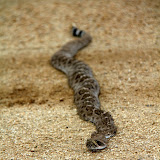
The rattlesnake didn't run away. Snicker. It didn't slither away at first, either. It may have frozen to try to go unnoticed.

Here's a perfect example of why I wanted a camera that will also make videos. The snake put on quite a performance for the camera. Keep in mind that I have quite a bit of zoom. I wasn't nearly as close as the pictures and video make it seem. I'm not afraid of snakes, but I have a healthy respect for the poisonous ones. It would be foolish to put yourself close enough to one of these that it could take a strike at you.


At one point I was driving down Battle Axe road (the road to White Canyon). It had lots of little gullies across it from the rain. There were also sticks laying across it. So there were lots of things across the road that I didn't really need to pay much attention to. Instead, I was looking ahead at the cliffs near White Canyon. Then I noticed the black and white stripes around one of the things in the road. I slammed on the brakes but it was too late. I went over its tail. I felt really bad. I guess if one ever bites me I won't feel so bad about running over a rattlesnake, but they have their place in the scheme of things and they're pretty animals. Maybe it'll survive and bite somebody because it doesn't have a rattle to warn them. Gee, I hope not. I continued down that road for a while and decided I had better get out before the road got slippery. Rain was moving in.


I thought I might get some really cool pictures of sun's rays, but I just got some so-so pictures.


Third rattler of the day.

On the way back to pavement, I came across the third rattler of the day. There must be something about the cooler weather or the wet weather that has them out and about in the middle of the day. As with the other two, it was stock still in the road. I got out to take pictures and got close enough to get it stirred up. They will ignore pickups until they get run over but they don't want people getting too close. This one rattled as it backed away.


Once it got to the bushes at the side of the road, it quit rattling and hurried away. Then, in the quiet, I heard the other sound. The ominous crackling of high voltage power lines. I turned around and there they were, right behind me. They're following me around! I looked down at the road. Yes, it was still damp from the last shower. I hurried back to the truck and got out of there.


The scary part.

Click below to see all of the pictures.

2010_07_25

Sunday, July 25, 2010

Escaping the heat, again

It was only 104 when I left the house this afternoon. In may or June, that would be decent hiking weather. The dew point was up around 60 today, though. The body can't get rid of heat very effectively when the humidity is that high. Doing strenuous things in the sun miles from anybody that might notice you getting loopy would be dangerous. I hurt my knee yesterday and wasn't planning to do anything strenuous, but you never know. I went out near Oak Flat (east of Superior) again.

Since my knee was kind of achy, I thought that I might spend the day exploring roads out there. I started out on N Cerro Rd. There is a power substation out there and the road is almost paved out to the substation. I wanted to get some pictures of the substation but all that electricity makes me nervous. I saw a cactus I've never seen before right next to the substation. I rolled down the window to take pictures.


I've never seen one of these before. It looks sort of like a fishhook pincushion with barrel cactus flowers.

I took a wrong turn on the other side of the substation and the road got very rough. After going up a really bouncy stretch, I stopped and got out to take a few pictures and relax. I was still pretty close to the substation and could hear the 60 Hertz hum. I could also hear the high voltage crackling around the power lines. That's an unnerving sound. I needed to get rid of a bunch of water I had drank before leaving the house, but I wasn't about to put a conductive path between my vital organs and the ground so close to that substation. No circuit path for current to flow, you say? Then perhaps you will demonstrate how safe it is. High voltage doesn't give a hoot about open circuits. I headed back to the other side of 60.


The substation is hidden by the hill on the left. It's getting cloudy.

I was thinking about hiking out to a different part of Apache Leap. I thought I could see a faint trail on Google Earth. It would have been a long hike, though. Probably too much for my knee. Also, the clouds were getting bigger and darker. I kept driving until I was almost to the spot I had parked last weekend. I didn't want to drive that last quarter mile. I found a place to park and thought I might be able to get to the bottom of the canyon I was looking at last weekend without too much trouble from where I parked. With the clouds moving in, it had cooled down to about 90. I wandered slowly along a wash enjoying the scenery. Sweat trickled down my temples. It was so humid, I worked up a sweat by swatting at the occasional gnat. Well, I guess I always sweat out there. It just couldn't evaporate now.


I took mostly HDRIs out there, but I must not have had a wide enough exposure range. The clouds are still washed out.


Because of the clouds, most of the pictures I took were HDRIs. I felt strangely stable while trying to stand still for the three exposures. Maybe it's because I was standing in sand, or maybe because the wind wasn't blowing me around, or maybe it's because a couple of weeks ago I decided to cut down to one cup of coffee a day.


I bet this looks cool with lots of water flowing through it.

Not long after I left the truck, I heard thunder rumbling in the distance. It kept getting louder as dark clouds moved in from the north. I didn't want to walk very far anyway, so that was a good excuse to turn around. I tried to make a short video to record the sound of the thunder but the breeze blowing across the mike was louder than the thunder.


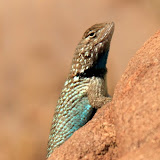
I saw a couple of cool looking lizards but they wouldn't pose for pictures.

Click below to see all of the pictures.

2010_07_24

Sunday, July 18, 2010

Near Oak Flat

I'm not sure what the name of the area is, or if it even has a name. I think its name may soon be "open pit mine" though, if McCain has his way.


Exploratory well. I don't think they're looking for petroleum. I saw 2 rigs drilling and evidence of previously drilled wells.

It was too hot in the valley (over 110) to do anything close to home. The altitude where I was going is only around 4000 feet but that's enough to reduce the temperature to a tolerable level. It was in the upper 90's where I started my hike. The humidity is way up, though. I had sweat trickling down my temples after a short leisurely stroll down a mild incline, and I was looking for places to get out of the sun.

Before I got out of the truck, I was driving down the road that goes past the Apache Leap trail. I got to an uphill stretch that I hadn't been able to drive up in the past. The tires just spun. I was able to drive up it without any trouble this time, though. Hooray for Michelin tires! It's always cool to finally go over the top of a ridge that you've only looked up at several times before, and finally see what's on the other side.


Finally, at the top of the next ridge. The road in the background was too rough for my liking, so I didn't go that way.

I decided to continue along the road as far as I could. The road split near the stock tank in the previous picture. I took the left fork because the right fork looked rougher that what I wanted to drive on. Well, the left fork was just as rough, but I couldn't see that part at first. It was one vehicle wide. It would be impossible to turn around. It kept getting steeper and rougher. I was afraid I might have to back all the way down. I was just hoping that I would find a place to turn around and get out of there before I encountered somebody going the other direction. It turns out that that section of road is only a quarter mile long, is a dead end with a lot of room to turn around, and I was the only person to drive on it since the last rain (maybe a day or two earlier). When I got to the top, I decided that would be a good place to hike around a little and get some pictures.


If you like hoodoos, this is your place.


This looks like it's a popular spot for people to visit.


It's the time of year for agave flowers.

I was wandering along mostly aimlessly taking pictures of rocks and plants when I noticed a faint trail and a cairn. It headed into the canyon to the east. There were large trees at the bottom of the canyon and I thought I could hear a waterfall. Maybe the trail ends at a pool of cool water and I can go swimming.


Rock columns visible from the trail.


Looking across the canyon. Notice how green the bottom is.


Rocks.

As the trail descended, it also headed towards a stone column. At first I thought that was coincidental.


The trail is heading towards the base of the column on the left


The view above me.


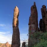
At the stone column. I'm guessing that it's about 50 feet tall.

When I got to the base of the stone column, the trail just ended. That seemed really strange. Why come out here and just stop? It looked like a fair amount of people had been out here since spring. They had trampled the grass. They had hacked through bushes. They had built cairns. I looked more closely at the column and thought I could see why they had been there. I zoomed in with the camera and confirmed my suspicion.


I don't know the technical names of climbing gear, but there's a metal ring attached to the rock. People come out here to climb this column.


An HDRI of the columns and the moon.

I guess the rock climbers don't climb this time of year. That column would not be a good place to be during a thunderstorm. Click below to see all of the pictures.

2010_07_17

Thursday, August 06, 2009

Proposed mine, editorial

The Arizona Republic has been running editorials regarding the mine that will wipe out the area in which I've been hiking lately (east of Superior). Click here to see the latest.

Monday, July 27, 2009

100 degrees is so ... cool

On Saturday I messed around all day and didn't really get outside until about 5. There were big black clouds all around. I decided I had to go somewhere and get some pictures (I just don't like pictures of clouds that have houses in them). I drove for about 15 minutes before I decided it was too late to try to get somewhere interesting and went back home to wait for the rain. It never rained, though.


I wasn't going to let the same thing happen on Sunday. I left the house about 1. So where do you go in the desert at 1 on a sunny July afternoon? Up. I drove to Superior, then kept going, and didn't stop until I got to 4000 feet. I went out past Oak Flat Campground, which is where I was last weekend but it was too late in the day to do much then. I was able to negotiate the bumpy parts of the road more smoothly this time. I had also studied the area on Google Earth, and I knew where I wanted to go. Remarkably, the road I wanted to follow was on my Magellan GPS receiver. Also remarkable, the receiver was working. It hadn't been for a couple of weeks, but Skid turned it on and it started working again. Oops, I'm wandering off the trail here. With my Magellan, a tow strap, and a come-along I felt secure. I had been down the road once before, years ago, on a gloomy spring day. Some parts looked familiar but most didn't. I didn't stop until I got to a gate that I had to open. I remember knowing that it was OK to go through the gate, but I couldn't remember why. Oh well, who cares as long as it's OK. When I got out of the truck to open the gate, I stood there and marveled at the fact that I didn't feel like I was being scorched all over. Wow, I'm out in the sun and I'm not on fire!


The gate. It doesn't look like it would contain much. It was closed when I got there, so I closed it after myself.


It took all my skills as a photographer to get a picture of this place that looks boring.


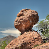
After I went through the gate, there were no tire tracks. It had rained Saturday night and erased the tracks, and nobody had gone out there before me today. Still, as I drove along the road, I couldn't help looking for other vehicles. As I glanced in my mirror one time, I spotted something that I was hoping to find again. There are a lot of balanced rocks out there, but there is one that looks just like the Grinch. I didn't get very good pictures last time, and I wanted to try again. The lighting was a little better this time.


The Grinch!


This is a really lumpy place.


There are power lines running through this area, and for some reason, it's hard to take a picture without getting them in it. There are plenty of directions to point a camera besides at the power lines, but they always seem to be next to what I want to take a picture of at the moment.


Omnipresent power lines.


So I decided I should quit struggling against the power lines. I need to accept them as part of the landscape. I need to incorporate them creatively into my pictures. I thought that maybe I could somehow compare and contrast the power in the wires to the power of the thunderheads growing behind them, or that the elegant beauty of an agave flower stalk and the efficient geometrical shapes of a transmission tower could complement each other. So I took a bunch of pictures with power lines on purpose. They suck. Pardon my French, but they do. I guess I'm just not very good at photographing power lines yet. I'll work on it some more. Yep. Sure I will.


I got out of the truck at the end of the road and decided that since it was so cool, I had to go for at least a short hike. I also had to hike for another reason. You see, for several months there was an impending RIF where I work. We knew it was going to happen; we just didn't know when or who would be affected. I was a nervous wreck. I was having about 4 migraines a week. All the stress made it difficult to concentrate on work. I managed to get some good stuff done, but man, what could I have done without that axe hanging over my head? Anyway, I decided that if I didn't get RIF'd, I would get a new backpack. The one I've used for the past couple of years was pretty simple, and if I carried a lot of water the weight made my shoulders hurt. Also, when I was tired it tended to slip off my shoulders. I survived the RIF and bought a Kelty Redwing 2650. Then it got really hot and I couldn't use my new backpack. Crackers. Well, I was going to use it now come Hell or high ... Hah, not much chance of high water. So I set off for the summit of a small hill nearby.


Parked at the end of the road.


The view from a small hill.


Unfortunately, I was climbing the leeward side of the hill. It was also the shady side, but you could only say that because all the other sides were sunnier. There were only 1 or 2 rocks where I could actually get out of the sun. I was at 4000 feet, too, so I was a lot closer to the sun than I'm used to. Yes, I wore my hat. I don't like burns on my bald spot. I left one bottle of water on the seat of the truck, so I couldn't do what I had planned, which was to get the thighs of my pants wet to cool me off. I always hear that you shouldn't hike in denim, but I have never worn any other material that I would rather wear while pushing my way through catclaw acacia. There was a lot of catclaw on this hill, too. It grabbed my hands and forearms a few times, and the drops of blood gleemed bright red in the high sun. I would have taken a picture, but have you ever tried to photograph your own arm when you can't get the camera closer than 1.4 feet from your subject? I enjoyed the breeze at the top for a while and then headed back to the truck. By the time I got back to the truck, the blood was gone. You know you are sweating a lot when you can't find the trails of blood from cuts you got half an hour ago.


Clouds and sotol stalks.


I turned all the vents to blow on me and drove slowly out, stopping now and then to get some pictures. I had cooled off pretty good when I stopped to follow what looked like a well-worn trail. I took my sunglasses off as I got out (you can't take pictures with sunglasses on, especially if you are using a polarizing filter) and squinted in the bright sunlight. You know you have been sweating a lot when you can feel the salt crystals in the creases around your eyes when you squint (or laugh, but I rarely laugh when hiking by myself).


It's getting late and I'm tired. It was an eventful afternoon, but I'll tell you about just one more thing I saw. As I was driving back, and was almost back to the campground, I saw some ants crossing the road. These weren't the usual large red ants you see around here, though. They were a lighter shade of red, but about the same size. The thing that got my attention was how fast they were moving. I got out to get some pictures but they were moving too fast to get good ones. I also noticed that I had gotten there just as they started to cross the road. The lead ants had just gotten to a culvert and were exploring for a path around it. Watching them reminded me of videos of army ants in South America. I'm going to have to do some research on Arizona ants. Maybe tomorrow. Click below to see all of the pictures.


2009_07_26