Showing posts with label Apache Leap. Show all posts

Sunday, July 09, 2017

Apache Leap and a New Gadget


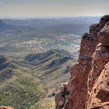
Apache Leap as seen from Apache Leap.

As you approach Superior, Arizona, from the west on US 60, you will see some cliffs towering above the east side of the town.
That's Apache Leap. I've hiked out to Apache Leap a few times (from the other direction). It's about 2 miles round-trip and about 500 feet (about 150 meters) in elevation change. It isn't a difficult hike if you stay on the trail. If you lose the trail you will be worn out quickly. The manzanita is thick in places and difficult to push through. The open ground is covered in calf-high grass so you can't see what you are stepping on. Since your feet will usually come down on the sides of round rocks you will be struggling to maintain balance, which is tiring. So stay on the trail if you go.

The trail is marked with cairns but sometimes they are difficult to find. This, of course, is an easy one.

Which kind of brings me to the new gadget. I've always thought that using electronics to keep track of your workouts was silly. Listen to your body. You don't need all that distracting crap. Then we were offered a deal on Fitbits through work. I thought it might be nifty to see what my heart rate does during a hike so I got one.

There was a short blurb about fitness trackers in a recent issue of Scientific American. A doctor wanted to know how accurate they were as heart rate monitors and so he compared their results to medical-grade heart monitors and concluded that they are acceptable. The article didn't get into any details about the conditions under which he tested them, though. My experience is that they can be way off if you are doing something besides sitting in a chair.

Apache Leap is 500 feet above the unofficial trailhead. Five hundred feet of elevation gain in a mile is not real steep. Normally I could walk up something like that at a slow but steady pace. I was struggling on this hike though, and was wondering what was wrong with me until I remembered that I started out about 3000 feet higher than I'm used to hiking. Anyway, I checked what the Fitbit thought my pulse was on a stretch where I was gasping for air. It said 86. No way. I felt my pulse. I didn't have a watch to count my pulse, but it felt like it was well over 120. Fitbit still insisted it was a rock-solid 86.

I have seen it make errors in the other direction, too. It has recorded that my pulse was over 140 when I was on an easy downhill section of trail. If my pulse was really as wacky as my Fitbit says, I don't think I would feel as good as I do while I'm hiking. Also, I wore a medical grade monitor for a couple of weeks not too long ago and it didn't show anything wacky, so I am confident that how I feel is a better indication of what my heart rate is than the Fitbit.

This stock tank is just before you get to the cliff of Apache Leap.

Apache Leap hasn't changed since the last time I was there. It may change soon, though. A land swap has been pushed through congress that puts the Oak Flat area in the hands of a mining company. I think it would be kind of hypocritical of me to say that's a bad thing while I surround myself with high-tech gadgets made possible in part by the copper that comes out of mines. Instead, I go hiking in that area whenever I can and take photos of whatever I come across.

Picketpost Mountain as seen from Apache Leap.

A tarantula hawk visited as I sat on a rock resting. This wasp is about 2 inches long. I hear they have a paralyzingly painful sting. I'm not going to try it myself, though.

The trail goes up the middle of this canyon. This is facing back down the canyon (Apache Leap behind me). I tried hiking up to Apache Leap on one of the ridges between canyons once. The terrain varied from difficult to impossible.

Just before I retired a lot of people asked me what I planned to do in retirement. One thing I said was that I was going to work on taking better pictures. I am working on that, but don't expect to suddenly see NG-quality photos on my blog, OK?

Tuesday, March 01, 2011

More snow

I had been reading the weather forecasts last week. I knew there was going to be snow. Some forecasts said it would be as low as 2500 feet. Still, on Sunday, after listing to rain all night, I didn't think about going to look for snow. Just before noon, though, I got a call from somebody saying that I should take a look at the Superstition Mountains. So I grabbed my backpack and my camera bag and headed out the door. Forgot to eat lunch. Sure enough, there was quite a bit of snow on the Superstitions. There was also a very large, very dark, very ominous looking cloud coming from the northwest that was dumping something (maybe more snow) on the Flatiron, at the western end of the mountains. I probably should have taken a picture, but I don't like taking pictures in town. Power lines and light poles in my pictures really annoy me, so I try to avoid them.

I drove all the way out to the Hieroglyphic Canyon trailhead, even though I knew I would be too close to the mountains to get good pictures. I figured that I probably had enough pictures of the Superstitions with snow on them and I just wanted to look around. Of course, I took pictures, too.


The view from the Hieroglyphic Canyon trailhead. The Flatiron, and the black cloud over it, are out of view to the left. It's getting dark here, though. Damp snowflakes were hitting me before I left.

It looked a little sunnier to the east, and I could see a lot of snow on the mountains in that direction, so that's where I went. D**n the Renaissance Fair traffic and full speed ahead. Actually, I think a lot of people decided that it wasn't a good day to go to the fair. There wasn't much traffic at all.

I've always wanted to get a good picture of Picketpost Mountain from the west. With snow on it and the sun peeking through the clouds now and then, it would make a nice picture. The trouble is, there isn't any place to park with a good view of the mountain. I don't like the idea of parking on freeway shoulders unless it is absolutely necessary. I found a place to get a hundred feet or so off the road (and almost got stuck in the mud) but couldn't see the mountain. I was hoping I could after climbing a small hill, though. Before I started out, I looked back at the storm. I had gotten a little ahead of it, but now it was catching up with me again. I would have to hurry. I moved quickly to the top without taking any pictures of all the cool stuff I saw on the way up. Well, OK, I took a picture of a saguaro skeleton with snow on it. On the way up, I kept hoping that I wouldn't see another hill between me and Picketpost when I got to the top.


Not a bad view of Picketpost, but the clouds are catching up with me; no sun on the mountain.


Superior. The dark band above it is Apache Leap.

While I was on top of the hill taking pictures, the wind picked up. I had made sure I had at least one poncho with me before I left the house, but being caught in a storm when it's in the 30's wouldn't be fun. I hurried back to the truck and drove on in to Superior.


The storm approaches.


The rest stop in Superior. This is a lot of snow by Valley of the Sun standards.

I was too chicken to continue going east from Superior. The road climbs a thousand feet and I didn't want to drive on any snow, so I headed south on 177.


Looking back towards Superior from 177. The mountains north of it are hidden behind a wall of white.


Snow on saguaros.


A non-HDRI shows how dark it is to the north.

177 climbs gradually for a few miles, then climbs steeply to a pass. There are truck safety pullouts at the top on both sides of the pass, and each had a few people out looking at the snow. I stopped at both to take some pictures and was pelted by tiny balls of snow. I suppose there's some technical name for that kind of snow but I see snow so seldom I'm not going to bother looking it up.


It was snowing in front of me and behind me as I drove south.


A small open-pit mine made slightly less ugly by the snow.


Snow capped saguaros. That seems so out of place, kind of like a bikini at McMurdo Sound.


Snow at the mountain pass. I also took a picture of these people with their camera so they could all be in the picture.

On the south side of the pass, the road descends into the Gila river valley. Of course, there was no snow down there. I went a very short distance down Battle Ax road and climbed a small hill there to get some pictures. The clouds were clearing by then but there was a strong breeze from the north. I stood at the top of the hill for a couple of minutes taking pictures of the mountain to the east and was a little scared when I quit and it felt like the left side of my face had frozen into the goofy expression I make when I'm taking a picture. It thawed quickly when I got out of the wind. Whew.


That cloud looked awesome.


Landscapes look great in the clear winter air. The edges of these clouds look strange. I wonder if it's an HDRI artifact. I'll have to check the original pictures when my NAS isn't so busy (long story).


The wet ground and clear air made the Ray mine look especially colorful.

By the time I started back north, it was clearing over Superior. It was such a nice day, I decided to go east on 60 after all. The road was heavily traveled and completely clear.


Clear sky towards Superior.

60 climbs a canyon east of Superior, and it's very scenic there. There's a tunnel at the beginning of the climb where I've always wanted to take some pictures but have never stopped. I stopped this time, though, since I wasn't in a hurry to get someplace else.


At the uphill end of the tunnel.


The tunnel.

The area at the top of the canyon is called Oak Flat. In such rugged terrain, flat areas are rare and they always seem to have a name. Being flat, it had lots of snow and also lots of people playing in it. I went past there on Magma Mine road and took some pictures of snow on all the rocks. I kept thinking I needed to work on being more artistic with my pictures of the snow instead of just showing what was there, but my pictures are rarely, if ever, artistic, so I don't know why I kept thinking that.


An almost artistic picture of snow on a rock.


This almost looks a little artistic.

By the time I got back to the western side of Picketpost Mountain, the sun was shining on it and the snow was quickly melting. I took a few pictures from the road to the Picketpost Mountain trailhead.


It didn't take long for the snow to melt.

The sky was clear over the Supes when I got back there, and there was just a thin line of snow at the very top. I thought about getting some pictures from Silly Mountain, but by then I was way too hungry. I ate all the beef jerky in my backpack but it just wasn't very filling. Click below to see all of the pictures.

2011_02_27

Monday, June 15, 2009

A real EveryTrail trip

I put together a regular trip on the EveryTrail site. There are some things I like about it (it didn't crash) and some I don't (no 3D view, but maybe I just haven't looked hard enough yet). Somebody out there tell me what you think. Somebody? Hello? Is anybody there? Oh well.


Apache Leap hike at EveryTrail

Map created by EveryTrail: Share GPS Tracks

Saturday, June 13, 2009

Monday, June 08, 2009

Apache Leap trail

On Saturday, I tried to get to Apache Leap, but I hardly made any progress at all. I was looking at the area in Google Earth, trying to figure out how to get past all those huge boulders. Then I noticed a stock tank very close Apache Leap. Somebody had to put that there, and they probably went up there now and then, so there had to be a way to get there. Looking at the valley in which the tank was located, I thought I could see a trail. Maybe it was wishful thinking. At least it looked like there weren't as many huge boulders there. The usually problem with areas like that, though, is all the vegetation. But if there's a trail, there will be a path through the vegetation.


So I drove out past Superior again. It's a beautiful drive from Phoenix to Superior. The road from Superior to where I turned off (Oak Flat Campground) is spectacular. I'll have to take some pictures some time. Anyway, I parked in the same place I did before and walked down to where I thought the trail should be. Lo and behold, there it was.


It would be easy to miss the turn-off for this trail.


At its beginning, the trail was narrow; bushy oaks brushed my shoulders and legs. I didn't have much hope of such a seldom-used trail getting me to my destination.


The entire trail is marked with frequent cairns.


At the beginning, the trail frequently crossed sandy or dusty areas. The only human footprints I saw were mine. It's obviously not a heavily used trail. But there were lots of cairns. I was almost always within view of at least 3. Somebody put a lot of effort into putting those things up. At times they were the only way to tell where the trail went. It was hidden in spots by this past spring's growth.


This area is a lot different than where I'm used to hiking. There are a lot of different plants. I noticed manzanitas with berries on them. Then I noticed poop on the trail with manzanita berries in it. I don't know what animal did that, but I imagined that it was black bears. I know there are a lot of them around Four Peaks, so they may be here, too. I would love to get a picture of a bear. I would hate to surprise a bear. Hikers are advised to make noise as they hike so bears will be aware of their approach. I'm not normally a very noisy guy, but I decided I had better be for a little while Every once in a while I stopped and did my impression of a large dog barking. I've gotten pretty good at it. It fact, a couple of times when I heard my echo, I picked up a rock to bean that mean dog.


The trail was overgrown in lots of places. Also, there were a few times that I wasn't paying attention (imagine that) and lost the trail. The point is, unless you really enjoy bleeding, wear long pants on this trail. There's lots of catclaw acacia. There are a lot of other sharp things, but they pale in comparison to the catclaw. My arms were covered with dried splotches of blood by the end of the hike.


The stock tank I saw on Google Earth.


It's only about a mile hike to Apache Leap. It seemed to take a long time, though. It's about a 1000 foot climb but didn't seem steep at all. It was a very enjoyable hike. BTW, I've hardly seen any gnats since I got back from Texas. They must have starved to death while I was away. It was exciting when I got to the stock tank, because I knew I was very close to the cliff.


After passing the stock tank, I wasn't sure how close to the cliff I was. Then I noticed the wind whipping some agave flower stalks around. I knew I was very close. A couple of more steps and I could see Picketpost Mountain in the distance.


Campers built this wall to shield their fire from the wind.


The wind and the view reminded me of the South Rim of the Chisos Mountains in Big Bend, though not quite as spectacular. The breeze felt great, and the view was very nice.


Unfortunately, I was shooting into the sun.


The Superstition Mountains and Weaver's Needle can be seen on the horizon. Yes, there are more cairns over there.


My pictures do not begin to capture what it was like to be up there. You'll just have to go with me some time. Click below to see all of the pictures.


2009_06_07