Showing posts with label EveryTrail. Show all posts

Sunday, October 24, 2010

Wandering around in the desert

I had plans to go further into the Goldfield Mountains on Saturday. I wasn't feeling very energetic, though, so by the time I got out there I changed plans. First I had to decide where to start. That was easy. I started where I found a place to park. Then I started walking in a direction that it seemed unlikely that most people would go. Several people had been out there, though. I saw a very old can, a gun shell, and several mining claim markers.


I started out going in this direction.
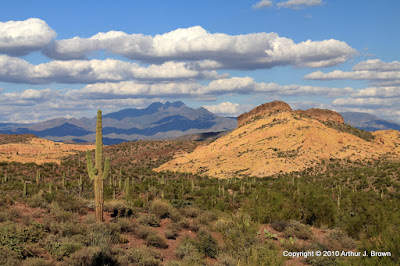

There were some nice fluffy clouds around.


I eventually decided to hike up to the top of that cliff on the left.


A mining claim marker. When I came across this, I felt obligated to empty my pockets of all the gold nuggets I had collected so far. That's OK; they were pulling my pants down.

I kind of headed uphill, then cut over to another ridge and headed uphill, and kept doing that until I noticed I was getting close to a cliff. It looked like it would be easy to get to the top of the cliff, and the view was bound to be great from up there. To the cliff, then.


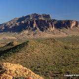
Almost to the cliff (that's it on the left). I took a lot of pictures of the Superstition Mountains on this hike.

There were large animals out there, too. I got close to two of them but never saw them. The first one was in a dense stand of paloverdes. I could hear it walking away. Sounded like a deer. The second one was near where I started walking out onto the cliff. I was slowly walking up to the ridge, snapping pictures along the way, when I heard what sounded like something sliding and then a lot of rocks tumbling. I quietly peeked over the ridge but whatever it was, it was long gone.


That's the top of the cliff on the right.


Not zoomed in on the Superstitions. They look so small.


Panorama of Gold Canyon and Apache Junction.

As I was standing on the cliff, I decided to take a picture of the Superstitions with my phone and send it too a few people. As I was doing that I noticed that there was an update for the Droid EveryTrail app. I downloaded it and decided to use it to make a trip out of my hike back to the truck. One reason I wanted to do that was to see how it handled loss of cell phone service. I was sure that would happen as I descended. It didn't, though. Even though no bars were showing, the map kept getting updated (the map isn't stored in the phone). I'll have to try that experiment again someplace else. The app looks much more sophisticated than it did the first time I tried it out. It seemed to work flawlessly, too. I used the phone camera for the pictures in this trip, so they aren't too hot.

Bulldog Canyon Experiment


EveryTrail - Find the best Hiking near Mesa, Arizona

Click below to see all of the pictures.
BC_2010_10_23

Tuesday, October 12, 2010

Finding a route

A few weeks ago, I had gone on a hike trying to find a route to the old Massacre Grounds trailhead. I didn't quite get to it, but I was worn out anyway. Well, yesterday I was looking at Google Earth and decided to try going it that direction again, only this time I would follow a large wash. My destination had changed, too. I wanted to get to some hoodoos that are in that direction.


This looks interesting from far, far away, so I want to get a closer look.

The sun sets so early these days I knew I wouldn't have time to get all the way out there. I just wanted to see if using the wash to go that direction would be workable. I quickly learned that being in the wash was a bad idea. Lots of boulders to step over and lots of loose sand to sap speed and energy.


This is not a preferred place to hike.

I stayed in the wash for a while, though, because there were lots of footprints there. Maybe they knew something. I think maybe they didn't. There were getting to be a lot of trees in the way so I got up on the left bank of the wash. Wow, it got a LOT easier to walk. There were a lot of teddy bear chollas in places so I had to be careful where I put my feet, but I didn't have to worry about twisting an ankle.


My favorite variety of cholla, despite all the pain it's inflicted.

I made pretty good time on the way out and wasn't too worn out by the time I had to turn around. On the way back, I learned that I should follow the right bank at first, then switch to the left after a quarter mile or so. It was a successful outing. I learned what I wanted to know.


I think most of the saguaros in this area were wiped out by a fire many years ago. There are black brittlebush stubs all over the place.

It was getting pretty dark on the way back. I figured the rattlers were probably coming out and looking for a meal. The last half mile or so made me a little nervous but I didn't see or hear any snakes. It's a good thing, too, because the internal flash on my camera refuses to pop up. For some reason it thinks an external flash is attached. I wonder if I messed up some setting somewhere. Gotta figure that out.


Got a picture of the moon.

Remember how I used to put hikes on EveryTrail? I started using EveryTrail because it was so easy to transfer pictures from a web album to an EveryTrail hike. A few weeks ago, that function broke. I mentioned that in my previous blog. The very next day, I got a message from Joost. I think he is one of the two guys that started and runs EveryTrail. You know, I gripe about Microsoft all the time, but Bill has never sent me an email asking what he can do to help. Anyway, when I got my jaw off the floor, I sent info on the issue to Joost. It turns out that Chris (the other EveryTrail guy) had responded to my issue on an EveryTrail forum; I thought I would get an email when somebody responded but either I didn't or I missed it. Anyway, the problem seems to be on the Picasa end so there probably isn't much the EveryTrail team can do about it. Well, they may have some connections at Google. Anyway, I'll try it now and then to see if it's fixed. It might already be fixed. I haven't tried it for 2 or 3 weeks. I'm also going to see if I have some software that will resize pictures for upload in batch mode. (I'm an engineer. I'd rather spend 2 hours writing a program to do something than 15 minutes doing it by hand.) I'll let you know what happens. Well, you knew that. Click below to see all of the pictures.

2010_10_11

Tuesday, March 16, 2010

Another EveryTrail map

I've been putting recent trips / hikes on EveryTrail. Here's the White Canyon hike. If you look at the elevation profile, you'll see that GPS satellite reception isn't very good in narrow canyons.

White Canyon, White Canyon Wilderness Area


Map your trip with EveryTrail

Monday, January 11, 2010

Near the Carney Springs trail

Saturday was a beautiful, sunny day. By the time I started to leave for a hike, though, it was after 3. I decided it was too late and instead charged the motorcycle battery. Sunday, it was overcast. Dangit.

So then I thought that I should take the ATV out to Bulldog Canyon and drive down some roads I hadn't been on in a few years. I hooked it up to the charger on Sunday morning. It was charged after lunch and I tried to start it. And tried and tried. Then I gave up.

I loaded my camera and backpack into the truck and headed out, wondering where I was going. I wanted to go someplace different. I couldn't think of someplace completely different that was nearby, so I drove down Peralta road thinking that I would stop somewhere along there or maybe even hike on a trail at the end of the road. I wound up stopping where the road that used to go out to the Carney Springs trail was. The road is closed now (long, sad story) and I haven't been out that direction since it closed. I figured I could walk where the road used to go and see how long of a walk it is. It turned out to not be as bad as I was afraid it would be. I got to the Carney Springs trail and started along it, still thinking that I wanted to see something different.


This is where the road used to be. It's been dug up, and there have even been a few cacti stuck in the dirt (that's all it takes to get them growing).

The Carney Springs trail gets to a spot where it looks like there may have been a concrete water trough at one time. There are only a few pieces visible in the dirt now. I was looking around in that area when I noticed a side trail heading east. Cool, something new! Of course, I followed it. It went a few yards and became hard to follow. Then after a few more yards it crossed a small wash. Then it all but disappeared. A fair amount of people had to have gone this way, though, so I was determined to follow it whether I could see it or not. So I started going uphill, because that's a direction I often like to go, and downhill didn't look interesting. Somebody that had been on the "trail" recently couldn't be bothered to step over plants in the path, so I was able to follow a trail of smashed brittlebush, smashed fairy dusters, and displaced rocks. The smasher didn't step on any cholla, though.


Somebody left a trail marker that turned out to be a Planet Hollywood windbreaker from Paris. I kept it.

Since I was in an area that was new to me and because it would be easy to lose the trail, I was stopping frequently to look around. On one of those stops I spotted a cave. I thought that must be the trail's destination, and it did go there.


A cave.


On the inside looking out. Gee, writing that took me back to the mid-60's. The Animals. Wasn't a big hit in the colonies.

After looking around in the cave (not much to see), I went up on the rocks on top of it. The view was much better up there. From up there I thought I could see some mine tailings. I knew there was a mine up there somewhere, but I didn't know where. I thought I had found it. Stomper had gone in that direction, too, so maybe I was on to something.


One of the views from above the cave. Find the truck!

As it turned out, what looked like tailings from a distance was actually solid rock. I walked across to the other side. The "trail" continued beyond there but the slope it was on got too steep for me. I didn't want to descend doing cartwheels through cacti. I headed back down the slow way.

My GPS data logger did pretty good until I got up on the side of the mountains. I'm convinced that it's the terrain in which I hike that's causing all the problems. Well, that's not gonna change (I hope).

The GPS track looked good on the @trip map, but when I uploaded it to EveryTrail, it looked like I flew back and forth across a canyon at 85 mph. Wow, I wish I could really do that! The @trip software must filter out stuff like that. EveryTrail allows you to edit the track, so I moved a couple of track points over to the correct side of the canyon. There's still some screwy stuff in the data. I'm doing this for fun, though, so I'm done worrying about it.

Click here for the EveryTrail map and below for all of the pictures.

2010_01_10

Monday, December 28, 2009

Wandering in Bulldog Canyon

OK, the EveryTrail maps are making my blog unreadable with their picture slide shows. I tried disabling them by default, but I think that only works if you look at the map on the EveryTrail web site. I'm going to try putting a link here for the map, but I'm not sure if the link will work for somebody that isn't logged in as me. So somebody (anybody) let me know if the link works. Anybody who cares whether the map is on the blog or if there is just a link to it, let me know. Here is the link. It will open a new window (or tab), so you can click on it now while you are thinking about it and continue reading if you would like.

I also figured out how to make the map default to satellite view, but you can change that easily while looking at the map. Also, click the play button at the bottom of the map to view the slide show.

Let's see, I went for a hike today. I had planned to try to go up to the top of the Goldfield Mountains. I thought I was leaving the house about 1, but it turns out that I left after 3. I wouldn't have enough daylight to climb over 1000 feet. I was trying to decide what to do instead of my planned hike but didn't decide until I was out of the truck and walking. I decided to wander around on a rocky hill near where I parked. It was in the upper 50's and windy (about 15 mph), so I was glad I had worn a flannel shirt. On the down hill portion of the hike I even put some earmuffs on. I'm just not suited for cool weather. It was also overcast, so the pictures are terrible.


Here's a terrible picture showing where I went. I climbed just a little to the left of where the road points.

I wasn't really planning to go to the top of the hill. I just wanted to see what was over there. It turned out to be pretty easy to get to the top, though. At the top, it looked like it might be easy to descend on the other side. I had enough water, food, clothes, and stamina to backtrack if I had to, so I went for it. It was easy.


I had originally planned to hike up that canyon. It looks like there might be a cliff near the top that will block my progress. Only one way to find out.

I think I mentioned last time that I wanted to write a program to removed useless data from my GPX files that was causing EveryTrail to show me moving at 30 to 300 mph. I wrote the program this morning. It's a very simple program but it took me an hour or so to remember / re-learn enough Perl to write it. The totally amazing thing is that it did what I wanted the very first time I ran it. That's only happened once before (with a rather complicated memory test program) in my life that I can remember. It's not that I'm a bad programmer. It's just that it's almost impossible for a humid bean to do that much typing without making some typo, logical error, syntax error, or something that prevents the program from doing what is intended. Anyway, the program removed 76% of the track points from the GPX file. There's still one point where my speed jumps up to 12 mph. That's where I fell off a cliff. Just kidding. I think that is where something screwy happened with the satellites. My elevation is shown as dropping by 100 feet at that time, and that did not happen. Before the speed burst, my position is shown as being about 50 feet south of where I really was, then it suddenly jumps to being closer to correct. Maybe the data logger got another satellite signal or collected WAAS data and so it had a better fix on my position. That jump was in the data before I ran my program, so I didn't cause it.

Click below to see all of the pictures.

BC_2009_12_28

Thursday, December 24, 2009

A view of Hackberry Mesa

While I was on Hackberry Mesa about 3 weeks ago, I was looking at a mountain ridge to the WNW and thinking that I had probably been up there before. I decided then to climb back up there and take a look at Hackberry Mesa from over there, since I would know more about what I was looking at now.


The ridge I was looking at on November 27.

Yesterday was a beautifully sunny day (after a dark and rainy Tuesday) and I was able to get away from the house in time to climb the ridge. I had already planned my route a couple of weeks ago. It was an easy hike, but I moved pretty slowly. It was about 50 when I left the truck, with a very light breeze from the west. I was wearing a T-shirt because I knew I'd be warm going uphill. I didn't want to get sweaty, though, because then I'd be cold. I tried to move slow and made lots of stops, but sweat was dripping from my temples as I neared a saddle on the ridge. The view was wonderful and I stood on the ridge snapping pictures for a couple of minutes, but I was quickly getting chilled in the light breeze. I found a sheltered spot in the sun and put on my flannel shirt. Ahh, toasty!


Hackberry Mesa is on the left. If you look closely, you can see a little bit of Garden Valley.


First Water Creek is visible here. I had to stand in the shade to take this. Brr.


Weaver's Needle is on the left and the Superstition Mountains are on the right. I glanced at some pictures and thought I was holding the camera crooked, then checked the view and everything does seem to slope to the left.

You can probably tell from the pictures that it was a little hazy. I think that's moisture in the air from the rain the day before. The ground was soggy and there were puddles around. Also, the moss and resurrection plans were green.


Some very green moss.

I've been making EveryTrail maps of my hikes lately. One reason I've been doing that is because you can add pictures to an EveryTrail trip directly from a Picasa web album. In looking at the trips, though, there's something annoying. You can view a graph of altitude and speed versus distance. The graphs usually indicate that I sometimes move at 30+ mph for short bursts. I do walk fast sometimes, but I doubt that I exceed 4 mph. I decided that my GPS data logger is sometimes losing visibility of enough satellites to navigate for short periods of time. When it does get another fix, the sudden change in position makes it look like I moved very quickly. I had the logger on my camera strap, so it was normally positioned at my neck, over my left shoulder. I thought that maybe my head was blocking satellite signals and if a mountain blocks signals on the other side, the logger wouldn't be able to navigate. So I tried putting the logger on top of my hat. The first hike I tried that on showed I was moving in excess of 300 mph. Well, I was in some narrow canyons then. I should have had pretty good satellite visibility yesterday, though, and there are still several places where my speed is indicated as being over 20 mph. I think it's the mountains blocking signals. The graph for a walk I took around Brazos Bend State Park (flat as a pancake) has a much more believable speed graph. The map for this hike is below. I also included the Brazos Bend map, in case you want to compare.

Off trail 101


Map your trip with EveryTrail

Brazos Bend State Park


Map your trip with EveryTrail

Maybe I'll write a program to smooth out the data, some day when I'm feeling ambitious. Click below to see all of the pictures.

OT_101_2009_12_23

Saturday, November 28, 2009

Everytrail map to Hackberry Mesa

I've been meaning to put some of my recent hikes on EveryTrail. I finally got around to doing that today. There have been some improvements to their web site and I really like it now. You can import the pictures for your trip from your Picasa web album, which is really handy. The display on the trip on their web site has some nifty features, also, like graphs of altitude or speed vs. time, etc.

Hackberry Mesa, via "back trails"


Map your trip with EveryTrail

Wednesday, June 24, 2009

Another hike on Everytrail

It was too hot to hike today (106 is TOO hot), so I sat around watching tv. Yuck. I finally decided to put another trip on Everytrail.


Cross Canyon hike at EveryTrail

Map created by EveryTrail: GPS Trip Sharing with Google Maps

Monday, June 15, 2009

A real EveryTrail trip

I put together a regular trip on the EveryTrail site. There are some things I like about it (it didn't crash) and some I don't (no 3D view, but maybe I just haven't looked hard enough yet). Somebody out there tell me what you think. Somebody? Hello? Is anybody there? Oh well.


Apache Leap hike at EveryTrail

Map created by EveryTrail: Share GPS Tracks