Showing posts with label White Canyon. Show all posts

Monday, April 08, 2013

White Canyon Wilderness

I've been making Gary climb to the top of this or the top of that for years now. He suggested that we go someplace that wasn't vertical or miles and miles of hiking. I thought the hike up the canyon in White Canyon Wilderness might be perfect. It isn't vertical (well, the sides are, but you don't climb those) and you can't go very far before it gets too difficult (at least for me) to go any further. With a 4wd truck, I could park at the start of the trail, too, instead of a mile or so back. On top of all that, it's very scenic.

I signed in at the register and there were notes there about cairns and purple dots. When I had been there before, cairns were next to nonexistent and there were no purple dots. Anyway, we followed the purple dots and it turned out to be my easiest hike up that canyon. I don't think we saw quite as much in the way of pools of water or small waterfalls, but somebody from Houston probably isn't as obsessive about pools of water as somebody that has lived in the desert during a drought for 10 years.


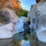
The trail went through places like this, to the side of the main channel, where walking is easy and doesn't involve climbing over boulders or hoping over water.


We were there early in the day, which is good if you don't want half of a picture in darkness and half extremely bright.


Gary by a small waterfall and extremely white rock. I didn't know he was also taking a picture at the time.

There were flowers all over the place. The water was flowing but was underground at least half of the time. The pools were wonderfully cool.


One of many pools of cool, cool water. There were waterbugs and I hear that they bite, so I didn't want to go wading.


Here's a large stone "paddle" that looks like it's smiling. I don't think it would be easy to get into a position where you could photograph it with a blue background.


I like the way this picture turned out.

It was pretty easy following the purple dots up the canyon. I had more trouble on the way back and wandered from the trail several times. I think that if I had been going where I thought I should go instead of looking for purple dots, I might not have overshot the truck by several hundred feet. If you look closely at the pictures, I think I got the purple dots in a couple of them.

2013_04_05

Thursday, February 14, 2013

New discoveries, just around the corner

This past weekend, I had planned to hike up to the arches I had seen the previous weekend. When I left the house on Saturday, it was overcast and gloomy and I could see rain falling here and there and it was cold (well, about 50) and breezy. I wouldn't like any pictures I took in such weather and I would have to keep moving to keep warm. I talked myself out of hiking before I had driven 4 miles. I kept driving east, wondering where I would wind up. The first place I stopped was just west of Superior. I saw a dirt road heading south and decided it needed exploring. After driving about a quarter mile, though, it crossed Queen Creek. There was actually water in Queen Creek and the bed looked very muddy and slippery. I'm sure Skid would have enjoyed some excitement that afternoon but I didn't want to have to call him out there to pull me out of the mud. I headed back towards 60 and turned east at an intriguing sign.


Why would a sign point to wagon tracks? Is it really wagon tracks or a town called Wagon Tracks?

As I drove along, I came to some tire tracks through some mud. Surely that isn't it. I kept going and, sure enough, there were wagon tracks. In stone. Deep wagon tracks.


The tracks have cut almost 2 feet into the stone in places.


Notice the holes down the middle.

I did some Googling last week and found out that the tracks were made by wagon loads of silver ore coming from mines to the north to a mill at Queen Creek, in what used to be the town of Pinal. The holes down the middle were made by the mules pulling the wagons. Allegedly they always walked in the same footprints.

Well, that was interesting. Before I knew it, I was back on the road and headed toward White Canyon Wilderness. The road goes right by the entrance to the wilderness but I had never driven on that road before because I thought it was too steep for me to be able to drive out. I knew that wouldn't be a problem now, though. So I drove a couple of miles further along that road and discovered that there is lots of fantastic scenery back there. Too bad it was so gloomy.

The wind wasn't blowing as much the next day, though the temperature was about the same. The sun was out, and there were small, fluffy clouds. I loaded up the Ranger and Sweetums, Emily, and I headed back out there.


A large parking / staging area has been built just off of Hwy 177. There were only two other vehicles there when we arrived. Nice view from the staging area.


One of my favorite views. We'll be circling around that peak on the left.


At the high point along the road, there are beautiful views all around.


Looking another direction from the high point. The trail you see halfway up that slope on the left is the Grand Enchantment Trial.

Emily got out to run around when we stopped at the high point in the road. She did not want to stop running around. Can't blame her. She convinced us that she's probably still too young for such adventures. She fell asleep a few minutes after we got moving again.

I saw at least 3 places out there that I'm going to have to try to hike to. A couple of them are rugged (scenic) looking canyons. The third is a hollowed out spot on a cliff face. There's a trail going up to it, so maybe there's something interesting up there. Even if there isn't, it will be a nice hike.


Notice the trail going across to that "cave" in the cliff face.

Wandering around aimlessly can result in some interesting finds sometimes. Click below to see all of the pictures.

2013_02_09

2013_02_10

Monday, April 18, 2011

Return to White Canyon

I had gone hiking in White Canyon for the first time about a year ago. There was a lot of water flowing through the canyon and in other areas near there. I made the comment that I would have to return in the summer and see if the water was still flowing. I did try to do that last summer, but the "road" had deteriorated and I couldn't park very close. I had parked about 0.8 mile away when I hiked there, and that extra distance wore me out. I couldn't get closer than about 1.2 miles as the road deteriorated and I'm just too lazy to walk that far, especially when it's hot.

I'm taking a long time to get to the point, and I'm not there yet. Sorry. On Friday evening I was trying to decide where to hike the next day (yes, I do actually plan ahead sometimes). I was looking at Google Earth and saw what looked like a road or trail going up to the top of a ridge. The view might be nice from up there, and I would get to see what was in the canyon on the other side without having to climb over boulders or push through shrubbery. And yes, I would rather walk up a 500 foot high ridge than climb over dozens of waist-high boulders.

I charged my batteries, ate lots of lunch, loaded up on water, and headed out. As I approached White Canyon, I could see the road going up the side of the ridge In one spot there was enough dirt piled on the slope that it looked like there could be an old mine up there. Could be interesting. In the satellite view, the road or trail looked like if faded away by the time it got close to the main road. I drove to where I thought I would need to start climbing and it looked like the first 50 feet or so would be very steep and difficult. I kept driving, looking for an easier spot to start. I think 2011 must be the year for bulldozing dirt roads, though, because this one was in much better shape than it had been the last time I was on it. I decided to keep driving and see how far I could get before I climbed the ridge.

I easily cruised past the large cottonwood where I had gotten a huge boulder stuck in my wheel well before. I could have hiked about a mile on the energy I burned up getting that boulder out from under my truck so I could move again. Oh, and I had to do that while standing in flowing water. The spring was dry now though. When I got to the next obstacle, which used to have black tire marks on it from all the people struggling to get over it, it was barely a bump now. I started thinking that I might be able to hike in White Canyon again. The road was remarkably smooth all the way to the entrance to the wilderness area. I had to park a quarter mile away because the final descent is too steep for me to drive back up, but it's an easy quarter mile to walk.


This part of the road might be too steep for me to drive up, but look how close I am!

So far, on the drive, I had not seen any water in places that I was used to seeing it. I had read somewhere that water was always flowing in White Canyon, but I couldn't find it. Anyway, I started up the canyon at about 2:30 and the temperature was in the mid 90's. I stopped in shade whenever I could find it, but there wasn't much.

I eventually came to a puddle. The water didn't look like anything I wanted to drink, or even get on me. It looked stagnant.


The first puddle.


I don't remember seeing this rock column before. It's hard to see unless the lighting is just right. I'll have to climb up there some time to get a better look.

I got to a spot where the canyon floor is solid rock, and there I found flowing water. It emerged from the gravel in a pool upstream and vanished again in a pool on the downstream end. I suppose it looked drinkable as long as you didn't think too much about the people wading in it. It looked very inviting after stumbling over river rocks in the heat. So maybe there is water here year round. It's just hidden part of the time.


A family enjoying the cool water. These are the only people I encountered on this hike.

Not only had the road been bulldozed, but the trail had been marked with cairns. And not only was it marked, but somebody had cut most of the branches out of the way. I was back at the point where I'd had to turn back before in no time. I found an easy path around the boulders that had stopped me back then. I think I may not have been able to get to that path last time because of all the water. Not much further upstream, though, I encountered more truck-sized boulders. I found my way around several of these before I decided that it was getting late enough that I should turn back.


I made a short video of one of the boulder obstacles, from the inside.

Up until I started back, I had taken only 1 or 2 HDRIs. I figured there were so few shadows, I didn't need that. It turns out that there were a couple of places with very bright rocks where I should have used it. I was in the shadow of the western canyon wall on the way back, though, so I wound up taking more HDRIs then.


I like the way this turned out.

I was past most of the interesting scenery and was thinking about how there are bears and bighorn sheep in that area and how I should have been looking around more for the sheep (and probably the bears) when something to my left moved and hissed. I must have startled it for it to jump like it did. It was a Gila Monster, the third one I've seen in 8 years of wandering the desert. I took a bunch of pictures. I think it was too dark right there for video. Anyway, that was the perfect finish to a very enjoyable hike.


Gila Monster sniffing the air.

There's beautiful scenery everywhere you turn out there. Click below to see pictures of a little bit of it.

White_Canyon_2011_04_16

Sunday, May 16, 2010

Near White Canyon

I planned a little better this time. I had food and lots of water in my backpack. I left the house early enough that I would have plenty of time to explore. Some unexpected things spoiled my plans, though. The first little problem was a boulder. Well, first some background. The last part of the road to White canyon is actually a stream bed. It seems to flow constantly with water from springs. That flowing water continually re-shapes the "road". OK, so I'm driving down this road along a stretch that hasn't been a problem before and come to a rocky spot. I must not have been paying attention because I didn't see the boulder to the right side of the road until I got out to see why the truck wouldn't move, and what had made that scrunching sound. I couldn't move forward or back. I had to slide the boulder out and roll it out of the way.


The boulder on the left got stuck under the truck.

There are fences in the area and at one point there's a gate across the road. I vaguely remember having a little trouble on the other side of that gate the last time I left White Canyon. This time it looked like it would be very difficult to make it back so I decided to not go any further. I parked the truck near where I had gotten stuck earlier. Now I'm going to have to walk quite a bit further than I had planned just to get to White Canyon.


The (now broken) gate is in the background. This rocky spot doesn't look bad in the picture, but the placements and angles make it a good truck trap.

After I had been walking and enjoying the scenery for a little while, I realized I had left my hat in the truck. It was early afternoon. Without a hat, I'd get fried. I didn't want to go back to the truck to get it, which clued me in to the fact that I'd worn my legs out moving the boulder. Since I was standing in front of another attractive canyon, I decided to explore up there a little.


Second choice canyon.

Progress up the canyon was very slow, partly because I was tired and partly because there was no escaping the sun. I kept trying to go on, though, because it looked interesting up ahead. I was eventually stopped by a thick clump of plants. There was no way around them in the narrow canyon and my forearms were itchy from pushing past similar plants. Time to turn around before I get into a regrettable situation.

There were lots of lizards in the canyon. Most scrambled out of sight before I could get a picture. A couple of them posed for me, though. They had both lost and regrown their tails. Somebody did a study of lizards that lose their tails and determined that the only factor that affects how easily they shed their tails is the presence of poisonous snakes in their habitat. If there are no poisonous snakes, the tails do not detach easily.


Note the regrown tail.


I think this tail is still regrowing.

When I got back to the spot I didn't want to drive over, I noticed something I hadn't seen before. There was a broken lug nut cover there. Somebody had had trouble getting out. They were frustrated because they couldn't go forward and backed up quickly to take another shot at it. I know this because of the pieces of broken tail light on the steep embankment. I bet there was a lot of cussing.

Since I was done hiking earlier than planned, I decided to go south on 177 and get some pictures of the Ray mine, which is a large open pit copper mine. I was taking pictures from the highway and finally noticed that there is a visitor viewing area (open daily from 7 am to 2 pm). The visitor area offers an excellent view, if you like looking at huge holes in the ground.


A view of the mine.

It's difficult to grasp the scale of the mine. There are dump trucks moving all over the place and the tendency is to use them for scale, but these are not normal dump trucks. Their tires are about 10 feet in diameter.


There are dump trucks and a train in this picture. At first I wondered why the train was so small, but that's a normal sized train.


The rig on top is drilling holes for dynamite to loosen the rock.


A normal size pickup near one of the dump trucks. You'll probably have to go to the web album and zoom in to see the pickup, though.

The only sound I heard at the mine was the machinery. It wasn't very loud, though, because everything is so far away. Click below to see all of the pictures.

2010_05_15

Tuesday, March 16, 2010

Another EveryTrail map

I've been putting recent trips / hikes on EveryTrail. Here's the White Canyon hike. If you look at the elevation profile, you'll see that GPS satellite reception isn't very good in narrow canyons.

White Canyon, White Canyon Wilderness Area


Map your trip with EveryTrail

Sunday, March 14, 2010

White Canyon, first hike

Saturday was a beautiful day. I was really curious to see what White Canyon is like, so I decided to brave the Renaissance Fair traffic and head out there. The traffic wasn't nearly as bad as I was afraid it would be on such a pretty day.

BTW, I found a map of the White Canyon Wilderness area. Wilderness.net has maps of all wilderness areas. It's pretty cool.

Battle Axe Road was rougher than it had been the last time I was on it. Rain water had cut notches through it. Parts of the road that follow a stream bed had changed quite a bit since last time. I parked as close to White Canyon as I thought I could. I didn't want to try climbing the hill out of there and finding out that I couldn't after a long, tiring hike. I could save a mile to a mile and a half of walking by going driving down that hill, though. I'll have to figure out some way of determining if it's too steep.


I was walking by the time I got to here.


Vehicles on the steep hill.

The temperature was about 70 when I started out. It was nice, but I got chilled if I sat in the shade of a boulder for too long. There was plenty of shade under boulders, too. There are dump truck size boulders all over the place.


Some large boulders.

There were waterfalls scattered here and there. I got pictures of a few of them. I also took too many pictures of the stream, because that's what I do. The water is what slowed me down most of the way and eventually stopped my progress. I guess it wouldn't have mattered if I didn't mind being it ankle to thigh deep water, but it was cold. I think the water flows year round, but I think I'll see what it's doing in July. Of course, it'll be too hot to hike then.


This is where I stopped. I might have been able to get around this, but the brush was getting thick and I was tired of pushing through it.

White Canyon is beautiful. There's plenty to explore, too. I need to find a way to get through the brush, though. I wonder if machetes are allowed in wilderness areas. Catclaw grabbed me several times. The time it grabbed my armpit really hurt. That reminds me, near the beginning of the hike, a young couple was behind me. Once, I heard the girl saying, "Ow, ow ow!" I didn't see them any more after that.

Click below to see all of the pictures.

WC_2010_03_13

Sunday, February 28, 2010

Video of the stream

After having lived in Arizona for several years, I can't help doing this. It seems so unusual to see flowing water, I made a video of it. This is a stream I crossed on my way to White Canyon Wilderness.

Battle Axe Road

I was looking at my EveryTrail profile the other day and discovered that I am an EveryTrail guru for the White Canyon Wilderness area. That distinction must have been bestowed upon me because I have some EveryTrail hikes that are close to there. It couldn't have been because I have hikes in there because I didn't even know where it was. I found a Bureau of Land Management website for the area. It has a description and directions for getting there, but no map. There is also a description on the Arizona Republic website, but no map. EveryTrail has a map but it can't be correct. Their map includes Superior and I doubt it goes that far north. I'd really like to see a map. I may have to create it. Or maybe I can get a map from the BLM.

Anyway, I left the house kind of late yesterday. I thought that since it was late and since it had been overcast all day, maybe there wouldn't be many people going to the Renaissance Fair to the east of Gold Canyon. I might be able to get to Superior without too much trouble, and then to White Canyon. The only trouble I had was finding Battle Axe Road. I drove by it a couple of times and glanced at the sign there and thought it said "PRIVATE ROAD", but actually it said "PRIMITIVE ROAD". I finally figured that out and headed down the road. It was in very good shape for a primitive road until I got a little ways past the right turn at the corral. High clearance became necessary and 4wd or locking rear axle highly desirable. Even then, much of the "road" was nice and smooth as it followed a wash. I soon got to places that would have had me stuck if I couldn't have locked the axle. I think the road used to follow the wash through an area that had been washed out (ha ha), leaving nothing but large boulders in the path. Since then, it looks like people have created a route around the washed-out part (still in the bed of the wash). I had to lock the axle to get on and off the alternate route, in both directions. If I wasn't so lazy, I could have made that easier by moving some small boulders to the side. Maybe next time I'm out there. Or maybe they'll get washed away with today's rain. Anyway, that's enough of this wash stuff.


Battle Axe Road heads for Copper Butte. This is Copper Butte from the side; didn't want a picture of it shooting into the sun.

I drove along the road until I got to a fence. There is a gate, but I turned around there because it was getting late and the road was downhill and steep on the other side. I didn't want to be stuck down there after sunset.


Cottonwoods along the way.


Now that's a spring. Wonder what it looks like in July.


Impressive cliffs all around.


That cliff is pictured in a lot of descriptions of this area.

The area is beautiful. I didn't get to see much of it, though, and I didn't get any good pictures. I will definitely be going back. I would be there now if it wasn't raining. Click here to see the EveryTrail map. Click below to see all of the pictures.

WC_2010_02_27