In some places out there, the soil is very red. It would look just like Mars if it weren't for the plants and animal tracks in the dust.
The pictures:
 |
| 1900_2007_ |


 |
| BC_2007_04 |
I think the snake is a coachwhip, aka a red racer. Click here to read about the coachwhip snake. Here's a short video of the snake making his getaway.


Here's a short video of a helium balloon used to advertise some new homes being built near our neighborhood. It's really being whipped around by the wind. You can see that the air is kind of dusty, too.
Here's a few pictures of various things I saw while I was out. Richard called me at about 2 this afternoon to tell me that he saw black smoke coming from the mountains north of here. He probably saw that burning microwave relay station in the pictures. I took that picture at 4.
 |
| Dust_storm |
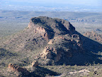
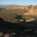
It doesn't seem to be so horse shoe shaped when you are on top of it. Also, those parts that seem to have gentle slopes seem much steeper when you are on them. There's a very nice view from up there, especially if you like looking over cliffs that seem to drop away forever. I couldn't make myself get closer than about 3 feet from that edge, though. Here are the pictures from this hike:
 |
| Conquering another ridge in Bulldog Canyon |
There are a couple of pictures of the view, then there's one of a stand of teddy bear cholla. I learned that you shouldn't talk on your cell phone when walking through them. I didn't start down until close to sunset, so I called Suzanne while I still had a good signal to let her know I was OK. I kept walking because I was running out of daylight. By the time I got to the other side of those cholla, both feet were covered with cholla balls and they were halfway up my legs, too. I managed to shake them off and kept going, but I kept getting poked by cholla needles until I took a shower.
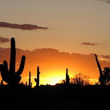
There are some pictures of cholla flowers and the setting sun. I turned to get that picture of the sun and briefly thought about moving to the left a little so the tree wouldn't be in the way, and almost screamed at myself. The cliff was 3 feet to my left. Ever since I started taking pictures (25 years ago?) I've worried about falling while trying to get in position for a good picture. I hope I never do that. Talk about embarrassing.
I added some of these pictures to my map of Bulldog Canyon, in case you want to know exactly where I was, and even if you don't.
Here's a few of the pictures, including some with airplanes, birds, and rooftops.
 |
| Sunset |
I wish I had taped the little girl that growled at me on one of the trails, or the look on her parents' faces when I growled back. I missed a great opportunity there.
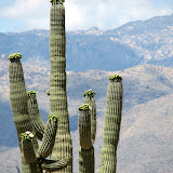
I had always thought prickly pears were boring plants, but now they are covered with pink and yellow flowers (both colors on the same plant). They were very pretty. The ocotillos also had flowers, but I'll try not to overwhelm you with pictures of them again. Click below to open a new window with the Saguaro National Park Pictures.
 |
| Saguaro National Park |
I had to walk slowly so my foot wouldn't hurt. Walking slowly makes my hip hurt. I was ready to sit down for a while by the time I hobbled back to the van. I grabbed a bite to eat at McDonald's and went back to the hotel to take a nap and then pick up Suzanne from the conference. She was already at the hotel, though. They got out early. She wasn't feeling too good, though. Some kind of intestinal bug. Well, we weren't going out to eat and there was still sunshine, so I headed for the Tucson Mountains. They are some small mountains on the west side of Tucson.
I had driven through the Tucson Mountains in January but didn't have time to stop. Now I could check out a trail or two. Now the bad news. I left my camera in the hotel room. Bummer. I had the video camera with me and it will take pictures, but they look so bad I can't stand to let you see them. I'm putting a video on Google Videos but that will look bad, too, since they seem to reduce the resolution. Tough luck. I may not put a link to the video on here until tomorrow. The upload is going very slowly.
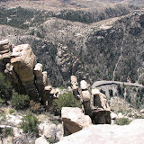
I ate at Church's yesterday evening, but Arizona Church's don't have fried okra. What a disappointment. Then I made 2 or 3 trips to the pharmacy as I nursed Suzanne back to health. I must have done a good job because this morning she felt good enough for the drive up to Summerhaven, on Mount Lemmon. I'm still trying to get some good pictures of Mount Lemmon. In the mean time, here are some that I took today.
 |
| Mount Lemmon |
 |
| Pool |
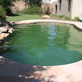
The pool had way way too much mineral build up in the water. I think it was about to start forming travertine on the waterfall. Richard and I just found out that you aren't supposed to drain your pool if it's over 85 or the plaster will crack. It was cool this past weekend and was probably going to be the last cool weekend before October. I really wanted to change the water because I haven't been able to use the pool for the past two years. It made my skin itch. It got really green because I wasn't able to balance the water and therefore couldn't maintain any chlorine in the pool and if you get any algae it clogs the filter and you can't circulate enough water to keep more algae from growing and it's a big mess. It looks a lot better now. Enough about the pool.
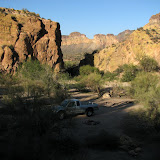
I have also been very busy at work for the past few weeks. I was able to leave on time today, though, and headed out to Bulldog Canyon as fast as I could. Oh, it was so nice to be out in the desert again. I really missed it. It was in the mid 70's with a nice breeze. Perfect. I went to check out the place that rock climbers like to use there. There aren't any places to attach ropes. Maybe they just wrap them around a rock. Anyway, here are the pictures.
 |
| Rock climber spot |
Click HERE to open a new window with my customized map. Be sure to bookmark it and check back now and then. I'll be adding more pictures to it over the next few days. Please let me know what you think. (Click "comments" at the bottom of each post.) I think the customized maps will be a great way to show where I am on my hikes.
Thanks to my friend Steve in H-town, who says last Sunday's mystery bird might be a cedar waxwing. He included this link to a page with pictures and a description of the cedar waxwing.
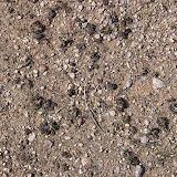
The main reason I went was to look for some cryptobiotic soil. I found lots. In fact, as various articles on the web will tell you, it seems to cover 80% to 90% of the ground in the desert. When you read that it can take up to 500 years to recover from damage, it makes you want to quit hiking in the desert. I've always walked carefully, though. I don't dig my heels in or push off with my toes so that they dig a hole. I probably disturb the soil when I slip, especially if I fall, but I try not to do that. Anyway, I'm sure I do much much less damage than the horses out there. Everywhere I went, I was within sight of horse hoof prints that broke through the crust. I guess deer don't break through the crust very often. The only places I've noticed their prints is in the powdered dirt of a trail or the sand of a wash. It was interesting to see how much of that stuff there is, now that I'm aware of it.
I wandered around out there for 3 or 4 hours and saw lots of pretty stuff. Didn't get any spectacular pictures (even though I took 107). No, not all of them are of dirt.
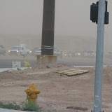
It was a little breezy while I was out there. When I was about to drive out the gate, the wind started blowing hard. There was a lot of dust in the air. The sun was completely hidden by dust 10 or 15 minutes before sunset. The wind had stopped by this morning, but it looked like the dust was still hanging in the air.
 |
| cryptobiot |
 |
| Black widows |
 |
| Flight_to_ |
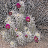
Hedgehog cacti have flowers all over the place now. I found a dead tree that might make some interesting pictures. I'll have to try to find it again in the day time. I also want to find what's in the last picture again. It looked like pottery that had been broken. The side against the ground was covered with gravel, as if it had stuck to it. I don't know what it was. It was too dark to see anything clearly.
I don't have any pictures of the most interesting thing I saw. I was standing still, listening to the quiet and looking at a saguaro skeleton when I heard the sound of hooved animals running. A couple of guys on horses had galloped by when I was driving and I thought it might be them. I heard a pause in the hoof beats as the animals jumped over something. Then I spotted a couple of dear about 75 yards away, heading north. I only saw them for about a second. I decided to go take a look at their footprints. At first I couldn't find them and felt like I had probably gone past them when I spotted some fresh horse hoof prints. I couldn't believe that I had mistaken horses for deer, even if it was a little dark. I was sure there weren't any riders. I was slowly making my way in the direction of the truck when I spotted the deer tracks. The dirt had just been kicked up; they were very fresh prints. Then I found a cholla and some brittlebushes in a row, with prints on either side. The prints on the north side were deep and a lot of dirt was displaced, as if the animals had landed hard. This was what I had heard them jump over.
 |
| Bulldog Canyon 2007_04_04 |
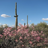
Fairy dusters are blooming. I saw a cactus I don't think I've ever come across before. I think it might be a pencil cholla. If anybody recognizes it, please tell me what it really is. I was feeling kind of quesy by the time I got to it, so I didn't get any good pictures.
 |
| Bulldog Canyon 2007_03_24 |
 |
| 2007_03_21 |

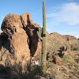
It was a little warm today. Low 90's, I think. We were sweating. It was a beautiful day for a hike. The first picture is Lindsey when we had gotten past the steep part of the hike. Next is Lindsey looking through a stone arch. Finally, there is Lindsey standing on the cliff. Unfortunately, you can't even tell there's a cliff there. It looks like there might be a small cliff, but it is not small. I have to lay down to peak over the edge, and it takes my breath away. Behind her is the ridge I've been to the top of a couple of times recently.
 |
| Lindsey in Bulldog Canyon |
On the way down, I kept hearing her slip and squeal. When I would look around, she would be standing there and say, "I'm OK". Later she showed me how red the palms of her hands were from stopping her falls.
One last thing; I finally got the video of Alex added to the album from the hike he and I went on a couple of days ago.
I almost got hurt on this hike. On the way down, I stepped on a rock that looked pretty solid. It wasn't. At first I was afraid I was going to twist an ankle. I managed to avoid that. Then I was afraid I would break a wrist. Avoided that, too. Then I was about to go head first into a large barrel cactus. Dodged that, too. Some how in all that twisting and contorting I wrenched a muscle in my side. I also hit my leg on a rock just below the knee. All minor stuff considering how worried I was when that rock first slipped away.
I think Alex had a good time. He was bored to tears by the time I parked the truck, but then he had fun. He was talking about how rough the road was and kept saying something about "... if you flip the truck again ...". I don't know why he thinks I've flipped the truck before.
The first picture is the hill we climbed (the taller one). Next is a natural stone arch we found along the way. Then a picture showing what happens when you get too close to cholla. I had to get the pliers out. Then a few pictures of the surrounding mountains. The picture that looks so bland is the one where you are supposed to find my truck. There's Alex on top of the hill, and then a bunch of sunset pictures. It was a beautiful sunset. Somewhere in there is a short video of Alex slip sliding down the hill.
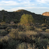 |
| BC_2007_03 |
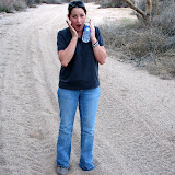
The pictures are so-so. The first is Lindsey acting like she's sinking in quicksand. We don't see much of that out here. In fact, I don't think I've seen any. The rest of the pictures are just stuff.
 |
| BC_2007_03 |
 |
| Overgaard |
The first couple of pictures show the cabin. It was nice. I didn't take many pictures of it, though.
One afternoon, we drove down Black Canyon Road. It was pretty. I realized how accustomed I am to taking pictures in the desert. I would stop to take a picture and get frustrated because of all the trees in the way. I finally gave up and took pictures of trees. Also, I found some places where there weren't so many trees, or they didn't get in the way.
The next picture is of Black Canyon Lake, which is a small man-made mud puddle at the end of Black Canyon Road. As you can see, many of the trees are just blackened trunks. They were burned in the Rodeo Chediski fire in the summer of 2002. You can also see some snow on the slope on the other side of the lake. There was still a lot of snow around, especially above about 6700 feet. It was very peaceful out at the lake. Even the kids there were sitting peacefully. Maybe the air was too thin for them.
The next picture shows what is being done with some of the dead trees. I guess you will find them in the mulch department of Home Depot soon. Next is more burnt trees. It's astounding how many burned. There were miles and miles and miles of burned trees, and I'm sure we saw only a small portion of them. You can also see that there are patches of green here and there, so it wasn't total devastation.
Next is a tree growing out of a rock. Looks like a natural bonsai. It seemed so unusual and unique. I took pictures of it from all angles. None turned out too good, though. Bad lighting, and no matter what the angle, there were trees and rocks in the background into which the subject blended. The next picture is of another tree growing out of a rock about 50 feet further down the road. Big whoop.
We came across some 800 to 2000 year old petroglyphs. The plaque near them listed several ideas about what their meaning could be, and at least one of those ideas is probably right. As I stood there contemplating the petroglyphs, I tried to imagine the people that had made them. I thought about what drove them to put those pictures there, about what important message they were trying to communicate to their people, to future generations, or to the gods. One image kept coming to mind, of teenagers drinking loco weed tea and messing around with some paint until their mother or father told them to quit goofing off and go pick some corn or catch a rabbit for dinner. Do we try to attach significance to the images just because they've survived for so long? Surely random grafitti would not be our only link to a civilization that vanished hundreds of years ago. They would not want their society to be remember for the "contributions" of their delinquents. I'm really starting to ramble. I don't know anything about petroglyphs, so don't pay any attention to my silly ideas.
They last picture is the side of Black Canyon. I felt like I had finally found a spot that the trees weren't in the way. Trees are nice, and I like them. I guess I've gotten used to taking pictures in the desert, though. Also, pine-covered landscapes look extremely boring to me. When Lindsey goes to northern Arizona with me, about the time that I'm thinking the scenery has gotten really boring, she says, "Oh, it's so beautiful out here". Mountains that are rocky have character. Pine covered mountains all look the same. I have a picture of one, and that's all I need. I guess I should challenge myself to take an interesting picture of a pine covered mountain. I'll work on it, but don't hold your breath.
It was very quiet out there today. No ATVs or dirt bikes zipping around. No Hummers full of loud-mouthed tourists lumbering by. I only heard two planes fly overhead. The clouds were a little lower than usual, and I think that soaks up some sound, too. I heard birds twittering on the way out there and listened to crickets all the way back.
No traffic on the road in the OHV area. I stopped in the middle of the road several times to take pictures and didn't get in any body's way. On most of that road, you have no choice but to stop in the middle (if you're going to stop) because it's only one vehicle wide.
Click below to open a new window with the pictures.
 |
| Perfect evening |
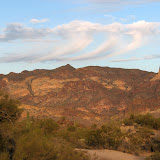
The first picture is some of the unusual clouds. Looks like virga. In Texas you wouldn't expect to see rain falling out of such wimpy little clouds, but here you see it a lot. The ridge I've been climbing lately is in the picture, but it blends in with the mountains behind it so it's hard to tell exactly where it is.
Every time I drive by the cactus in the next picture, I think, "Crown of thorns". Can't help it.
The next picture might be virga over Four Peaks, and the cloud that produced it is gone. I think the relatively flat area way off in the distance in the next picture is The Rolls. I can see some dirt roads out there, and it's in the right direction, so that must be it.
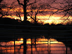
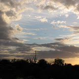
Last is the sunset. No sunlight was getting to the clouds for most of the sunset, then at the end it broke through and there were deep red clouds all around. It was fantastic. If anybody else in the Phoenix area even noticed it, they watched it through power lines and street lights, accompanied by the sound of traffic. Not me!
I took a few more pictures but I deleted them. As I was almost to the gate leaving the OHV area, I noticed that the Fountain Hills fountain was on and lit up. I hurried to a spot on the side of Usery Pass Road to try to get a picture (the fountain is only on for 15 minutes at a time). I set the tripod up in the bed of the truck so I could see the fountain over palo verdes. I had to take 5 second exposures for the fountain to show up, and was zoomed all the way in. I used the self timer so the camera would stop shaking from my finger pushing the shutter release by the time the shutter opened, but I could feel my legs quivering just a tiny bit. It was enough through the bed of the truck to blur all of the pictures. Next time I'll hike to a good vantage point and put the tripod on a rock.
I also took a picture of my truck, but you won't see it here. I took the picture in order to illustrate why a high clearance vehicle is required to drive through Bulldog Canyon OHV area. However, my skills were not sufficient to capture the immensity of the rock being straddled by my truck. I'll just have to take you out there some time and see if you stomp on the floor trying to hit a brake pedal that isn't on your side, the way my other passengers do. It isn't because I go fast; it's because they're sure I'm going to scrape the oil pan off (they don't know about the skid plate, though, or the fact that my skid plate has only ever touch one rock (gently)).
Next is the view from the top. I'm looking down on the part of the ridge that I was on top of last weekend. Then there is the Fountain Hills fountain. I included it to illustrate how windy it was. When I got back to the beer bottle, it had blown over.
The Superstition Mountains can be seen from this part of the ridge. You'll probably recognize The Flatiron. Then there are a couple of pictures zoomed in here and there.
The next picture was taken after I had gotten back to the truck. It shows the peak. Take note of the cliffs all around it and to the right. I broke one of my hiking rules today. The rule is, "Go back the way you came". On the way up, if you didn't know exactly where you were going, that's okay because you got there. If you take a different route down, you might find out that it doesn't work and then you have to retrace your steps to get back to the top and start down again. That's no big deal if you aren't too tired and you have plenty of water. So it was no big deal that I tried to take a shortcut back to the truck. I went along the base of those jagged rocks at the top of the ridge. There were several times that I almost turned back because I was not going to violate another one of my hiking rules, which is, "Don't walk in a place that if you fell and rolled or slid a few feet, you would go over a cliff." The picture does not show how steep the non-cliff parts are. If I slipped there, I might slide right off one of those cliffs. I was able to find a path that was relatively level most of the way, though. I finally got to a point that was just too dangerous, though, and had to turn back. No big deal, but my legs sure are tired now.
That's sounds like a bummer, but as in life, unexpected detours can bring you to wonderful things you wouldn't have seen otherwise. As I was retracing my steps to get back to where I could start down, I found the arches in the next two pictures. The are right next to each other. The picture of the second one shows part of the first. I started to climb up to them and look through them and maybe even climb through, since I was trying to get to the other side of the ridge anyway. I decided I was too tired and it was too risky, though.
Next is a millipede skeleton. I wouldn't have seen that either if I hadn't had to go back. I guess it might not have been worth the detour, though.
The next picture was taken on the eastern side of the ridge, as I worked my way back to the notch. Maybe I have too much imagination, but it looks like the head of a crinoid to me. Next is a different perspective on a saguaro skeleton. Hmm, lots of skeletons on today's hike. I also saw parts of a tortoise skeleton near the top of the ridge. The shell had been reduced to small white squares. I guess it had been out there a while. I didn't get a picture; not enough pieces to be interesting.
I had to include a picture of my truck, too. It's right out in the open, but cleverly disguised. Can you spot it? ;-)
I tried to talk Lindsey into stopping on the way home so I could get some sunset pictures, but she was too hungry. I was taking backroads home and when I turned from Meridian onto University, I saw a great sunset with palm trees in it. I have never gotten a picture of a sunset with palm trees. In fact, I have almost no pictures of palm trees. I managed to get a picture that doesn't have any traffic, power lines, or street lights in it. I had to stop the truck in a fire lane to get the picture. Lindsey stayed in the truck with instructions to bolt at the first sign of flashing lights. Just kidding. She said it was too cold to get out of the truck.
Three of the pictures have Geotags. If somebody who knows what Geotags are sees this, let me know if you were able to view these in Google Earth.
If you are interested in seeing other videos I've made (and uploaded to Google), after you watch this one, over on the right side of the window, click on "From user". All the videos that I have uploaded to Google are very short and were made using the video mode of a still camera. If you view them in a maximized window, they won't look very good. They would probably look great on a tv if you could get them to play there (unless you are watching Richard's HDTV).

On Thursday, I drove through Bulldog Canyon and went along the western side of the ridge. I decided that I might be able to get on top from that side, and it's cool enough now to do that. So today I headed up the western side. My foot isn't 100% yet so I thought I would just scout out the first part of the route. It was so easy, though, I went all the way to the top. It's cool being on that ridge, with cliffs and spectacular scenery on both sides of you. Click below to open a new window with the pictures.
The first picture shows part of the ridge. On the right side of the picture is a notch in the ridge. It's hard to see because of the mountains behind it. I headed for the notch. I had tried to get to the same notch from the other side, but it was just too steep. I eventually reached the top of the yellow cliffs on the left side of the picture.
The first part of the hike was the most worrisome. The road near there is in the bottom of a wash. I parked in a wide part of the wash. I was walking toward the notch and realized that I was in a large, "flat" area (flat except for the washes cutting through it, which you couldn't tell were there until you almost fell into them). I was a little worried about being able to find my way back to the truck. There weren't any trails to follow. I stopped a few times to look at the mountains around me so I would be able to find my way back. I hoped I would be able to see the truck from the ridge, too, so I could confirm my memory and make further notes of the surrounding topography.
The next picture is a kind of rock I've found in lots of places around here. I thought it might be quartz, but it was too smooth. I finally found out (at the Arizona Sonora Desert Museum, see link at right) that it's Smithsonite.
Next is a view of a butte that I would soon be looking down upon from above. Next is a picture I took up on the ridge. It's a couple of barrel cacti demonstrating how they lean to the south until they fall over. Next is a rock with some Smithsonite embedded in it.
I'm sorry, but I just had to include a picture that has my truck in it. That's my hand at the top of the picture, keeping the sun out of the lens. I'll give you a hint. The truck is parked on the right side of the wash. You might also notice a road on the far side of the wash and parallel to it for a while, then heading west. That road is a shortcut into and out of this part of the OHV area. I've succeeded in going west on that road 4 times out of 6 tries. To get out of the wash and go west, you have to get up a steep, rough piece of road. On two occassions I wasn't able to do anything but spin my tires. The last two times (today and Thursday), it was easy. I have never succeeded in going east on that road. In fact, going down the steep part heading wast is a little scary and the truck always slides some. No danger of flipping, though. Today on the steep downhill part I noticed some tracks that almost went off the road. I think some people take that hill a little too fast.
The next picture is of the mountains to the east of the ridge. I think the peak near the center is Dome Mountain. I want to climb up there some day. I guess I had better do it soon, before it gets too hot. Next is that butte I said I would be looking down on. In the background is the Fountains Hills fountain. I read that a couple of the pump motors are being repaired, so it isn't at its maximum height.
Then there are a couple of pictures of the ridge. I included some clouds, and I don't usually do that, especially the high, thin ones. These looked OK, though.
The sunset was beautiful. I was driving out, though, and wasn't in a good position to get good pictures. I've included one shot I made out the window.


I seem to do that a lot. I go somewhere hoping to get some good pictures of the weather or a sunset or something like that, but I don't see anything spectacular. Then I get back home and find out about the amazing stuff I missed there because I was gone. Well, I've got to try.
There are only two pictures here. One is of Lindsey and I would really like it if it weren't for the power lines in the background. The other is clouds on the Superstition Mountains. Clouds on mountains are pretty to look at, but I've gotten way to many pictures of that this year and it's getting boring. Next time I see that I think I'll just sit and enjoy it and not take any pictures.
Some day I'll find Corel Paint Shop Pro on sale and then I can remove power lines from my pictures.
The first is of a "dirt island" There are lots of places that are solid bare rock and nothing can grow on them (except lichens). Sometimes there will be a small patch of dirt held in place by resurection fern. The next is a closeup of some lichen. Some of it is black. I think it must have died.
There are a lot of rocks out there that sparkle a lot in the sunshine. I tried to get pictures of them but they just didn't turn out. The next picture is one of those attempts. You just have to see them in person. Stop by some time and I'll take you out there.
Next is a cute little cactus. Fish hook pincushion I think. If not, at least that's a fitting name.
The last picture is a barrel cactus that has fallen over. They seem to fall over a lot. I saw something at the Arizona Sonora Desert Museum that said they lean to the south. Some of them lean until they fall over. This one might have been leaning to the south. It looks like it's straining to get that last root out of the ground.
I'm going to have to find some different spots from which to take pictures. You will probably notice that these are taken from the same angle as some other recent pictures.
It was raining around the mountains and I was hoping to get some rainbow pictures today. As you will see, that didn't happen. I'll have to try again. Woohoo!
There were some interesting rocks on the hill. There was just one that looked like it had fossils in it. I took a bunch of pictures of it. There are several areas that look like pieces of crinoid stems. There's also one part that looks like the trail left by a worm as it ate its way through the mud.
I was a little surprised to find that rock there. It looked out of place and I kind of wonder if somebody put it there. Most of the rock in that area is volcanic in origin. The hoodoos all over the Superstitions are weathered tuff. I did find a few other rocks on that hill that looked like they were sedimentary rocks, though.
It always seems like I'm not able to sit and contemplate the rocks for very long. Usually it's the setting sun that forces me to leave. Today it was rain. I heard thunder in the distance on my way up the hill. The thunder stopped long before I got to the top, but the wind was blowing a steady 20 mph and then it started sprinkling. I got out one of my handy dandy emergency ponchos and started down the leeward side of the hill. It's a one-size-fits-all poncho, which means it fits me very loosely. I had to be careful to not walk too close to cholla or ocotillo, lest they shred my poncho. The rocks looked much more colorful as they glistened in the rain.
I wasn't feeling really lazy today, but my foot has been hurting a lot ever since I walked back and forth across WalMart real fast last week. I wasn't planning to hike, but Silly Mountain looked like it wouldn't be too bad for my foot.
The first picture shows Silly Mountain. I went up to the peak in the center of the picture. The next two pictures show how close to civilization the Superstition Wilderness is. The first is the high point of the mountains. The second is the Flatiron. That's a gnat in the upper left, not a UFO. The last picture is one of a couple of butterflies that were flying around my head up there. Unfortunately you can only see a small patch of the pretty blue on its wing.

 Posts
All Comments
Posts
All Comments