Showing posts with label flowers. Show all posts

Friday, June 22, 2018

Harvester Ant Mystery

Cottony stuff around a Harvester Ant mound

After 15 years I still come across stuff in the desert that I've never seen before. A couple of weeks ago I saw what looked like the stuffing out of a child's stuffed toy. I was close to a road, so that seemed like a reasonable explanation. I saw a couple more patches of the cottony stuff further from the road, though, and also noticed that it was just around Harvester ant mounds. I also noticed some ants carrying the stuff. I couldn't figure out where it came from, though. Were the ants doing their spring cleaning and this was garbage that had collected in the mounds all winter?


Scenic area

I pondered the possibilities as I wandered around but couldn't come up with any reasonable explanation.  I was about to find out what it was, though.

Closeup of agave flowers on a stalk that fell over.

The sun had set by the time I returned to the truck.  I got a little too close to an ocotillo and it caught my sleeve.  I kept walking and when the ocotillo finally snapped free, I was showered with seeds.  The seeds are wrapped in a thin white skin and have a fibrous, cottony layer between the skin and the seed itself.  The ants had been gathering the seeds (which is what Harvester ants do) and stripping off and discarding the inedible fibers around the seed.

Friday, April 04, 2014

A hike down memory lane

The road to the Massacre Grounds trailhead was closed several years ago. It had become a popular spot for yahoos with 4WD vehicles to go after a rain to spin their tires and fling mud around. The area consumed by the mud pit was steadily growing, so the forest service closed the road and built substantial barriers to stop those yahoos that know better than the forest service. The closure seems to have been effective in stopping the yahoos but the destroyed areas are a long way from recovered. The Massacre Grounds trail used to be one of my favorites but I hadn't been on it since the closure. I felt that by the time I hiked to the trailhead, I would be too worn out to do much more hiking.


The Massacre Grounds trail ends on top of that cliff. The view is great from up there.

I had found a very nice trail from the Jacob's Crosscut trailhead to the old Massacre Grounds trailhead a few months ago. I decided to hike that trail yesterday and then see how much further I could go. It was a beautiful and cool (upper 60's to lower 70's) day with a nice breeze. I had a long hike ahead of me so I started early. Consequently the pictures just show what's there and aren't very pretty.


The trail to the old Massacre Grounds trailhead is well-marked and heavily traveled.


There are lots of flowers along the way right now. Notice how some of these have bloomed and withered, some are in full bloom, and some have yet to bloom.

There were some spring flowers along the way. This part of the desert looks like it hasn't gotten a lot of rain over the winter so most of the flowers are on cacti. I was looking at the flowers on a hedgehog cactus when I had an idea. You know how there is software that combines exposure bracketed photos to create HDRI photos and there is software to combine photos taken with the focal point shifted slightly in each photo to create a photo with much greater depth of field? I was looking at the hedgehog cactus and noticed that while it may have had 20 flowers, only 4 or 5 of them were in bloom at any one time. This is also true of saguaro flowers and barrel cactus flowers and probably some other cacti. So I figured there needed to be some software that would combine multiple images of a cactus taken over several days or weeks so it looks like all the flowers are in bloom at once. Hey, I never said it was a good idea.


Four Peaks was more clearly visible than it has been for weeks.

As I hiked along the Massacre Grounds trail, I saw many sights that I hadn't seen for years and that brought back fond memories.


Lindsey and I went partway up there to get pictures of a sunset once.


Lindsey also had to check out this cave. She was disappointed at how shallow it was.


The place I stood to take this picture is as far as I went the first time I hiked on the Massacre Grounds trail because Sweetums was waiting patiently for me in the truck at the trailhead and I didn't like her being there alone. This is also as far as I could get Lauren and Lindsey to go on the trail with me.


This is taken on the really steep part of the trail and Steve did not like that part. He didn't complain, though. Just kept truckin'.

The entire trail is marked with frequent cairns now. Also, many horses seem to travel on it now, many more than did before the road was closed. The trail used to be faint in places and I used to almost always take a wrong turn on a faint side trail on the return hike and have to backtrack. You would have to try very hard to take a wrong turn now, though.

Speaking of horses, I was thinking about how trails used exclusively by horses are so narrow but people trails are always wide even though people (generally speaking) are much smaller than horses. I was thinking about this when I was stepping over some large loose rocks and having trouble keeping my balance. I was thinking that it would be much easier to keep my balance in such situations if I had a couple more legs. Then the realization hit me; that's why horse trails are so narrow. As they plod along with tourists on their backs, they always have at least 3 feet on the ground. Humans, on the other hand, are on 1 foot most of the time, and so they stagger all over the place. I know I do. Now that is a good idea. I'm glad I finally figured that out. Well, I also thought of another possible explanation but it can't be proven one way or the other so we won't get into that. OK, since you ask, it has to do with humans thinking of themselves as the current masters of the universe and horses being mere beasts of burden.

Where was I? Oh, the Massacre Grounds trail. I made it all the way to the cliffs at the end. Kyle is the only person that has hiked all the way out there with me. He gave the the usual single finger salute when I tried to take his picture there. Such a sweet kid. I knew I could get to the end this day. I knew I could make it back, too. I mean, wouldn't it be kind of stupid to go all the way out there if I didn't think I could make it back? Yes, I know, people do that stuff all the time. I try really hard not to, though.

The view from the end is the same beautiful view that it has always been, but it means so much more now. I sat there for 10 or 15 minutes finding many of the places I've explored over the past few years. From many of those places, I've been able to see the cliffs at the end of this trail. Now I was on top of those cliffs looking back at all those other places. I've thoroughly enjoyed every moment of the journeys.


I used to look at that road and wonder where it went. I've been on it several times now.


Over there is an unofficial route to Garden Valley and Hackberry Spring.


I've been on that sloped peak and many of the smaller peaks and rocks and have wandered in that area quite a bit.


The rare and beautiful Desert Mariposa. Does its rarity make it seem more beautiful?

It took me 2 hours to get to the end of the trail. I had tried to walk slow to conserve energy and to be gentle on my ankle. I might have to go slow on the way back so when I saw that I only had 2 hours until sunset, I started back. The hike was about 5.3 miles long with 1310 feet of elevation change. That's much longer and more climbing that some hikes I've been on recently that completely wore me out. I wasn't stumbling from fatigue when I got back to the truck and my ankle was only a little sore the next day. Hallelujah. Click below for all of the pictures.

2014_04_03

Wednesday, March 27, 2013

Familiar territory

Sometimes it's comforting to go someplace familiar. I went someplace on Sunday afternoon that I hadn't been before, but it felt like home. Well, I had been near there before, but not from that angle.


I drove by lots of flowers on the way out there.

I started hiking up a hill just to see what I would find up there. Part way up, I found a horse trail. It seems a lot of people ride their horses through there. I followed the horse trail until it got boring, which was also when I realized that I was very close to another road that I frequently take through Bulldog Canyon. Since I was climbing from a different angle, I hadn't realized exactly where I was in relation to everything else I already knew about.


I ended up going up there.

After I quit following the horse trail, I started going along the top of a solid rock cliff. That's what felt so familiar. I've done that in so many different places around here, it just feels like that's where I belong.


I walked along that rock behind the paloverde tree.

I found a hole in the rock up there. Not sure if it qualifies as an arch. It's a small hole at the base of a slab of rock. It was hard to get pictures of it.


A hole in a slab of rock.

As I moseyed around up there I recognized more things around me. It turns out that I was close to Richard's arch (I call it that because he spotted it). I was thinking about hiking up to the cliffs to the north of where I was but was relieved when I realized I had already been there a few years ago when I had hiked up to Richard's arch. I guess I'm still feeling kind of lazy since I didn't want to hike up there again.


Richard's arch is behind and to the right of those cliffs.

I stood around up there for about half an hour, enjoying the view and feeling at home. Click below to see all of the pictures.

2013_03_24

Monday, May 21, 2012

Missed flowers

It's hard to get pictures of saguaro flowers. That's because they are rarely less than 12 feet above the ground. There's a saguaro near the Superstition Mountains that has a couple of droopy arms that curve down to within a couple of feet of the ground. I've always thought that would be a good place to get pictures of the flowers. I was out there a couple of weeks ago, but it was too soon. I went out there again on Saturday and they were completely gone, like something ate them. Maybe that's why saguaros usually put them up so high.


We still had smoke from the Sunflower fire on Saturday.

I'm going to have to come up with a different plan for getting pictures of saguaro flowers. I have a few ideas, and most of them do not run the risk of serious bodily injury.


Four Peaks hiding behind smoke, dust, pollution, and saguaros.

There were no gnats on the way out to the saguaro, but that must have been because I was fresh as a daisy and was walking into the wind. They were somewhat bothersome on the way back to the truck. I was hoping high temperatures the previous week had singed their buzzy little wings but that's not the case. Click below for all of the pictures.

2012_05_19

Thursday, May 03, 2012

A short hike

I need to do more hiking. I've gotten flabby lately. It's just too much fun to play with Emily after work instead of hiking. I need to get out there now, though, before I start complaining about it being too hot. So yesterday I went looking for a particular flower that I wanted to photograph. It's near the Superstition Mountains.


There was something going on when I got there.

There were a lot of vehicles and a channel 3 news truck at the Crosscut trailhead when I got out there. Turns out a woman had fallen off a cliff at the end of the Massacre Grounds trail. I haven't been on that trail since the road to the trailhead was closed. It's a long walk just to get to the start of the trail.


Saguaro flowers are blooming. I'm going to try to get a picture of one this year. It's difficult to do because I'm not 15 feet tall.


I took a bunch of pictures of the Supes.


Somebody went to a lot of effort to put cairns along this "trail".

The flower that I wanted to get a picture of on this hike hasn't bloomed yet. I'll have to check back in a few days. I hope I don't miss it. Click below to see all of the pictures.

2012_05_02

Wednesday, April 18, 2012

Return to the Dutchman's Trail

Sunday was an absolutely beautiful day. High of about 70, nice cool breeze, almost no clouds. It was a perfect day for another attempt at the Dutchman's trail.


The Mexican Gold Poppies were gone but there were lots of prickly pear flowers. They all had honey bees and other bugs in them.

I loaded up on water and headed out there. The parking lot was full; I got the last space. I saw a lot of people on the trail again this time. I guess it's just a popular area.


People and horses on the trail.

I found myself taking pictures of exactly the same things I had taken pictures of the last time I was out there. I tried to keep moving instead of getting a lot of duplicate pictures.


There are lots of colors of cholla flowers.


There aren't quite as many ocotillo flowers here as near Mesquite Flat.

I didn't have any trouble going beyond where I had to turn back before. The trail got steeper and rocky but it was still easier than most off-trail hiking. I easily got to the intersection with the Whiskey Spring trail, which was how far I had hoped to be able to go. Shadows were getting long, though. I did some quick calculations and determined that if I didn't stop a lot, it would be dark when I got back to the parking lot. Even though I was at the halfway point in a loop and on heavily traveled trails, I didn't want to be in unfamiliar territory after sunset. The risk of being lost was low, but if there was anything cool there, there wouldn't be enough light to get pictures. Also, I would be getting very hungry by then and the temperature would be dropping. The only thing to do was to go back the way I came.


A view of Picketpost Mountain.

I think I went too fast on the way back. My ankle was pretty sore the next day. I was really tired the last mile or so (it was an 8.6 mile hike) and wanted to sit down and rest a few minutes when I came to a nice sitting rock, but then I would get to an uphill stretch and it felt so good to be going uphill for a change I didn't want to stop. Then I would get to a downhill stretch and it felt so good to be going downhill for a change I didn't want to stop. I made pretty good time getting back to the trailhead.


The parking lot was almost empty when I got back.

I made a few large panoramas again. I put them on Panoramio and not my web album, so if you want to see those go to my Panoramio page. Click below to see all of the other pictures.

2012_04_15

Sunday, April 08, 2012

Canyons

I did a little more exploring just east of Tortilla Flat. I walked along a road I had seen the last time I was out there. It was overcast. Not very good for pictures. I seem to have a knack for going out on cloudy days. The ocotillos had lots of pretty flowers and I wanted to get pictures of them. They look best with a blue sky background, but there wasn't any blue sky. I took lots of pictures of them anyway, and pictures of other flowers, too.


Hedgehog cactus flower.


Prickly pear.


Ocotillo.

Not only was it overcast, but it was hazy, too. I don't know what was in the air. It wasn't moisture or dust.


I thought I might try to get to those yellow hills.

I was on top of a ridge and could see some yellow hills not too far away. I thought I might see if I could get to them. I couldn't go directly toward them because there was a steep-sided canyon in the way. The road I was following eventually dropped into a canyon and I followed that upstream for a while.


There were lots of puddles in the canyon.


I eventually got to a spot that I thought might be very close to the yellow hills. Maybe on the other side of them. I would know for sure if I went another quarter mile or so with a lot of ups and downs. By that time, though, I had used half my water. Yes, there was lots of water around, and I had iodine pills, but I don't want to drink from stagnant puddles if I can avoid it. I headed back to the truck.


There was lots of nice scenery. The sun tried to come out for a little while, which made me realize how hot I would have been if it had been shining the whole time.

Click below to see all of the pictures.

2012_04_07

Sunday, March 25, 2012

Near Canyon Lake

Gary is in town for his annual visit to the valley. We went for a short hike to the top of a ridge with a view of Canyon Lake. It's off-trail, so it was kind of steep and rocky. I should quit doing that to Gary.


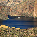
View of Canyon Lake, with the Dolly Steamboat.

It's a short climb, though, to a very nice view. There are places with a view of the lake that are easier to get to (like pulling into a parking spot), but I don't think they're quite as pretty.

The hedgehog cacti have been blooming. In fact, I think they are about done blooming. I was going to try to get more flower pictures this year, but it hasn't worked out that way yet. The saguaros and cholla have yet to bloom, though. Maybe I'll get some pictures of those.


Hedgehog cactus flowers.


Gary has trimmed down.

On our next hike, I'm going to stick to trails. Click below to see all of the pictures.

2012_03_21

Sunday, February 19, 2012

Dutchman's Trail, first attempt

It shouldn't have been a "first attempt", but that's the way it worked out. I was on a heavily traveled (i.e. smooth) trail with lots of food and water and daylight. But things happen.

I had been thinking about hiking on some trails accessed from the Peralta trailhead all week. I got out my map of the Superstition Wilderness on Friday evening and planned my route. I wanted to get pictures of Miner's Needle (strangely, there are very few pictures of that area on Google Earth), so I was going to go in that direction first. I was a little concerned that the parking lot might be full at this time of year, so I had a backup plan to get pictures of the mushroom rock.

On Saturday morning, the paper had an article about the Peralta trail. I figured the parking lot and the overflow parking lot would be full for sure because of that. I decided to check it out, anyway, but was pretty sure I would be going to the mushroom rock. I was surprised to see that the dirt road had had water sprayed on it (to keep dust down) as I left the pavement of Peralta road. Wow, were they expecting a lot of traffic today?

Well, it turned out that there were lots of spaces available in the parking lot. I took my time going up the hill at the beginning of the trail. I might be hiking 8.5 miles, so I didn't want to get worn out at the beginning.


A parking lot with empty spaces.


The first sight of Miner's Needle, near the beginning of the trail.

It was a gorgeous day; clear sky and temperatures in the mid 60's. Yes, I had sun screen on. I was a little concerned about the fragrance attracting bees. Sure enough, as soon as I got out of the truck, a bee tried to fly up my sleeve. That was the only one that took any interest in me, though.


Miner's Needle is on the left.

The beginning of the trail overlooks what I would call a valley, but maps call the northeast end Miner's Canyon and the southwest end Barks Canyon. I took several panoramas of it and the mountains around it. I uploaded them full-size, so you can zoom way in. I took over 200 pictures and uploaded most of them to the web album. I tried to get saguaros in them so they wouldn't be a bunch of pictures of the same mountains over and over again, but that might be what they look like, anyway. It was the middle of the day, too, so I don't like the looks of most of them. I had to plan to be there in the middle of the day, or I would probably have been hiking in the dark for several hours.

I saw about 10 other people on the trail. A couple that looked older than me saw me taking pictures of Mexican Gold Poppies and told me there were thick fields of them further up the trail. I decided to make seeing them my goal. My left ankle has been acting up lately and if it started to hurt much, I was going to turn back. It was feeling good at the time, though.


A picture of a saguaro with a mountain in the background.

Let's see, I need to back up a little bit. At work on Friday, I was walking down the hall and noticed that a spot on my lower calf was a little tender. That seemed odd because I hadn't done anything that could have injured it. So I'm walking along this trail, and that spot on my calf is still very slightly tender but easy to ignore. Then I took a step, just like the hundreds of previous steps I had taken on this hike, but this time it felt like a knife had been jabbed into my calf. It wasn't a cramp. It hurt when I tried to use the muscle. It hurt when I tried to stretch the muscle. It felt fine when I did nothing, which was nice, but you can't do nothing when you're on foot in the middle of the desert. I sat and rested for a few minutes. It felt no better. I walked very slowly, hoping it would ease up. It didn't. I was forced to take very small steps. I felt like I was crawling. I had no choice but to turn back.


Before I turned back, I took several pictures of 3 Mexican Gold Poppies. Most of the poppies have been tattered by the wind or are missing a petal or are stunted or have some sort of defect. Not these 3 (two pictured here). These are the megababe supermodels of Mexican Gold Poppies.

I didn't make as many stops for pictures on the way back, so that made up for moving slower. I thought I was only going about 1 mph, but my GPS track indicates that I was still moving at almost 2 mph. Every step hurt, though. I don't know if it's from me walking funny or if it was going to do it anyway, but my left ankle started getting achy, too. By 2 this morning it hurt so bad I couldn't tell if my calf still hurt. I'm going to have to figure out what's causing that and fix it. I was limping on both legs by the time I got back to the trailhead, which looks really pathetic (the limping, not the trailhead). I tried to walk normally but very slowly and tried to make it look like I wanted to walk slowly. That was difficult because I don't like walking slowly and tiny steps just don't look natural.


A hawk posed for pictures.


Blue Lupine.

Having to turn back was very frustrating. It was such a beautiful day, though, I couldn't be in a bad mood. Click below to see all of the pictures.

2012_02_18