Sunday, May 25, 2014

A better view of a hole in the rock

Several years ago, I had made an attempt to hike up to a hole in a rock that could be seen along the unofficial trail to the back of Garden Valley. I seem to vaguely remember that I didn't have a very good view of the hole when I got there. Mostly what I remember is that it was a windy day and there were rain storms around. Anyway, I did not have that in mind when I set off on a hike a few days ago. What I had in mind was getting some exercise and seeing some nice scenery. I didn't want to do a lot of climbing so I started out on the unofficial trail just mentioned. If follows a creek bed for most of the way.


Part of the beginning of the trail is in fine sand, which is great for showing snake trails. I couldn't find the snake.

I had mostly forgotten about the hole in the rock until I spotted it from the trail. It's easy to miss. You have to look up at just the right time.


The hole in the rock isn't easy to see from the trail.


Somebody also dug a hole in the dirt on the side of the creek. Strange.


I would like to see this when water is flowing.

I walked until I got to a scenic spot and "stopped" there to take a few pictures. Actually, what I did was start up a hill to get a better angle on a shot. Then I went a little further to see what I could see, all the while looking across the creek bed at the taller hill on the other side until I couldn't stand it any longer and started up that other hill. The view was much better from the taller hill.


This is a bare-rock kind of place.

I was wandering around on the larger hill taking pictures of various things when I turned around once to find that I had a perfect view of the hole in the rock. Now, finally, years after I had intended to do so, I have a decent picture of that hole in the rock.


The hole in the rock.

Click below for all of the pictures.

2014_05_21

Sunday, May 04, 2014

To the Mule Ears

I don't know if that's what it's really called. It reminds me of Mule Ear Peaks in Big Bend National Park, so that's what I call it. It's one of those places I've been meaning to hike out to for a few years. You can see it as you approach Canyon Lake on Apache Trail. Just last year I found myself very close to it and realized it wouldn't be very difficult to get to.


My destination. It was a dusty day.


I saw some Iron Cross Blister beetles near the beginning of the hike.

The wind had been blowing for a couple of days so the air was kind of dusty. It was cool and the wind would keep the gnats away, so I went hiking despite the dust. Between the dust and being out there in the middle of the day (I had no idea how long it would take, so I started early), the pictures aren't very good.


It rained just enough to make some small puddles out here the night before.

There was a faint trail out there the last time I had been there. It seemed better defined now, and there were more cairns. The trail seemed to go where I was going most of the time. I stayed on it because the grass was downtrodden there. That grass is almost as annoying as gnats. I had my gaiters on but the seeds still worked their way through my shoes. I had to stop three times to take my shoes off and remove seeds. It's really aggravating to have something jabbing you in the foot with every step.

There is a trail all the way up to the far side (the side you can't see from Apache Trial) of the Mule Ears. It's possible to climb up to the saddle between the peaks from the far side. It's about a 10 foot climb. I'm sure I could have done it but since a slip could have been disastrous, I didn't.


A pile of rocks in the saddle. I didn't climb up there.


Four Peaks through the dust.

The wind was blowing so hard, I thought my exposure-bracketed photos might not be combinable into HDRIs. Photomatix is pretty amazing at lining things up, though.


Weaver's Needle is usually easy to see from this area, but not this day.

One reason I wasn't in any hurry to hike out to the Mule Ears is because you can't get pictures of something like that when you get close to it. I wanted to do it just so I could say I had been there. Well, that's out of the way now. As expected, I saw some other things I want to look into the next time I'm out there. It sure is nice having such a large area to explore so close to home.

Click below for all of the pictures.

2014_04_26

Friday, May 02, 2014

A return, of sorts

Two or three years ago, or so, I had hiked out to some large hoodoos at the northwest corner of the Superstition Mountains. It was a long hike and I was very tired as I returned to the truck after sunset. That was when my ankle first started bothering me. It twisted just a little a couple of times on the way back. Didn't really hurt, but it didn't feel good. It was a couple of days before I could walk normally. After that, any hike over 3 miles would have me limping or hopping on one foot the next day. This went on for about 2 years until one day when I was walking on a sidewalk I noticed that when I picked my foot up, it felt like the bones in my ankle moved apart, and when I put it back down, they got jammed together. It didn't hurt at all, but I decided that doing that thousands of times on a hike was probably why my ankle hurt. Then I figured out that the reason it did that was because of my boots. I really liked them because they came far above my ankles and kept them from twisting much. The problem was that, even though I did not lace them tightly, they would squeeze my ankles just a little. If an ankle was slightly swollen, the squeeze would force the bones apart, only to be pounded back together when I put my foot down, which increased swelling and caused more pounding and, eventually, pain. So I had to quit wearing those boots. After years of abuse, the ankle still gets sore, but not nearly as bad as it did when I wore those boots. Anyway, the reason I bring all this up is because I went back out to those hoodoos recently. I wanted to see something near them but for years I didn't think I could hike that far, even though I've hike greater distances since then. I decided to hike out to the rock I wanted to see one day and use crutches if I had to the next day. It turns out my ankle was barely sore the next day, though.


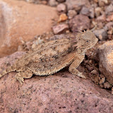
I haven't seen one of these for 2 or 3 years. I wouldn't have seen this one if he hadn't moved.


A little while later, I saw this one. Again, I wouldn't have seen him if he hadn't moved.

I saw 2 horned lizards on this hike. I don't think I had seen one for about 3 years before this year. I've seen 4 so far this year. I look around every time I pass a big red ant ant bed but if the horned lizards aren't moving, they are hard to see. Both of these were close to ant beds (they eat the ants).


Find the horned lizard in this picture. I have trouble seeing him and I know where he is. This is zoomed to how the scene would look if you were standing on the trail. You need to look at the picture full size, though.


There were some rain clouds in the distance. After 11 years in the desert, I knew I didn't have to worry about getting wet.


It is not unusual for a single prickly pear cactus to have 2 colors of flowers. I've seen two colors on one pad.

The rock I wanted to get close to looks sort of like a bent thumb sticking out of the ground. I had gotten pictures of it from a distance before but wanted to get closer. I was almost to the hoodoos before I thought I was close enough to the thumb to leave the trail and head for it. Unfortunately, I didn't see an easy way to get to it. I would have to go through steep-sided washes full of vegetation. I decided it wasn't worth the effort. Since I was almost at the hoodoos, I went on to them.


Nice-looking clouds over picturesque mountains.


Thumb rock. I still don't have a good picture of it.


I always seem to use that pointy rock as a gauge of how much I've climbed when I'm on this side of the mountains.

I didn't feel as tired when I got to the hoodoos as I remember being the first time I was out there. I sat in their shade and had a snack. I looked at all the other places I've explored since the last time I was out there and decided that I need to go to some of them again because they probably aren't beyond my reach now after all.


At the hoodoos.


I like the view from up there.

Click below for all of the pictures.

2014_04_19

Saturday, April 19, 2014

Just a little further up First Water Creek

For years I've wanted to get pictures of the waterfall at the end of the First Water Creek overlook trail from down in the creek. I couldn't get to the waterfall in the creek, though. When Gary and I had been in the creek a few days earlier, we got further upstream than I had been able to before. I thought that maybe a flood since the last time I was down there had rearranged the boulders. I decided to go back and see just how far upstream I could go.


I went earlier in the day so I had some sunshine.


There seemed to be a lot of water despite the dry winter.


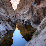
The creekbed is mostly a narrow canyon.

I finally realized that even though I was able to go further upstream than I had before, I probably wouldn't be able to do that if water was flowing in the creek. I would have been mad at myself if I had gone down there in the rain thinking I could get to the waterfall and then been stopped by water.


I may not have gotten through here if water was flowing.

I decided to see how far upstream I could go. Turns out it wasn't very far. I didn't have shoes for wading and I didn't want to get in that water anyway after I saw the dead toad floating in it.


Time to turn back. I guess the guys looking for the horse a couple of days earlier waded through this.


It doesn't seem to be very deep.

I decided to give one of the side canyons a shot on the way back. I had a view of the waterfall from it, and if I could get down that canyon when it's raining, I could get pictures of the waterfall.


I would be able to see the waterfall without going all the way down to the creek from the side canyon I chose.

The side canyon was a little steep but I didn't have to use my hands, so it's acceptable. After a short climb I topped a ridge and saw a landscape that looked completely unfamiliar. There wasn't much distance between the First Water overlook trail and Black Canyon so it seemed strange that nothing looked familiar. I guess I just didn't recognize if from a new angle. I did finally see a cliff that I recognized.


None of this looked familiar.


I finally noticed a cliff I had taken pictures of a few weeks back.

I took my time and wandered slowly in the direction I thought that I probably should. I went up to the top of a small hill because you just never know what you might find on top of a small hill out in the middle of nowhere, and I did find something. When I first looked at it the first thing that crossed my mind was that it was a large fiberglass model of a tooth with the mother of all cavities in its side. That isn't what it was, but now I was so biased I couldn't think of what it might be. Everybody else that looked at it figured out what it was right away. Yes, I took it home, because it didn't belong out there.


What does this look like to you?


If you haven't figured it out yet, turn this picture sideways.

I was going to throw it away but Skid liked it so much, he kept it. I'm sure his wife was thrilled. I'm probably on her s**t list again.

The next thing I knew, I was back in Black Canyon, on the trail. I just need to remember to turn right just before the last steep third of that trail to get to my route to a view of the waterfall next time it rains. I hope it rains soon. Not sure how long I can remember this. Click below for all of the pictures.

2014_03_22

Thursday, April 17, 2014

Told to go home

My friend Gary, from Houston, was in town last month. As usual, we went on a few hikes. We went after I got off work one day, so we got a late start. The days are getting long enough for that, though. I was planning to go down Black Canyon to First Water Creek. It's a very scenic area.


First rattler of the year.

There were several horse trailers in the parking area when we got there. As I was turning on and strapping on all my gadgets (I'm seriously starting to think I carry too much crap when I hike), one of the horse guys came over and asked if we knew where the trailhead was. I nodded towards the telephone pole where the trail starts and said it was over by that pole. Words mean different things to different people, though. He thought he had to do something about a rattlesnake (pictured above) that was at least 70 feet from the pole before he could take horses down the trail. I clarified. You can touch the pole at the start of the trail. The snake remained unmolested, and nobody got bit.

It turns out that the reason all those people and horses were there was because a woman's horse had run off a few days earlier and a hiker had found the horse that morning and they were all going to try to find it again and retrieve it. They were planning to take their horses down Black Canyon to First Water Creek. I don't know a lot about horse capabilities, but I told them that I thought it might be too steep for horses in a couple of places. Turns out they made it about two thirds of the way down before several people went back with the horses while a couple of guys carried on to get the horse in the creek.


This is about as far as we got going up First Water creek. It was too dark for good pictures.

The guys after the horse were in a hurry and left us behind once we got to the creek. Gary and I went upstream a little ways but it didn't take long to get to a spot where too much climbing over rocks was involved. Also, it was getting dark, so we started back. About that time, a Maricopa County sheriff's helicopter started circling the area. It spent a lot of time hovering over some parts of the creek and we wondered if they had spotted the horse. When we were about a quarter of the way up Black Canyon, it came and hovered over us. I zoomed in and took some pictures like I always do when they fly over. Then we continued hiking. As I walked, I thought it was strange that he hovered over us like that. I brought up the pictures and zoomed in on one and I could see a hand out a window pointing toward the trailhead. The copter couldn't get low enough for us to see the hand directly (copters in canyons are a bad idea). If I hadn't had substantial zoom and then zoomed in on the picture, we would not have had any idea what he was doing.


"Go home"

On the one hand, it annoys me that some deputy thinks he can say when it's time for me to go home. I'm an adult. If I want to dance with rattlesnakes in the pale moonlight, that's my business. On the other hand, maybe he thought we were also looking for the horse and he was letting us know we didn't have to search any more because somebody else had it. Here is the story about the horse's rescue. I would like to know what route they took to get out of there. I don't think they could have come out the way we went in.

When we got back to the parking area, there was a deputy there that wanted our names and the names of anybody else that was still down at the creek. It seems they did think we were with the people trying to get the horse. I guess if I was a deputy, I would want the names of everybody that came out of there, just in case somebody turned up missing that night. If he had the missing person's name on his list then he would know the missing person is probably in a bar somewhere and they wouldn't have to search the canyon for him.

Click below for all of the pictures. Didn't take a lot in the darkness.

2014_03_20

Friday, April 04, 2014

A hike down memory lane

The road to the Massacre Grounds trailhead was closed several years ago. It had become a popular spot for yahoos with 4WD vehicles to go after a rain to spin their tires and fling mud around. The area consumed by the mud pit was steadily growing, so the forest service closed the road and built substantial barriers to stop those yahoos that know better than the forest service. The closure seems to have been effective in stopping the yahoos but the destroyed areas are a long way from recovered. The Massacre Grounds trail used to be one of my favorites but I hadn't been on it since the closure. I felt that by the time I hiked to the trailhead, I would be too worn out to do much more hiking.


The Massacre Grounds trail ends on top of that cliff. The view is great from up there.

I had found a very nice trail from the Jacob's Crosscut trailhead to the old Massacre Grounds trailhead a few months ago. I decided to hike that trail yesterday and then see how much further I could go. It was a beautiful and cool (upper 60's to lower 70's) day with a nice breeze. I had a long hike ahead of me so I started early. Consequently the pictures just show what's there and aren't very pretty.


The trail to the old Massacre Grounds trailhead is well-marked and heavily traveled.


There are lots of flowers along the way right now. Notice how some of these have bloomed and withered, some are in full bloom, and some have yet to bloom.

There were some spring flowers along the way. This part of the desert looks like it hasn't gotten a lot of rain over the winter so most of the flowers are on cacti. I was looking at the flowers on a hedgehog cactus when I had an idea. You know how there is software that combines exposure bracketed photos to create HDRI photos and there is software to combine photos taken with the focal point shifted slightly in each photo to create a photo with much greater depth of field? I was looking at the hedgehog cactus and noticed that while it may have had 20 flowers, only 4 or 5 of them were in bloom at any one time. This is also true of saguaro flowers and barrel cactus flowers and probably some other cacti. So I figured there needed to be some software that would combine multiple images of a cactus taken over several days or weeks so it looks like all the flowers are in bloom at once. Hey, I never said it was a good idea.


Four Peaks was more clearly visible than it has been for weeks.

As I hiked along the Massacre Grounds trail, I saw many sights that I hadn't seen for years and that brought back fond memories.


Lindsey and I went partway up there to get pictures of a sunset once.


Lindsey also had to check out this cave. She was disappointed at how shallow it was.


The place I stood to take this picture is as far as I went the first time I hiked on the Massacre Grounds trail because Sweetums was waiting patiently for me in the truck at the trailhead and I didn't like her being there alone. This is also as far as I could get Lauren and Lindsey to go on the trail with me.


This is taken on the really steep part of the trail and Steve did not like that part. He didn't complain, though. Just kept truckin'.

The entire trail is marked with frequent cairns now. Also, many horses seem to travel on it now, many more than did before the road was closed. The trail used to be faint in places and I used to almost always take a wrong turn on a faint side trail on the return hike and have to backtrack. You would have to try very hard to take a wrong turn now, though.

Speaking of horses, I was thinking about how trails used exclusively by horses are so narrow but people trails are always wide even though people (generally speaking) are much smaller than horses. I was thinking about this when I was stepping over some large loose rocks and having trouble keeping my balance. I was thinking that it would be much easier to keep my balance in such situations if I had a couple more legs. Then the realization hit me; that's why horse trails are so narrow. As they plod along with tourists on their backs, they always have at least 3 feet on the ground. Humans, on the other hand, are on 1 foot most of the time, and so they stagger all over the place. I know I do. Now that is a good idea. I'm glad I finally figured that out. Well, I also thought of another possible explanation but it can't be proven one way or the other so we won't get into that. OK, since you ask, it has to do with humans thinking of themselves as the current masters of the universe and horses being mere beasts of burden.

Where was I? Oh, the Massacre Grounds trail. I made it all the way to the cliffs at the end. Kyle is the only person that has hiked all the way out there with me. He gave the the usual single finger salute when I tried to take his picture there. Such a sweet kid. I knew I could get to the end this day. I knew I could make it back, too. I mean, wouldn't it be kind of stupid to go all the way out there if I didn't think I could make it back? Yes, I know, people do that stuff all the time. I try really hard not to, though.

The view from the end is the same beautiful view that it has always been, but it means so much more now. I sat there for 10 or 15 minutes finding many of the places I've explored over the past few years. From many of those places, I've been able to see the cliffs at the end of this trail. Now I was on top of those cliffs looking back at all those other places. I've thoroughly enjoyed every moment of the journeys.


I used to look at that road and wonder where it went. I've been on it several times now.


Over there is an unofficial route to Garden Valley and Hackberry Spring.


I've been on that sloped peak and many of the smaller peaks and rocks and have wandered in that area quite a bit.


The rare and beautiful Desert Mariposa. Does its rarity make it seem more beautiful?

It took me 2 hours to get to the end of the trail. I had tried to walk slow to conserve energy and to be gentle on my ankle. I might have to go slow on the way back so when I saw that I only had 2 hours until sunset, I started back. The hike was about 5.3 miles long with 1310 feet of elevation change. That's much longer and more climbing that some hikes I've been on recently that completely wore me out. I wasn't stumbling from fatigue when I got back to the truck and my ankle was only a little sore the next day. Hallelujah. Click below for all of the pictures.

2014_04_03