Sunday, February 20, 2011

A solitary hiker

The forecast for the weekend was rain. I got home from work at a reasonable time on Thursday and decided I had better take advantage of the sunshine. As usual, I left the house not knowing where I would end up. The weekend before I had found that 10 through Bulldog Canyon OHV area had been bulldozed and was *much* smoother than it used to be. Paloverdes had even been trimmed so they wouldn't give your vehicle that "Arizona pin-striping". I still wasn't able to drive the length of it in my truck. I got to a steep, uphill corner and just couldn't climb it; it's hard to get around curves with the axle locked. So I decided to check it out from the other direction, starting at the Wolverine Pass entrance.

I didn't go very far from that direction, though. I got to a rough downhill section covered with the marks of burning tires and with rocks piled to smooth out the rough spots and figured I would never climb it, so I had better not descend. I parked near there and headed for a small hill to check out the view.


I'll climb up there.

As I walked along the road towards the hill, I found where the bulldozer had stopped. It was less that 0.1 mile from the rough spot that stopped me. Darn it.


Where the bulldozer stopped.

As I walked along the freshly bulldozed road, I saw a single set of footprints. You always hear that you shouldn't hike alone, but a lot of people do it. There shouldn't be a problem with that as long as you don't do anything stupid. I guess having somebody with you might keep you from doing something stupid. Some people would inspired to new heights of stupidity by an audience, though ("Hey, watch this!").


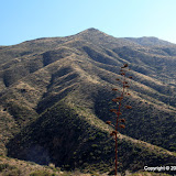
A view of the Supes from the side of the hill.

One of the main reasons I hike alone is because I usually don't know when or where I'm going until I'm on my way. I enjoy showing people the beauty of the Sonoran desert. When I take somebody out with me, though, I worry about their comfort and if they are having fun and whether I am talking too much or too little. I can't relax if I have somebody with me, but that's just me.


I didn't go to the top. It gets too steep up there.

Anyway, I was thinking about solitary hiking and the rules I try to follow to stay safe and wondering if other solitary hikers have similar rules for themselves and would solitary hikers be interested in sharing their experiences and maybe we could form a club and even go on hikes together and ... wait, that's not solitary hiking any more. One of the other reasons I hike alone is because I enjoy the solitude, and that's probably true for most solitary hikers. It isn't that we don't like to be around people (well, maybe some don't), but it's just nice to be alone with your thoughts now and then.


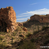
Another view of the Supes.

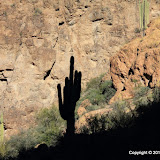
I stood at a level spot on the side of the hill, enjoying the view and taking pictures. I looked down at the road and there was a solitary hiker heading into the desert. I wondered if he noticed what was now two sets of footprints in the dust of the road. I wondered if he would leave the road and go explore a secluded canyon or a lonely hill. I felt a connection to him and thought about saying "Hello" and waving, but because of that connection I decided not to spoil his solitude, and slipped quietly down the far side of the hill and wandered slowly back to the truck.


A solitary hiker.

I don't think a club for solitary hikers would ever get off the ground. Click below to see all of the pictures.

2011_02_17

Sunday, February 13, 2011

Oops, wrong canyon

A few weeks ago, I had followed a wash downstream into a very scenic canyon in Bulldog Canyon. I have been planning to hike up that canyon from the other end. Yesterday, I made my first attempt.


There are still a few puddles out there.

I wanted Sweetums to go with me, and to stay with the Ranger while I hiked. I promised her that the Ranger would be parked in shade, but she was still worried about being hot. It was in the low 70's in town, which felt good to me, but most people are hot when I'm comfortable. She relented and went with me.


The view at the start.

I should have checked a map before I set out. I thought I knew which side canyon I wanted, but I was wrong. I knew I was wrong as soon as I started up it because it was way too narrow. It looked scenic, though, so I kept going.


Looking up the wrong canyon.

I also thought that maybe I could get to the canyon I wanted from this canyon. Silly me. The canyon I was in was narrow and had lots of very large (car size and bigger) boulders. The further I went, the more difficult is became to climb over them. It only took about half an hour to get to a spot that looked too risky to climb over.


Large boulders litter the canyon floor.


A scenic view.


A couple of hawks were flying around above me. I think maybe they were celebrating Valentine's Day.


I didn't want to climb over these boulders. Too risky for a solitary hiker in a narrow canyon (my SPOT may not have been able to get a signal out).


A hollow under the boulders that stopped me.


A spring-fed puddle in the hollow.


A skylight in the hollow.

There were footprints in the sand of that canyon. There must be something interesting further up there. I may have to try it from another angle some day.

When I got back to the Ranger, Sweetums admitted that she was actually cold. She hadn't gotten cold enough to move into the sunshine, though. Click below to see all of the pictures.

BC_2011_02_12

Sunday, February 06, 2011

Hoodoos, walls, and who do you think built those walls?

I've been wanting to take the Ranger out near Apache Leap. Things are changing out there all the time and I didn't know where I might be able to unload, so I drove out there by myself yesterday to check it out. I found a couple of great parking places and also found out the road I planned to explore was much smoother than it was the last time I was out there.


It's been cool out there. There was ice on most of the puddles.


One thing I like about the area is the balanced rocks.

I thought about hiking out to Apache Leap, but it was just a little bit too cool for my liking. Instead I just drove around on some of the easier roads. I found a new road in a canyon I had hiked about a year ago. It seemed strange to be driving through what used to be an isolated area.


The new road goes to this drilling rig site. The rig isn't here yet.


I took pictures of things that I probably have a dozen pictures of already.


I've never taken a picture of this before.

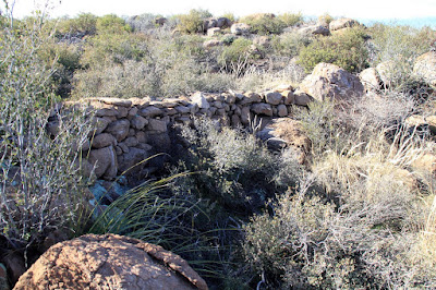
I got out to take some pictures of balanced rocks next to a canyon and was wandering around a little and came across a rock wall. I've seen them in in other places out there. They are built across stream beds. I don't think they are intended to be water dams, though. They are much to porous for that.


Rock wall across the bed of a wash.

I found several of these walls on this day. They are all low walls across the bed of a wash. They all have lots of dirt accumulated behind them.


Another fine wall.


The upstream side of the previous wall, showing all the soil accumulated behind it.

I may have discussed the walls in a previous blog. I don't remember if I said what I believe they are for. I think they were built to catch soil and form areas of deep, rock-free soil in which to grow crops. The ground away from the washes is mostly solid rock with a thin veneer of soil. It would be difficult to raise any crops there. Disturbing that soil would just allow it to erode away in the next rain storm.

I'll have to call the ranger station to find out who built them. I'm guessing that it was native Americans. That's why I'm careful not to disturb them; don't want to damage cultural artifacts.

Click below to see all of the pictures.

2011_02_05

Tuesday, February 01, 2011

Two for one

There's a road that goes from near the Boyce Thompson Arboretum up to the Rogers Trough trailhead. I drove a few miles along it last August. It was pretty rough in places and I got a late start, so I didn't go real far. We went back with the Ranger this past weekend. I took a wrong turn so we never got to the trailhead, but that's OK. We saw plenty of interesting stuff.


I thought this was a side road, but it was the road I wanted to be on.


Peachville Mountain. It looks much more impressive in person. Didn't see any peaches.

My PN-40 kept showing that we were passing through evergreen forest. I was looking around for pine trees but finally realized that the evergreens were junipers.


An evergreen forest southern Arizona style.

The mountains in that area are kind of smooth and blah looking. I don't recommend that road for the scenery. We saw a fair amount of traffic, which wasn't surprising considering the perfect weather.

Near where we turned around to head back, I saw a couple of ATVs tucked away out of site. I guess people do ride up there to go hiking. I was thinking about hiking myself. I walked to the top of a small hill and all the breathing made my throat burn. I guess I need to wait until I get over this cold to do much hiking.

The next day we headed out to the so-called box canyon at the end of Price Road, near Florence. I wanted to check out one of the side roads and maybe find the coke ovens (used around 1850 to smelt ore).

The last time we were out there, it seemed that the scenery wasn't as spectacular once we got out of the canyon. On this trip, the road we took went through some beautiful areas. I've looked at a lot of pictures of this area on Google Earth but none showed the great scenery. The vast majority of them are of people in their Jeeps trying to get into or out of impossible situations. I think the program that selects photos for Google Earth must not have been very selective when those pictures were uploaded to Panoramio. Anyway, I took a few pictures to improve coverage of the area.


This is the kind of scenery I like.


Several people had stopped here to enjoy the view. The guys with the dog were looking for the coke ovens, too.

A couple of guys passed us that were looking for the coke ovens, too. We caught up with them a little later. They had given up and turned back. We talked briefly and they decided to follow us, even though I told them that I wasn't sure we were on the right road. Just a little further along the road we came to a great view of the desert to the south. They were glad they went a little further, but they gave up again and turned back.


It was the wrong time of day to get pictures of this.


That pointy peak is called Grayback.

We turned back soon after that, too. The road was rough so progress was slow and it was getting late. We didn't make it to the coke ovens but it was a worthwhile trip.


This section of road is very rough in spots.


I think somebody spun their tires until their Jeep caught on fire here.

Click the two links below to see all of the pictures.

2011_01_29

2011_01_30

Monday, January 24, 2011

Mushroom Rock

That's what I call it. I don't know if it has an official name. It doesn't on any of my maps. I first saw it about 6 years ago. It looked impossibly far away from the trail. I hiked up to it in late 2005 or early 2006; can't tell from the dates on the pictures. I only took one picture of it from the uphill side and I don't like the way it turned out.


Taken in late 2005 or early 2006. I knew it was going to look bad when I took it, but I didn't have the tools to fix it back then. I estimate that this rock is 30 to 40 feet tall.

On Sunday afternoon I decided I needed to get outside and enjoy the beautiful, sunny day. My ankles were still a little achy from Saturday's hike so I didn't plan to hike, but I took my backpack just in case. At first I thought I might drive out to Superior and see what's happening out there. It's a scenic drive. As I passed through Gold Canyon I decided to drive up Peralta road, and as I drove along that road I decided I would mosey on over to the mushroom rock. I would walk slowly and turn back if my ankles hurt.


It was perfect weather for getting pictures from the uphill side of mushroom rock.

The wind was blowing pretty hard and had blown all the dust out of the valley. The sky was deep blue. I could get great pictures if I could get up to the rock.


Newman Peak was clearly visible. It's 46 miles away.

It was easy to find the mushroom rock. I see it in a lot of my pictures of that side of the Superstition Mountains. My ankles were feeling fine so I started the climb. About half way up I kept thinking that I didn't remember it being this steep. Well, I was younger then. Progress was slow. When I was within less than 500 feet, I saw that I had a deep, steep sided gully to cross or go around. That last 500 feet could take up to half an hour. I checked the time. If I moved as fast on the way back as I did on the way back and started right away, I would get back to the truck half an hour after sunset. It will be cold when the sun sets. As Kenny Whatisname sang, you gotta know when to hold 'em, and know when to fold 'em. I ate a snack and turned back. I didn't reach my goal, but I spent several hours out in a beautiful part of the desert. That's a winner.


Since I wouldn't be able to get a picture from the other side, I made a stereo picture. Crossed eyes method.

Once I was back on the trail, I still didn't want to hurry. I think hurrying is what made my ankles hurt in the first place. Also, the scenery was just too nice to hurry through it.


I like the way this mountain looks.

Soon the setting sun was giving everything a reddish tint. I corrected the white balance in the pictures. The redness you see is what it looked like.


This is what color it was.

When I got back to the truck it was getting dark and was 54 degrees. I suppose that is warm to some people but if it was 70 when you started out, it feels cold. I was putting stuff where it belonged and noticed some message on my PN-40 about not being able to get a position fix. At first I thought I might not have data for the last few hundred feet of the hike but when I downloaded the track, I found out I only had data for the first few hundred feet. I only geotagged pictures that I was able to figure out within a few feet where I was when I took them.

Oh, you might be wondering why we didn't go anywhere in the Ranger this weekend. It's in the shop. During our last outing the "check engine" light came on a couple of times, so I took it in Saturday morning. The mechanic said there had been some trouble with some wiring breaking on that model and they already had a replacement harness. Haven't heard if that's what my problem was yet, though. Click below to see all of the pictures.

2011_01_23

Sunday, January 23, 2011

Entrada del Oro

I was going to go for a hike somewhere on Saturday afternoon. I just didn't know where. I headed east and was thinking about going somewhere off Peralta road, but I kept going when I got there. There's a small housing development out in the middle of the desert a few miles beyond Peralta road. It's called Entrada del Oro. I decided that it might be a good place to park and go wandering off into the desert. The neighborhood has a playground on the northern end, with a parking lot. I parked there and went wandering. Right away I came across a dirt road going my direction. I thought about going back and finding a way to get to the road and drive out there, but I wanted to walk. The desert is more enjoyable that way. Turns out it's state trust land and I need to get a permit anyway.


N San Mateo Castro Road


I need to go explore over there some day.


There's a nice view of the Superstition Mountains along the road.

Once I got away from the neighborhood, it was quiet out there. It was kind of nice to walk through a mostly flat area of the desert. Without mountains or canyon walls close by, my attention was drawn to the plants around me. I took a lot of pictures of saguaros.


A lonely saguaro.

I followed the road because walking on a road is easier and that allowed me to look around as I walked instead of watching where I was going to put my feet. The road branched a few times and the path I followed ended at a small hill, which was very convenient because I wanted to get a view of the landscape from a little higher up.


The Superstition Mountains from the top of the small hill.


A Photosynth panorama from the top of the hill. It's not 360 degrees because about 100 degrees looked exceedingly boring.


The hill I climbed is on the right.

From the top of the hill, I could see a different road heading in the direction of the neighborhood. One of my solitary hiking rules is "When exploring new areas, go back the way you came", but this looked safe. The area is flat (no surprise cliffs to stop my progress) and landmarks were easily visible in all directions (no chance of getting lost). It was a scenic and uneventful hike back.

Click below to see all of the pictures.

2011_01_22