Showing posts with label Goldfield Mountains. Show all posts

Monday, March 09, 2015

Dome Mountain


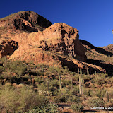
A view of Dome Mountain.

There are only a couple of mountains in Bulldog Canyon OHV area that I know of that have names. Dome Mountain is one of them. (The other is Lone Mountain.) It's also the highest peak there. I've thought about climbing it for years, but not seriously, because every view I had of it made it look like it couldn't be climbed without doing some actual rock climbing. I was just wandering around in October of 2010 and got pretty close to the peak and thought I saw a route to the top, but it hadn't been easy getting as far as I did and the rest of the route looked difficult, so I continued to wimp out.
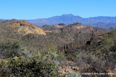

This is a view of Four Peaks from what I consider to be the halfway point. It's as far as I had gotten in 2010.

As usual, I was off work for a couple of weeks over the Christmas holiday. As is not usual, I didn't have anything but hiking planned. I was thinking about climbing Picketpost Mountain again and spending most of the two weeks gearing up to do that. I was going on long (for me) hikes with a lot of elevation gain to prepare and decided to go up to the halfway point again for the exercise. The first time I had been up there, there was a very faint trail. This time the trail was more pronounced and as I approached the halfway point, there were frequent cairns and even some white paint marks.


A cairn and a couple of paint stripes are visible in this photo.


At the halfway point.

I followed the trail up from the halfway point for a quarter mile or so, but I didn't have enough daylight, water, or snacks to go all the way to the top then. It looked like somebody had marked a trail all the way to the top, though, so I knew it could be done. I decided to concentrate on getting to the top of Dome Mountain instead of climbing Picketpost again because every time I looked at Picketpost I felt dread. Picketpost is a very steep and long hike and I wasn't looking forward to how much I would ache afterwards. I wanted perfect weather when I climbed Dome Mountain; no gloomy clouds. Perfect conditions arose on December 30.


Looking toward the Superstition Mountains from about 3/4 of the way up. There's a little haziness (pollution) in the air and it's the middle of the day, so I blame the blah-ness of the photo on that.


You can see how I really slowed down near the top in this plot of speed and elevation. It was steep and I was gasping for air. I was also going very slow in that area on the way down because it was steep and I didn't want to slip and land on a cholla.

The climb was uneventful except for the very nice views all around. I wandered around the top eating snacks, taking pictures, and relaxing until I was bored. The hike down was exciting as all steep descents on scree-covered rock are. My butt made unintentional contact with the ground only once.


The top of Dome Mountain.

From the halfway point back to the parking spot can be tricky. The cairns and paint are harder to follow in that direction. When I was up there on the 23rd I got off-trail and couldn't see how to get back to where I needed to be. I had to backtrack quite a ways. This is a warning to anybody else that heads up there. Come back in daylight and keep making sure you on on the correct route or you'll be stuck out there in the dark, which won't be so bad as long as you have a blanket and the mountain lion isn't looking for easy prey.

I made a couple of 360 panoramas from the top but they must be too many pixels. None of my viewing software can display them and I can't upload them. I'll put them on my Photosynth page someday.

Monday, November 15, 2010

Another attempt at another canyon

There's another canyon in the Goldfield Mountains that I've been trying to get to for a few years. I decided to try it from a different angle on Sunday.


My destination.

The problem I've always had with getting to that canyon in the past is that by the time I get close, I'm too tired. I hadn't approached it from the angle I was going to try this time, though.


Interesting clouds before I started hiking.

As it turned out, that was one of the worst approaches I've tried. I kept encountering bigger obstacles until I decided I was tired enough. Then I decided to see if I could find a crested saguaro I had seen in that area before. Amazingly, I remembered almost exactly where it was.


I was hiking with a co-worker (Paul) when he spotted this a few years ago.

There was another strange looking saguaro I had seen out there years ago. I couldn't find it on this hike, though. I may go back soon just to look for it. Click below to see all of the pictures.

BC_2010_11_14

Monday, November 08, 2010

85215

Yes, it's a zip code. I enabled the zip code layer (I forget what it's called right now) in Google Earth, and that's what shows up near an area of the Goldfield Mountains that I've been trying to get to for at least two years now. I had always approached it from the west, but that meant hiking a mile or two over rough terrain before I could start hiking where I wanted to be, and I'm just not robust enough to do that. I finally decided that the only way to get there was to wade or use a raft or small canoe to get across the Salt River. Dave told me that usually in December the Salt is pretty low and he has waded across it then. So I was planning to check it out this December. I drove by there on Saturday, though, and the river looked almost dry. Woohoo!


I want to get up there. You can't really tell how low the river is in this picture.


Actually, there's no water where this horse with no name is standing.


I held my camera up and this kid jumped in front of me. I took the picture because more kids were on the way. Maybe they would have made the picture more interesting, but you know me.

So I studied Google Earth carefully and picked the spots on both banks where I would cross. I packed sandals for wading and snacks and lots of water. I brought my hiking stick so I wouldn't be stumbling around in the river trying to keep my balance on the slick, round rocks. I had a plan. I was prepared.


This is the river entry point I had picked on Google Earth. As I suspected, I had to go through a tunnel through mesquites and reeds to get here. I can also see my exit point on the far bank.


My exit point, right where it should be. You can't get in and out of the river just anywhere because of the reeds.

I sat in the sand and put my sandals on and waded in. The cold water felt great. Of course, the distance to the other side was much greater than it looked, especially since I was walking on smooth rocks covered in slippery water grass.


The rocks are dry, but it's wet under them and it stinks.


A really stinky part. This would make a great picture with water in the river.


On the far bank! I'm not across the entire obstacle presented by the river, though.

Getting across the water is the biggest hurdle, but it is by no means the only one. I knew there would be lots of paths through the brush to the river on the right bank because lots of people fish there. I knew from past experience that the left bank wouldn't be as easy.


Thick trees on the left bank.
It was easier to get through the trees on the left bank than I thought it would be. Lots of paths criss-crossed through there. I had to walk in a crouch, though. There were a lot of fresh horse droppings, so maybe they (the horses) made the paths. Soon I was at the final river obstacle; a vertical bank 15 feet high. I knew there would be spots where I could walk up it. I just had to find one I could get to through the trees. It didn't take too long.


Finally, completely across the river. Find the truck!

On Google Earth, you can see a faint trail going from near the river, up into the canyon I was headed for. I was on it after I got across the river, but I missed a turn after I went between a couple of hills and lost the trail for a little while. I knew I would come across it again, though.


I felt like I was halfway to my destination. Boy, was I wrong.


There's my canyon.

After a little while I found myself on a trail of sorts. It seemed too faint to be something that would show up on Google Earth. Maybe the Google Earth picture was taken after a wet spring. I was starting to wonder if I was following some horse trail (there was plenty of evidence that horses use the trail) when I came across a couple of cairns. Horses don't build cairns. I was on the trail.


A couple of cairns marking the trail. This part of the trail is not very well defined.

The trail was easy to follow most of the way. There were a few spots where it was too faint to be seen. Those were also the spots where there were no cairns. In those places I just went the direction that seemed right and it worked. I wanted to follow the trail because I knew that if I didn't, I would probably run into some dead ends.


The trail got very steep in the canyon. Fortunately, there was some shade.


A red tailed hawk screeched at me now and then.


This looks like an easy trail here.


This is what a lot of the trail was like, though.


There were great echoes in the canyon.

Progress in the canyon was slow. It was steep, so I kept stopping to rest and cool down. Stopping was easy. It was nice to stand there and enjoy the beautiful new scenery. Since there was a trail of sorts, I didn't have to push through much brush or dodge many cacti. That helped a lot.


Near the top of the canyon.

As I approached the top of the canyon, I realized I was far behind my planned schedule. It had taken me about 40 minutes just to cross the river. Then it was another 2 hours to the top of the canyon. I had planned on 2 hours to get up there from the truck. I thought it would be easy to get from the top of the canyon to the cliffs overlooking the Salt River. That would involve more climbing, though, and it was quite a distance, and I was getting tired, and I knew that if I started down now it would be dark before I got back to the truck. It's not wise to be on unfamiliar trails after sunset. I wandered around a little up there, looking at all the places I wanted to go from there, and wondering how I could do it. The top of that canyon would be a cool place to pitch a tent. A 2 or 3 day hike would mean carrying a 35 pound backpack up the canyon, though. There is no water up there.


Going out there is more than I can do on this day.


A 360 degree panorama at the top of the canyon.

I got back to the river shortly after sunset. It's a little spooky going through those tunnels in the vegetation in the dark. It was a little spooking walking across that stinky river, too, but the cold water felt wonderful on my aching feet. I was really glad I had my hiking stick with me then. As tired as I was, and in the dark, I would have sat in the water several times without it. Click below to see all of the pictures.

BC_2010_11_07

Sunday, October 31, 2010

Further into the Goldfield Mountains

It looked like the weather was going to be nice on Saturday. All week long I had been thinking about going further into the Goldfield Mountains. I used Google Earth to pick a destination.


My destination. Of course, this picture isn't in Google Earth yet.

A few months ago, a guy in Apache Junction (Dave) had contacted me about one of my EveryTrail trips (on the Carney Springs trail). Earlier in the week he asked about going on a hike with me some time. He joined me on Saturday. I tried not to slow him down too much.


Dave enjoying the view.

The view was very nice from the top of the rock at the far end of the hike. Several times while we were out there, we heard what sounded like thunder. The sky was blue all around; I don't think it was possible for it to be thunder. It didn't sound like explosions. I have no idea what it was.


The view from the rock at the far end of the hike.


Saguaros.

While planning the hike, I was thinking that I might take a loop around at the far end. While looking down at the wash I thought I would follow for part of that loop, I could see that it was full of paloverdes and catclaw. I didn't want to push through that for a quarter mile. Also, it was getting close to sunset, so it would be wise to take a known route back. That's what we did.


I took a lot of pictures of the Superstition Mountains on this hike.

I think we only hiked about 4 miles, but I was tired. I'm not sure how I'm going to go further into those mountains. I may have to make some 2 day hikes. Click below to see all of the pictures.

BC_2010_10_30

Tuesday, July 06, 2010

More of the Goldfield Mountains

Monday was another cool (below 105) day. I planned to go for a late afternoon hike. There was a road in Bulldog Canyon OHV area that I wanted to check out. I had been on it a few years ago but about the only thing I could remember about it was that I would have to climb a slope that looked terrifyingly steep and rough when I went down it on my ATV about 3 years ago. Fortunately, I would have to go up it first in my truck.


I used the Wolverine Pass entrance. This is one of the entrances that I don't like to use because it's close to town, so all the knuckleheads use it.

When I got to the 60 degree, 40 foot climb with foot deep ruts and 1 foot diameter loose boulders, I was relieved to find that it wasn't near as bad as I remembered. The steep, rough part was only about as long as the truck and wasn't quite so steep that I needed to get out and use the come-along. I locked the axle and drove up. Uneventful. Thank goodness.


There are some very fine parking spots next to the Goldfield Mountains.

The road goes north and I followed it to where it makes a sharp turn east. It looks like it continues to the north, but that's not a valid road there. Driving on that part will get you a fine and loss of your BDC pass. Everybody else can get away with it, but I have a knack for doing the wrong thing while the cops are watching. Many years ago, I decided that I was tired of driving 55 and I wanted to get to Fort Stockton before the next day and I hadn't seen another car for about 2 hours, so I set the cruise control on 70, went over a hill, and got a ticket. But I digress.


Despite appearances to the contrary, this is NOT a road.

The plan was to hike north to the end of the "road" and see what was out there. In a nutshell, there are some pretty mountains out there. There was a low hill near the end of the "road". I was planning to continue on the road, but first I wanted to check out the view from the hill. As soon as I started climbing I saw a faint trail and decided to follow it since it was going the same direction I wanted to go. There were cairns along it. Hmm, maybe it goes somewhere besides the top of this little hill. It looked like a lot of feet may have walked along that trail, but they did it over many years. I think it has been more heavily traveled by animals than by people since the winter rains, at least. I followed it for as long as I dared; I wanted to get back to the "road" before sunset. It's not good to be in unfamiliar territory in the dark, especially when you are down to your last bottle of water. Silly me.


Every time I looked at this rock I heard it whisper softly, "Climb me. The view is fantastic. The breeze at my crest will give you goosebumps." I resisted its Siren call. This time.

From the trail, I couldn't tell where it was going. It looked like it might just continue up the canyon. After looking at maps, though, I'm hoping it goes up to a ridge dividing two canyons. I bet the view is incredible from up there. I don't know when it will be cool enough for me to go out there again, though.


The trail goes in that general direction.

Click below to see all of the pictures.

2010_07_05

Sunday, June 13, 2010

A little deeper into the Goldfield Mountains

I pushed a little deeper into the Goldfield Mountains yesterday. I walked down the wash I had been in a couple of weeks ago and then a little further. I thought the first part of the hike would be quicker this time, since I had already taken pictures there. I should know by now that that doesn't help much. There's always something different or something that I didn't see before that I have to get pictures of.


There were puffy little clouds today. I think that makes for more interesting pictures.


Here's something I hadn't seen here before. It looks like a metate.

As I walked through sandy parts of the wash, I saw what seemed to be too many footprints to be mine from my last hike there. There were new tire tracks from a 4wd vehicle, and it looked like maybe 2 people had continued on foot from where the vehicle had to stop. The footprints didn't go any further than I had last time I was out there, though. That was nice.

Since I wanted to go further than I did last time, I had to resist the siren call of the hills and mountains around me. If I started climbing things, I'd be too tired to go on. Walking in the wash was tiring enough. The solid rock stretches are very uneven, the bouldery stretches are rough on the ankles, and the sandy stretches drain your energy. I got out of the wash whenever the terrain allowed it.


Even "smooth" parts of the wash are tiring.


I hurried past the rock wall so I wouldn't succumb to its temptation. After all, there are places up there I haven't explored yet.


This chipmunk chirped and flicked his tail at me for a while.

It was a strange feeling when I got beyond where I had been before. As I looked around, I couldn't see anything that looked familiar. Also, the only sign of people was a can and a piece of plastic that had been brought down the wash by flowing water. No cigarette butts. No shotgun shells. No discarded underwear. Not even a golf ball. It seemed that the birds sounded different, and I imagined that they were looking at me and saying, "What the heck is that?" It was a wonderful feeling.


Mountains I've never seen before.

The mountains were pretty, with lots of jagged rock. The lighting wasn't very good for pictures, though. A large cloud was blocking the sun. It was only in the upper 80's (which is why I went way out there) and there was a good breeze, and it felt really great to have a cloud between me and the sun. I hadn't had to hide behind a saguaro to escape the sun for at least a mile.

With all this new scenery around me, a little voice in my head was saying that I shouldn't go further, lest I get lost. I decided it was a wise little voice and that I would climb something to look around, then head back. On the way up I had the feeling that I should see Four Peaks to my right and when I got high enough, I did. At least I wasn't turned around, though knowing which way is which out here won't necessarily help you get where you want to be.


While looking at a map earlier in the day, I thought I might go all the way out to that light colored rock. It turned out to be a little further than I wanted to go, though.

It was so pretty and so isolated out there, I hated to leave. I hung around so long I knew it would be dark before I got back to the truck. Well, I had a feeling it might be dark before I got back to the truck before I even left the house.


Looking back at where I'd been.

I'll be back out there when it's cool enough to walk that far. I already have an idea of the new areas I'm going to explore. I've got to see if I can figure out a way to avoid walking in washes, though. I only walked 4.5 miles, but my knees and ankles ache from the boulders and rough rock and my thighs are worn out. I might need to take a tent and spend a few days out there. Click below to see all of the pictures.

2010_06_12