Monday, October 18, 2010

I made it

Last weekend I was exploring for a route to some pinnacles at the base of the Superstition Mountains, and thought I had found a good one. On Sunday morning, though, I was looking at Google Earth and saw what looked like an old road going almost straight to where I wanted to go. Beyond the end of the road I could see a faint trail. It looked like the trail ended at a wash, but I didn't think it really did. I was pretty sure it would continue. Maybe some rock climbers had a trail marked out all the way to the pinnacles. Walking along an old road and a trail would be easier and quicker than stepping around a bunch of brittle bushes, so I changed plans.


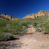
My goal seems far away and high above me.

The old road enabled me to move very quickly toward my destination. In fact, I was walking so fast I missed a lot of things. I saw them on the way back, or hints of them, but it was too dark for pictures by then.


The sky was a mixture of pretty and ugly clouds.


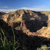
One cool thing about being up high is seeing all the other places I've been.

I could tell that I was approaching the end of the wide part of the trail when I encountered a couple coming the other way. I asked them where the trail went and they said that in about 10 minutes I would come to a lot of boulders that I would have to climb over. That's where they had turned around. I didn't want to climb over boulders, so I was hopeful that I would find a way around.


The couple I encountered is in the lower left corner of this picture. I didn't mean to get them in the picture, so that's why they are hard to see.

A couple of minutes later the trail became a narrow foot path that twisted this way and that. It was marked with cairns along this part. It's the kind of trail that is easy to loose if you don't keep looking to your left and right. I think that must be what happened to that couple. They thought they were following the trail but ended up in the bed of a wash. I never encountered any boulders that I had to scramble over.


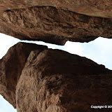
This lovely arrangement is very close to the pinnacles.

I was elated when I stepped on the the bare rock that forms the base of the pinnacles, but not so elated that I forgot to take careful note of where I was, so I would be able to find the easy way back. I spent about 45 minutes wandering around up there taking in the sights and taking pictures.


One of the sights.

I hung out there long enough that I knew it would be dark before I got back to the truck. I just wanted to make it to the straight part of the trail before it got dark, and I did that with no problem. It was a much longer hike than I've been on for a few months, so I welcomed the chance to stop and take sunset pictures on the way back.


I spent 2 or 3 days wandering around out there looking for a route to those pinnacles, then on the day I hiked all the way too them, I took a route I found looking at Google Earth. Well, I had fun wandering around those 2 or 3 days, so that wasn't wasted effort. In fact, my primary objective on those days was to wander around in the desert. Finding a route was secondary. You never know what you'll come across just wandering around off the beaten trail. Click below to see all of the pictures.
2010_10_17

P.S. I've had my SPOT satellite messenger for a year and 10 or 11 months. I finally had to change the batteries. That's pretty amazing for a GPS receiver that also transmits my position to an LEO satellite 3 times every ten minutes.

Saturday, October 16, 2010

Spur Cross Ranch Conservation Area

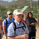
There was an article in the paper last week about a retired teacher who leads geology hikes in the Spur Cross Ranch Conservation Area once a month. I wanted to learn something about rocks, so this morning I went on that hike.


Tom McGuire, our guide for the hike.

The hike started at 9, and I quickly remembered why I don't like to go hiking in the morning. There's something distressing about hiking in the heat when it keeps getting hotter. It wasn't real hot, though. It probably didn't even get up to 90 before we finished the hike 2 hours later. The air was very still, though.


Elephant Mountain. I took half of my pictures before the hike even started.


There are some nice mountains in the area, but it was the wrong time of day to be getting pictures of them.

I didn't take a lot of pictures on the hike because the sun was too high and because every time I saw I picture I wanted to take, there was somebody standing in it. There were about 100 people on that hike. Some looked like they were accustomed to hiking in the desert and some looked like this might be their first time off the pavement. A lot of them had wooden hiking sticks. I carry one, too, if I'm going on a long or steep hike. Didn't need one today. This wasn't a comfortable hike for me, though. It was mostly level and we moved slowly. Kind of like ambling through a shopping mall with a window shopper, which makes my hips hurt for some reason. The last few hundred feet back to the parking lot were uphill. Oh, that felt good!

Tom is a good speaker and is very knowledgeable. He would stop to talk about something every now and then. In between stops people would ask him questions and I tried to walk close by to listen in. Consequently, I was usually in the middle of the crowd. Not a good place to be for getting pictures. Anyway, click below to see all of them (pictures, that is).

2010_10_16

Tuesday, October 12, 2010

Finding a route

A few weeks ago, I had gone on a hike trying to find a route to the old Massacre Grounds trailhead. I didn't quite get to it, but I was worn out anyway. Well, yesterday I was looking at Google Earth and decided to try going it that direction again, only this time I would follow a large wash. My destination had changed, too. I wanted to get to some hoodoos that are in that direction.


This looks interesting from far, far away, so I want to get a closer look.

The sun sets so early these days I knew I wouldn't have time to get all the way out there. I just wanted to see if using the wash to go that direction would be workable. I quickly learned that being in the wash was a bad idea. Lots of boulders to step over and lots of loose sand to sap speed and energy.


This is not a preferred place to hike.

I stayed in the wash for a while, though, because there were lots of footprints there. Maybe they knew something. I think maybe they didn't. There were getting to be a lot of trees in the way so I got up on the left bank of the wash. Wow, it got a LOT easier to walk. There were a lot of teddy bear chollas in places so I had to be careful where I put my feet, but I didn't have to worry about twisting an ankle.


My favorite variety of cholla, despite all the pain it's inflicted.

I made pretty good time on the way out and wasn't too worn out by the time I had to turn around. On the way back, I learned that I should follow the right bank at first, then switch to the left after a quarter mile or so. It was a successful outing. I learned what I wanted to know.


I think most of the saguaros in this area were wiped out by a fire many years ago. There are black brittlebush stubs all over the place.

It was getting pretty dark on the way back. I figured the rattlers were probably coming out and looking for a meal. The last half mile or so made me a little nervous but I didn't see or hear any snakes. It's a good thing, too, because the internal flash on my camera refuses to pop up. For some reason it thinks an external flash is attached. I wonder if I messed up some setting somewhere. Gotta figure that out.


Got a picture of the moon.

Remember how I used to put hikes on EveryTrail? I started using EveryTrail because it was so easy to transfer pictures from a web album to an EveryTrail hike. A few weeks ago, that function broke. I mentioned that in my previous blog. The very next day, I got a message from Joost. I think he is one of the two guys that started and runs EveryTrail. You know, I gripe about Microsoft all the time, but Bill has never sent me an email asking what he can do to help. Anyway, when I got my jaw off the floor, I sent info on the issue to Joost. It turns out that Chris (the other EveryTrail guy) had responded to my issue on an EveryTrail forum; I thought I would get an email when somebody responded but either I didn't or I missed it. Anyway, the problem seems to be on the Picasa end so there probably isn't much the EveryTrail team can do about it. Well, they may have some connections at Google. Anyway, I'll try it now and then to see if it's fixed. It might already be fixed. I haven't tried it for 2 or 3 weeks. I'm also going to see if I have some software that will resize pictures for upload in batch mode. (I'm an engineer. I'd rather spend 2 hours writing a program to do something than 15 minutes doing it by hand.) I'll let you know what happens. Well, you knew that. Click below to see all of the pictures.

2010_10_11

Sunday, October 10, 2010

Back in July, I had come across a faint trail in the Goldfield Mountains. I ran out of light and water before I got to the saddle the trail seemed to be headed toward. I went back to that trail on Saturday.


My destination is up there.

It was in the mid 80's; very pleasant. There weren't many people in that part of the OHV area, either. I just saw 2 guys in some sort of dune buggy thing roar by in the distance. Once I went over the saddle, I think I pretty much had the place to my self. Just me, quail, cactus wrens, and crickets. Strangely, no buzzards circled me on this hike. Maybe I looked a little too lively.

The trail seemed more clearly marked than before. I don't remember so many cairns. Some that I had seen before were gone, though. Maybe blown over during storms. I wonder who made the cairns, and why they went to all that effort. In places the trail is hard to see, but in other places it looks like hundreds of footsteps have passed over it.


This was dry last July.


The saddle is just up there.


Dome Mountain.

It's a climb of only about 500 feet. There are a few short steep parts, but they aren't bad. I covered 3 miles in 2 hours and 42 minutes. That includes time spent enjoying the view. Two hours and 17 minutes of moving time. Hmm, that makes my average speed below 2 mph. And people always complain about me walking too fast. Ha.


The view on the other side of the saddle; a sight few people have seen.

I didn't realize I was right next to Dome Mountain until I got home and was looking at a map. I didn't take many pictures in that direction because it was to the west (and it was afternoon). I wondered if the cairns might be marking a trail to Dome Mountain, but I didn't see any more of them once I got to the saddle. No trace of a trail towards Dome Mountain, either. Maybe I'll find a route up there this winter. I've kinda wanted to go up there for years, but didn't think there was a route without real climbing. Maybe there is, after all.


This looks much prettier when you are standing there. Maybe I just don't know how to get a good picture of it. Or maybe one thing that makes it so pretty is being there, away from the turmoil in town, and looking at the picture at home while lazy kids are doing things that give me heartburn has removed its most enchanting aspect.

I took pictures thinking I would put together a panorama of the view from the saddle. It looks to me like there is plenty of overlap in the pictures, but ICE couldn't figure out how they go together.

I'd like to put this hike on EveryTrail, but I haven't been able to upload pictures to my hikes there for a few months. Something is broken, but nobody else seems to be complaining. I've tried 2 computers and 3 different browsers. I'm trying to upload from my web album. Maybe the web album has more albums than their software can handle ("Nobody will ever have more than 512 web albums!"). Who knows? Click below to see all of the pictures.

2010_10_09

Wednesday, October 06, 2010

Stormy weather

We've been having some exciting weather around here lately. There was a storm on Saturday with lots of wind and dust. There was just enough rain at my house to make the dust stick to my truck. Then we had storms most of the day yesterday. The last one to come through, around 8:30 or 9, had lots of wind and hail. We got a decent amount of rain, too.


In the desert, we water our grass whether it needs it or not, and I don't believe this grass needs any more water.

I went driving thinking that I might get some pictures of storms or rainbows. By the time I got out to the Superstition Mountains, it looked like the rain had stopped. I stopped on the side of Apache Trail and took a few pictures.


I like the way this turned out.

I went into Bulldog Canyon OHV area over there and drove to the top of a hill to see if I could get some sunset pictures. The sun was gone by the time I got there.


It smelled wonderful out there. I love the smell of creosote bushes after a rainstorm.


I hung around out there until is was getting dark. As I drove back to the gate, I realized I didn't have a flashlight. They were all in my backpack, at home in the bedroom. The lock can only be seen from the outside, so my headlights wouldn't do any good. Then I remembered the flashlight app for the Droid, and remembered further that I didn't download it because I thought it was a silly app. Who's silly now?


I had no signal. Couldn't download it. I hoped that I would have a little signal by the time I got to the gate. Just a few hundred feet later, I got a text from my Sweetums. A signal! I downloaded the app and had no trouble getting the gate open.

I was in a store last week and wanted to know the price of something for which the price label had been removed from the shelf. I downloaded the barcode scanner app and looked it up. This Droid is pretty handy. Kinda reminds me of Trinity on The Matrix when she needed to know how to fly a helicopter. Click below to see all of the pictures.

BC_2010_10_05

Sunday, October 03, 2010

A couple more Photosynths

It was still a little warm on Saturday so I didn't want to go on a long hike. I decided to go up to the top of Coronado Mesa and take pictures for a Photosynth of the canyon to the north. I was going to try something different, too. I took HDRIs and tweaked the contrast before stitching them together. I didn't zoom in a lot. I didn't want a lot of detail. I just wanted to get a picture that showed the view.


Click below to see the rest of the pictures.

2010_10_02

Thursday, September 30, 2010

More lessons learned

I've been feeling the urge to get out and do more hiking lately. I feel it every time I try to zip up my pants. Most people would complain that their pants are shrinking, but I know what the problem is. So I went for a short hike to burn a few calories.


It's tarantula season. They guys are out looking for some cute gals.

I went wandering around near the First Water trailhead. I thought I would go someplace I hadn't gone before, but I fell into some old footsteps. It must have been humid yesterday because it wasn't long before I had sweat trickling down my temples. It fact, the air has been much more moist the past couple of years than when I first moved out there. The relative humidity is rarely in the single digits anymore.


Does this remind you of a dog?

I wound up on top of a small hill near the trailhead. I decided to experiment with making a Photosynth panorama without using a tripod and found out that I shouldn't do that. I also zoomed in quite a bit for the pictures. I shot in RAW mode and corrected for the vignetting, but the stitched result still has smudges in the sky.


I found out that if you click on the "expand" symbol on this, you can view the picture full screen.

I need to keep experimenting to figure out what the limitations are with the equipment I have now so I can decide if I want to go out and buy something like a Giga Pan. Maybe by the time I figure that out, I'll have taken huge pictures of everything I want to do that with. And no remarks about my prepositions, please.

Friday, September 24, 2010

From the south side

Thursday was a beautiful, cloud-free day. After work I headed out to Peralta road. I went to the top of a small hill south of the Superstition Mountains. I set up the tripod on the side of the hill and tried to get it level. I thought it was but for some reason I looked through the viewfinder with my left eye, and then it looked very crooked. One of my eyeballs must not be screwed in right. Anyway, I actually used the bubble level app in my new Droid phone to get the tripod level. Who woulda thought it could actually be useful?


I took pictures of stuff like this.

It was uncomfortable bending over to take pictures, so I didn't zoom in much so I wouldn't have to take a lot of pictures. Still, you can zoom into this picture quite a bit.


Photosynth panorama of the south side of the Superstition Mountains.

I had the camera set up correctly this time, so I think that helped it stitch together a little better. I took the pictures in RAW mode so I could correct for the darkening in the corners. As usual, I was hurrying to get the pictures taken before the sun got too low. When I was done taking the pictures I wanted, I grabbed a water bottle and stood there and finally looked around me. It was wonderfully quiet and the lighting was perfect and the temperature was perfect and there were no bugs buzzing around my ears. I'm glad I stopped and looked around before I hurried home to see the pictures.

I've been seeing a bunch of animals recently that I keep forgetting to mention, so I'll catch up now. On the way home from the hike along the top of Ittindi Rock I almost hit a deer that ran across the road in front of me. Something else ran across the freeway in front of me later, but I think that was my imagination. When I was taking pictures on Sunday for my first panorama of the Superstitions, there were a few bats flitting around near sunset. That's the first bats I've seen this summer. They were thick last summer but ominously missing this summer. Maybe that's why there have been so many bugs this year. Then, on the way home yesterday, I saw something that I've been trying to get a decent picture of ever since I moved out here. A roadrunner ran across Peralta road in front of me. I knew it would be long gone but I stopped where it crossed and it was still standing there. I knew it would be a wasted effort but I got my camera out to take a picture, and the roadrunner just stood there. It stayed there while I took several pictures. There was barely enough light, so the pictures are grainy but I think they are pretty good, considering.


Finally, a picture of a roadrunner!


I saw some cows, too.

Click below to see all of the pictures.

2010_09_23

Sunday, September 19, 2010

The dark side

I was playing with ICE (Image Composite Editor) Friday evening and kept looking at the "Publish to Photosynth..." button. From what I remembered about Photosynth, ICE composites didn't belong there, but what the heck; I pushed the button. The result is below.


My first ICE/Photosynth panorama.

The cool thing about that is it's the full resolution image. You can zoom way in and see lots of detail. The viewing area is rather limited in this embedded image. You can go to my Photosynth page and look at it almost full screen there.

Naturally, I started thinking about what else I could do with this newly discovered capability. As an experiment, I decided to take a bunch of pictures zoomed in on the Superstition Mountains and throw those into ICE. Since it was kind of hot yesterday, I planned to wait until late afternoon. I waited a little too long, though, and was almost running to get to a spot with a decent view before sunset. I stopped at the first acceptable spot and took some pictures. Then I continued to the hill I wanted to be on for the pictures. There was still enough light so I took a bunch more pictures. Since I was in such a hurry, I didn't have the camera set up quite the way I wanted, but that didn't seem to have a detrimental effect. I was still in a hurry when I got home and the first time I put the pictures into ICE, the result reminded me of Brundlefly. While eating dinner I realized that I had put pictures taken at both locations into ICE at the same time. No wonder I got strange results. I had to geotag the pictures to figure out where one batch ended and the other started. One of the panos is made up of 31 picture and the other has 80 pictures. Not all of the pictures are perfectly focused. ICE had a little trouble stitching the pictures together in a few places, too.


Superstition Mountains super panorama composed of 80 pictures.

While I was skimming through the Photosynth blog, I saw that geotagged Photosynths are put on bing maps within a few hours. I thought that would be cool, but there were a couple of issues to overcome. First, even though all the pictures were geotagged, the final Photosynth isn't. I had to geotag it manually, which was a little tedious since Google aerial views and bing aerial views don't look exactly the same. A nifty feature is that you can also specify the orientation of the Photosynth, though. Second, and this is the kind of thing that makes me mad whenever I have to use microsoft tools, how to turn on Photosynth pictures in bing maps is far from obvious. I tried a couple of times Saturday morning and gave up. On Sunday morning I went down a path that didn't seem right but could not be ruled out, and there it was. Typical microsoft. If anybody else is able to figure it out, please let me know. I want to know if microsoft tools are really as obtuse as I think they are or if I'm just a dummy. Wait, maybe I don't want to know. I'd rather just grumble about microsoft.

I just remembered a third irritation. While geotagging the Photosynths, I thought it might help if I looked at the bing map in 3D. Guess what; 3D works ONLY in internet explorer. Typical microsoft. I'm getting mad thinking about all this. That's good. I haven't gone completely over to the dark side.

Thursday, September 16, 2010

ICE

No, not water ice. Not an In Circuit Emulator. Not In Case of Emergency, either. But I'm getting ahead of myself. Or maybe behind, because I'm not really sure where this started. Anyway, a couple of days ago I was walking along the top of Ittindi Rock and thinking about how I wished my Sweetums could see what I was looking at. The pictures are nice, but they just aren't the same as being there. Then I thought about making a huge panorama, with pictures taken horizontally and vertically, all stitched together into one huge picture that you can zoom into forever. Then I remembered that Skid had sent me a link for a contraption that can be used to take pictures just for that use. That would be something else to carry around, though, and I think my backpack is heavy enough. Plus, I'm usually too impatient to sit around waiting for dozens of pictures to be taken. I might look into getting one of those, though. Anyway, then I started thinking about how I sometimes take a series of pictures that could be stitched together but I don't do it and wondered if I have any software that will stitch both horizontally and vertically. Before I could think about the software much more, I was distracted by some ants that seemed to be going in the same direction I was, and so I started thinking about them. Then I started thinking about horned lizards and gila monsters but I had to stop thinking about that to figure out what to do about the fallen paloverde blocking my path. You know, I used to think about fun stuff in my spare time, not ants and lizards and trying to derive an equation that describes the error associated with determining the equation for a straight line using two points when the positions of the points are not known exactly (i.e., they're noisy) and how the error will increase as the points get closer together. Speaking of points, that is not the point, but I've wandered so far off track I'm not sure I know how to get back.

Today at work, I somehow ran across something called Microsoft Power Toys, and a tool called Tweak UI. I thought it would solve a problem I've been having with a computer at home, so I emailed the link to me. I installed it when I got home, but it didn't do what I wanted (preventing a window from losing focus), but when I ran it I noticed something called Microsoft ICE had been installed on that computer. While I was messing with Tweak UI, I remembered that I had installed ICE, but couldn't remember what it was. I started it up and then remembered the demo video I had seen. Some guy dropped a couple of hundred pictures of the Golden Gate bridge into it and it instantaneously stitched them all together. I think he must have been working with very small (640x480?) pictures or was sitting at a super computer because it isn't that fast for me, even with just 2 pictures. Anyway, the software figures out how the pictures fit together and stitches them. You don't have to tell it anything, or arrange anything for it. Just drop the pictures in the window and away it goes. It had a little bit of trouble with some of my pictures but that may be because of the way I took them. I'll have to read up on ICE to see what I can do to improve the stitching.


This is the best stitching result.


ICE had a little trouble putting the saguaro together.

Once I figure out how to get good stitched photos, I'll have to figure out where to put them. I tried uploading these to my web album at their original size. The photo information on the web album says that they are original size. But when you zoom in on them, they are NOT original size. In fact, I don't have to zoom in to see that they have been shrunk so that their maximum dimension is 1600 pixels. I'll figure all that out when I'm not so sleepy.

P.S. I noticed yesterday that the picture at the top of my blog got shrunk. What's up with that? I didn't do it.

Wednesday, September 15, 2010

To the top of Ittindi Rock

It was only 103 when I got home yesterday, so headed out to go for a hike. I was planning to go to Bulldog Canyon but along the way I remembered that my pass has expired. So then I headed toward Canyon Lake, not sure where I would end up. I eventually decided that I would go to the top of Ittindi Rock. I'm out of shape from staying indoors during the hot weather and I didn't want to do anything too strenuous. When I parked and looked out the window at Ittindi Rock, though, it looked anything but easy. It looked enormous. The sun was headed for the horizon, though, so I wasn't going to go someplace else.


Ittindi Rock doesn't look quite so tall in this picture as it does when you are standing there planning to climb it.

It had been long enough since I've been up there that I had completely forgotten I would be following a power line maintenance road for a while. That made the hike easier and faster. I got to the saddle where the real climbing starts well before sunset. Well, it isn't real climbing, but it's a lot steeper than a road.


Mormon Flat dam from the top of Ittindi Rock.

There seemed to be more of a trail up there than there was last time, though it's still pretty faint. Paloverdes had blown down on it during the recent monsoon storms, too. A trail isn't really necessary, though. Unless you are rock climbing there's only one way up, and only one survivable way down.


The views are very nice from the top. This is looking toward the Superstition Mountains.


A view of Canyon Lake. It's getting dark down there.

It wasn't as difficult to get to the top as I was afraid it would be. It was beautiful up there as the sun sank toward the horizon. I wan't to sit and enjoy the view for a while, but I also wanted to get down the steep part with plenty of light.


The Superstition Mountains, again.

My legs weren't too wobbly by the time I got back to the truck. It was a good workout, and hiking in 100 degree Arizona weather feels so much better than standing around in Texas coast mugginess. Click below to see all of the pictures.

2010_09_14

Sunday, September 12, 2010

A welcome back to Arizona

I have just returned from about 10 days in Texas. It was good to see family and I enjoyed the peace and quiet at Mom's house. There's nothing quite like drifting off to sleep while listening to a couple of owls hooting in the woods. Anthony's excellent cooking put back the pounds I lost from cafeteria food the night before I left Arizona. I enjoyed watching the 3 inches of rain fall at Mom's house from tropical storm Hermine (she didn't get as much as surrounding areas) and then a few days later, watching the Colorado River rise with runoff. I missed the desert, though. Especially whenever I got out of an air conditioned vehicle and was blinded by foggy glasses or when I got wet with sweat walking to the end of the driveway to take a picture. It feels good to be back in Arizona. It was the same temperature when I got here as it was when I left Houston, but it felt soooo much better.


I stepped outside around 6:30 and the clouds looked like they might make some good sunset pictures. I grabbed the camera and headed up Meridian road. As I walked out to a spot from which to take pictures, I thought about how I should be selective in which pictures I put on my web album. I should just upload the 2 or 3 best. I couldn't do that, though. I uploaded all of them that I like, which is most of them. Click below to see them.

2010_09_12