Showing posts with label abandoned mine. Show all posts

Sunday, February 02, 2014

Old mines

I guess you could call them mines. Is there some other name for small holes dug in the ground while looking for something valuable? I think that if they had found anything worthwhile, they would have kept digging.

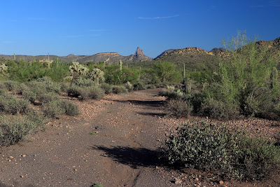
There are several small mesas at the southeast corner of the intersection of Usery Pass Road and Bush Highway. I was looking for someplace to burn a few calories after work and that area is quick and easy to get to. I've been there several times in the past, but I hadn't been on all of the mesas. I headed to an area I hadn't been to before and was walking along a ridge when I looked across to another mesa and saw what looked like a spot that somebody had been digging.


The Salt River is over there.


The patrol copter.


Somebody has been digging over there.

I wasn't paying close attention when I decided to hike over to the dug-up spot, so I didn't go in quite the right direction and didn't find it. I couldn't spend much time looking because the sun was setting. Click below to open a new window with the pictures from this hike.

2014_01_22

I looked at the pictures when I got home and it was obvious that the ground had been dug up. I memorized a saguaro near the spot to use as a guide the next time I went out there, which was the next day. I easily found my destination saguaro and then the hole in the ground.


The first hole in the ground was very shallow. Yes, first.

From the hole in the ground, I could see another one a little further uphill.


The second hole was deeper and a critter had put a lot of cholla balls in it.

I went to the top of the mesa from there and wandered around a little taking pictures, then headed toward the truck. I had just started going downhill when I found another hole.


Cholla.


Sundog over Red Mountain.


Another hole. This one looks familiar.

The hole I found on the way downhill looked familiar. I was pretty sure I had seen it maybe 7 or 8 years ago. I continued downhill and found another hole that went into the side of the hill and was pretty deep. Now I was sure I had been out there before. For years I had been meaning to go back to this mine when the sun was higher in the sky to try to determine how big the inside was. I could never find it again. The first time I was out there was before I had the stuff to geotag my pictures. I had given up on ever finding it. I still need to go out there when the sun is high in the sky, though.


I think the rock dug out has this channel in it to keep the mine from filling with rain water.

Click below to open a new window with all the pictures
2014_01_23

Thursday, June 06, 2013

Where I meant to go last time

I made it to the place I intended to go that day that I got distracted by a balanced rock. It was prettier and more interesting than I thought it would be. It wasn't as hot as I was afraid it would be, either. 97 when I got in the truck after sunset. I forgot to look at the thermometer earlier. It was dead calm most of the time. The most amazing thing was that I did not see or hear a single gnat the whole time. Hallelujah.


It was pretty right from the beginning.


See that truck that is so plain it stands out? I saw another one exactly like it as I was driving home. Play Twilight Zone music here. I guess it could have been the same one if the guy was just driving back and forth and back and forth on Apache Trail.


This area has a LOT of these round rocks. The don't get that way from weathering. They form that way.


I found a bunch of junk like batteries, a flashlight, a convex mirror, a bottle of salad dressing, etc. around this bag from the "International Conference on Design and Construction of Deep Foundations". Odd.

I just kind of wandered around out there. I would see someplace that might be interesting and head over there but get distracted by something else and take a side trip, and so on and so forth.


A picture of my wanderings.

There was a ridge to the south that I wasn't even looking at because it seemed much higher than I wanted to climb. As I got closer to it, though, I kept seeing signs of a faint trail. No cairns, just places without grass that should have had grass. Also narrow paths where the thin veneer of desert soil had been damaged by careless footsteps and then washed away in a rainstorm to expose the solid rock beneath it. I had seen so much strange stuff already, I had to follow it to see what else there was. As I approached the top of the ridge I realized that the path I was currently following was actually an ant trail. Yes, those big red ants actually clear vegetation from their heavily used paths. Fortunately it was getting to be late in the day and most of the ants had returned to the mound, so I didn't have to try too hard to not step on them. Well, they've never bitten me, so I don't want to step on them.


I had a nice view of Canyon Lake and Four Peaks.


I took a lot of pictures of this view. You can tell that the sun is getting low.

As I approached the top of the ridge, I got excited like I always do about what the view might be like from up there. I topped the ridge and, lo and behold, there was ... Apache Trail. Oh well. I was catching my breath and looking around when I spotted a structure of some sort.


My first thought was "swing set" but I quickly ruled that out. Then I wondered if it was some sort of mining contraption.

I took a picture of it and started to move to my left to get it from a different angle. A person that has been hiking in the desert for a few years does not move his feet without looking first. Good thing. I was standing next to a very deep hole.


I guess I should have taken an HDRI. There's a ladder down there. I couldn't seem the bottom. Well, I just couldn't get very close to the edge. This is about 7 feet long by 2 feet wide.

I hung around for a few minutes up there enjoying the view, then had to hurry back to the truck before it got dark. Yes, I'm sure there's a faint trail now. Maybe made by the same person making repeated trips, and he doesn't want to be followed (no cairns). He needs to learn how to walk more carefully, though. Click below for all of the pictures.

2013_06_04

Tuesday, September 18, 2012

Weaver's Needle Vista Viewpoint

It seems repetitive, but that's what the sign says. Several years ago, I had gone to the end of the paved trail there and continued on the dirt trail for a while. It's been long ago enough that I had no recollection of what I saw out there, so it was time to go again.


The paved trail takes you to this spot. The view of Weaver's Needle is mostly obstructed from here, though.


The further you go along the unpaved portion of the trail, the better the view of the Superstition Mountains.

It was a little warm out there, especially with the sun on my very dark blue jeans. There were some gnats, too. Most of them just flew around the brim of my hat. I also seem to have gotten a couple of mosquito bites while out there. They would be my seventh and eighth mosquito bites since moving to Arizona over 9 years ago. I can't figure out how people manage to get West Nile in this state.


I like the way this turned out. Can you tell what's different between it and the last 40,000 or so pictures I've taken?

I finally got to an unobstructed view of Weaver's Needle, about a mile from the trailhead. Shortly after that I came to the overflow parking lot for the First Water trailhead. Since I've seen that area recently, it was time to turn back.


View of Weaver's Needle.

I wasn't on an official trail. There are random trails wandering all over the place out there. I decided to take a different one on the way back, thinking it would re-connect with the trail I had been on before. It quickly became obvious it wasn't going to work like that, though. I was headed well south of where I had been before. I had plenty of water and was in an area where it would be darn difficult to get lost and I could always get to Apache Trail to escape.


I was almost to Apache Trail when I decided to cut across some hills to get back to the truck. I was doing a lot of pointless ups and downs but there was some interesting scenery along the way.


One of many mining claim markers in the area. These guys aren't Hispanic, or can't spell, or both.


I spotted the truck and was about to descend to a wash when something on the side of the hill up ahead caught my eye. I was tired and it was getting late, but I couldn't resist going to see what it was.


What are those white and black squares all about?

It didn't take much more clambering around to get to it. Turns out it was an old mine shaft, going straight down for 20 or 30 feet.


I hear that there are thousands of these all over Arizona. More numerous than mosquitoes, apparently.

Click below to see all of the pictures.

2012_09_16

Sunday, March 13, 2011

In the middle of nowhere

There are places in Bulldog Canyon OHV area that look like they would be interesting to explore, but I haven't been there yet because they are hard to get to. There are also places I haven't explored because they look boring. I didn't want to do a lot of climbing yesterday, so I went to one of the places that looked like it would be boring. It's a large, mostly flat area. Well, flat compared to mountains. I studied the area on Google Earth and the most interesting thing I could see there was a small patch of light colored ground. I've looked into such things in the past and sometimes they turn out to be old mines, so that would be my destination. I even saved the coordinates in my PN-40 in case I had trouble finding it.


I knew there would be plenty to get pictures of out there.

As I started out, the desert smelled wonderful. It still had a little bit of that fresh creosote odor from the rain a couple of weeks ago. There was also something sweet mixed in with it. I didn't see many flowers, though. As I walked by a paloverde the sweet smell was really strong. This paloverde had a lot of parasites (similar to mistletoe) in it. The parasites were covered in flowers almost too small to see. I think that's where the sweet fragrance originated.


Paloverde full of parasites.

I came across some light patches of soil that I had seen in Google Earth. It was just different colored rock. Not too exciting. They didn't stand out as much as the one I was headed for, though.


Light colored rock.

I climbed a small hill and thought I could see my destination. It didn't look very interesting from the hill, but I had to be sure.


Looks like just another patch of light colored rock.

It turns out that it was mildly interesting. Somebody had dug a hole there and spread the light rock around, which is why it stands out in Google Earth. The hole is about 6 feet deep at its deepest part. The hole is why the center to the light patch looks dark on Google Earth.


A hole in the ground.


It isn't very deep.

I climbed some hills north of the hole to check out the view and found a Y saguaro. These are supposedly rare but I seem to find them all over the place. They aren't as rare as crested saguaros.


A Y saguaro.

I took lots of pictures of saguaros and sticks on this hike. I was trying to be selective about what I photographed, but everywhere I looked there was something pretty. It was a very enjoyable hike.

I saw tiny flowers scattered here and there, and about 5 Mexican Gold Poppies. I had read in the paper that the rain didn't fall at the right time for good spring flowers and so far that seems to be the case. Click below to see all of the pictures.

BC_2011_03_12

Sunday, May 17, 2009

Cross Canyon

Yesterday I wanted to go someplace I'd never been before. I was looking around Superior in Google Earth and noticed some dirt roads heading off into the wilderness. I decided to drive on some of them and if I couldn't drive, I would walk.


On Google Earth, it looked like I could drive east out of town on the old road between Superior and Globe. I turns out that you can't get to the old road, though. While I was driving through town, though, I came across the old high school. It's the second oldest school in Arizona (the oldest is in Globe). It's closed now because of asbestos. It has for sale signs on it, but I hear that some guy bought it for $250,000.


This doesn't look like a place I would want to spend 3 or 4 years as a teenager.


I headed south on 177 and turned off at the first dirt road I'd seen in Google Earth. The tires slipped and spun on the steep, gravely road for about 30 feet before I got to a place to park, and park I did.


I parked near the cross on the east side of town.


An advantage to going to Superior is that it's at a higher elevation, which makes it slightly cooler than the valley. I think it was about 95 when I got out of the truck. I followed the road to its end, so the walking was pretty easy. By easy, I mean it wasn't real steep, not any PUDS (Pointless Ups and Downs; thanks anonymous), no grass to hide rattlers, no cholla to stab my legs, etc. It was very rocky in places so it was a good ankle workout. My new boots tend to slide a little easier than most I've had in the past. On the way down I got used to sliding a few inches every now and then.


On the way up, I almost stepped on a lizard before it ran off. That's unusual. It happened again on the way down and I almost pulled a muscle dancing around trying not to hurt the lizard. I also came across a snake. I saw one just like it last Tuesday but it got under a brittlebush before I got a picture. This one stayed in the road while I took pictures. It's a western patch-nosed snake.


It's a little noisy at the end of the road, where you can hear the traffic on 60.


US 60 far below.


I wonder if I can get up there.


On the way up the road, I saw several spots that looked like mine tailings. I checked a couple of them out, though and decided that it was dirt that had been pushed out of the way while making temporary roads, maybe while fighting a fire many many years ago. Then on the way down I glanced to my right and saw a mine entrance that had been closed off with a grate. It wasn't until I got home and was looking at pictures that I could see that some of the other piles of dirt were mine tailings. In the pictures I could see grates covering abandoned mine entrances.


Click below to see all of the pictures.


2009_05_16