Sunday, February 12, 2012

An afternoon stroll

If you want to go for a walk just to go for a walk, a good place to go is over by the Superstition Mountains. The scenery is nice and you might get some good pictures. I headed over there after work on Thursday. The days are getting long enough to hike after work now. I parked at the Crosscut trailhead. There was only one other vehicle there.


A stand of cholla along the way.

There was just a very light breeze. It was very peaceful and relaxing out there. I had been along the same trail about a year ago and didn't see much on either side because I was focused on reaching my destination and on the way back I was just too tired (and it was dark). Since I didn't have to be anywhere before sunset on this hike, I wandered off the trail now and then checking things out. I didn't see anything real exciting, but at least I saw it.


I've done a lot of hiking in those mountains.

Every once in a while, I thought I heard voices, and would stop and listen and then decide it was the wind playing tricks on me. Eventually, though, I heard the voices even while crunching along the path, and I could tell what direction they were coming from. It must have been the people from the other vehicle. Looked like a father and a couple of teenagers.


The other hikers.

I turned back soon enough that I would get back to the truck well before it got dark. I felt like I had to keep stopping to look around for good picture opportunities as the sun sank.


Clouds to the west let the sun illuminate portions of the landscape.


The filtered sunlight made cholla look like they were glowing.


I see lots of cool stuff on my hikes, but pictures of the Supes always seem to turn out more impressive than all the other stuff.

It was a pretty sunset. I almost missed it as I concentrated on not twisting an ankle on the last little bit of the hike to the truck. Click below to see all of the pictures.

2012_02_09

Sunday, February 05, 2012

Yet another ridge in Bulldog Canyon

I wanted to see something new yesterday, but I didn't want to drive a long way to see it. I went to Bulldog Canyon and started down a wash I've been down a couple of times before, and then headed up a ridge. It's one of the places along there that I'm planning to explore some day.
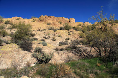

I went up there, sort of. There's not much for scale, so this doesn't look like much.

I went up one of those bare rock ridges out there. If you can find spots that aren't too steep, they are easy to walk up because they aren't covered with loose rocks. On the other hand, they can be covered with marble sized pebbles that roll under the hard soles of my hiking boots. Progress can be slow on slopes with those pebbles. That was OK, though. I had donated blood in the morning and seemed to be getting out of breath more quickly than usual.
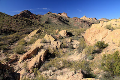

You can't see all this structural detail from down in the wash. It just looks like a solid orange wall.
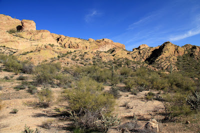

There are several large, flattish spots up there. I decided to head for that notch towards the right. I want to see what's on the other side.

I crossed some sizable "flat" areas on the way up. It's nice to be on ground that you don't feel like you're about to roll down every now and then. Some of those areas were covered with thick grass about mid-calf high. It was tricky walking there because the softball size rocks were hidden. I almost twisted an ankle in one of those spots.


Treacherous meadow.

I took my time on the way up, partly because it was pretty up there and partly because I needed to catch my breath a lot. I also spent a lot of time studying optional routes to decide which way to go. You can't really tell which way will work out until you try it, though. I got lucky and made it to the top of the ridge on my first attempt.

I need to go in that direction, but I don't want to hike in the bottom of that draw. Vegetation will be too thick.

I steadily and easily made progress. It was a little strange not coming to any dead ends. The route I chose wasn't very steep, either.


Steadily gaining altitude.

I eventually got to a spot where I was going to have to go up a narrow channel that was full of plants. I expected to get ripped to shreds. There was no catclaw, though. I was able to get past all the other thorns without losing any blood.


The most formidable obstacle.


A nice view.

At the top of the channel, it looked like I was almost to the top of the ridge. It was tempting to run the last few feet and check out the view. There was a chance that I would get up there and see that I had a lot more climbing to do, though, so I took my time.


Almost there.

It turned out that I really was at the top. The view to the other side was not what I expected. It was very nice, though.


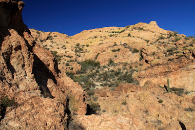
The other side. That's the Superstition Mountains back there.

I wasn't at the top of the tallest part of the ridge. I didn't see an easy way up there from where I was. I was getting a little tired of climbing, anyway.

The very top. No easy way up from here.

I hung around up there for a while taking pictures and enjoying the view. I started back in plenty of time to get to the truck before dark.


People sometimes ask why the rocks have a greenish tint. This is why. Lichens.

On the way down, I came across a hole in a flat part of the rock. It was about 2 feet in diameter, and very dark. I couldn't see into it because of the bright rock around it. It seemed bottomless, or maybe full of water. I zoomed in and took a picture. Turns out it was much shallower than it looked.


Bottomless pit?


Not bottomless, but it is wet.

It was a very pleasant hike. Click below to see all of the pictures.

BC_2012_02_04

Sunday, January 29, 2012

Perfect weather

Saturday was perfect weather for a hike. It was in the low 70's with a light breeze. There were almost no clouds. I headed for Bulldog Canyon. There was something I saw in one of my pictures from about a year ago that I wanted to check out. It looks like a large natural cave in the picture.

I was a little concerned about going in at the Wolverine Pass entrance. With the beautiful weather, I thought there would be lots of people there and the gate would be left open and there would be dirt bikes tearing up the desert. Strangely, there were just two vehicles in the parking lot (one with Alaska plates) and no people to be seen. There were no dirt bikes or ATV's tearing up the desert. It was like the twilight zone. I saw that a lot of "area closed" signs had been put up in all the places people shouldn't drive, but the people that drive out there never let stuff like that stop them. They just use the signs for target practice. Maybe a bunch of people got ticketed and that put a damper on things. Hope so.

I didn't see or hear anybody all the way out to where I parked. As I started my hike, I heard an engine that sounded an awful lot like a WWII plane. Turns out it was.


Something you see surprisingly often out here.

I headed up the wash where the "cave" should be. It was very rocky and, of course, full of thorny plants. They didn't get me too bad. They did get my lens cap, though. I didn't notice when it fell off, so I've got to head to the store for another one.


Rocky path.

Every time I get scratched, I think about the first guy to be given penicillin. He had a garden and was working in it one day and got scratched on the face by a rose bush thorn. The scratch got infected and he was going to die, so he got to be the first guinea pig for the new drug. He was making a miraculous recovery when they ran out of penicillin (a manufacturing process hadn't been worked out), so he died. When I first read that story, I thought that it must have been scary to live in a world in which a tiny scratch could kill you. It turns out that can still happen today, though, especially with all the drug resistant bugs that are evolving. That's one reason I no longer like to use antibacterial soap. I figure the bugs I've got are good ones that will keep the bad ones at bay, so I need to leave them alone. Yes, there is such a thing as being too clean. I'm getting way off-track, though.


It was pretty up there, but I didn't get any good pictures.

I never did find the cave. Maybe it was just a shadow.


The first Mexican Gold Poppy of the season.

As I was standing on a small ridge trying to decide whether to continue uphill (I was tired after having a cold and two weeks of slothfulness), I made a noise (long story) that bothered something on the other side of a nearby wash. I thought I saw something move under a tree, but it wouldn't move again. I took some pictures thinking I might be able to see what it was later. Turns out it was a javelina. I saw several of them running off later.


Javelina hiding under a tree.

I encountered four vehicles on the drive to the gate as I left. All were on the road. The gate was locked when I got to it. Strange happenings. Click below to see all of the pictures.

2012_01_28

Wednesday, January 25, 2012

Reflections

We've been having unpleasant weekend weather lately; Gray, overcast skies but no rain. During the week, we have had beautiful blue skies. I didn't even go for a hike last weekend because it was so dreary looking. I felt like I had to get out in the sunshine after work yesterday, even if it was late in the day. I wanted some nice scenery, so I headed down to the Salt River.


The Salt River always looks picturesque.

The river is very low, as it usually is this time of year. There was one other vehicle parked out there, but I never saw the driver. I wandered around for about half an hour taking pictures.


There was no wind, so the water was very calm where it was deep enough.

I found out you can have some fun with reflections on the water.


Looks like a rocky sky.


A rock-shaped UFO?


This just looks strange.


Just a picture, but I like it.

I wonder if I can get somebody to get in the water and pose for some pictures. I can think of some strange pictures to create. Any volunteers? You don't have to be a swimsuit model; just be willing to stay mostly submerged in cold water (it's even icy cold in the summer) without shivering (that would make ripples) for several minutes at a time.

While you're thinking about that, I have some great news. Bulldog Canyon OHV permits are now available online. No more "I couldn't get off work before they closed" excuses. They have also put the Bulldog Canyon OHV Area information packet online, which has a new and much more readable map, though I don't think it's quite as good as my UNOFFICIAL map.

Click below to see all of the gloriously sunny pictures.

2012_01_24

Wednesday, January 18, 2012

Fish Creek Hill overlook

I made my third attempt at finding an overlook of Fish Creek hill on Monday. I didn't have a lot of hope of being successful, since on previous attempts I had come across terrain that required rock climbing skills to cross. I had to try, though, because it was a good excuse to go explore someplace new.


I'm going to be going out along that ridge that can't be distinguished from the background in this picture. It was a very cloudy day.

There was a little bit of pointless ups and downs, but overall it was an easy walk. I saw a couple of cairns along the way, but it doesn't look like people go out there very often. Other than the two cairns, I couldn't tell that anyone else had been there.

The cliff I was at the top of drops at least 300 feet straight down. Such things make me nervous, so my first pictures are taken pretty far back from the edge.


Just can't make myself get close to the edge.

After a while, I managed to get a little closer to the edge. I also sat down and kept my backpack on, so a breeze wouldn't blow me over the edge. I sat there enjoying the view for a while. Several cars going up and down the hill were honking their horns. I guess they were hoping to hear an echo. Maybe they did. After a while, I got a little bit of sunshine.


Sunshine looks amazing after a couple of days of overcast skies.

I loaded my route into Google Earth. I usually do that just to look at it against the satellite view. I also viewed a profile of the track. It showed that I descended about 300 feet at the far end of the hike and stayed there for a while, which I did not do. I think that maybe the small cliff behind me was blocking some satellite signals, and the receiver was using signals that had bounced off surrounding cliffs. Mountains and tall buildings can really confuse GPS receivers.


That dip in the middle of the altitude profile is when I stopped to enjoy the view. The receiver must have been having some multipath issues then.

Click below to see all of the pictures. They get kind of repetitious. Near the end is a panorama that I uploaded full-size. You can zoom way in.

2012_01_16

Friday, January 06, 2012

Rye Creek, first shot

I seem to be making a habit of going to all of these places at least twice. Well, that's a good thing. They're nice places. If I had to take pictures in a bar along Main in Apache Junction, I'd be sure to get all I needed on my first visit there. I suppose the bars could be very nice places, too, if you like that sort of thing. I guess I'm judging a book by it's cover, so to speak. But I'm getting way off track here.


The Last Roundup.

I used to visit cemeteries years ago. I was looking at the plants, and specifically rose bushes. I used to have some rose bushes and really enjoyed them, and I hear that you can find some really nice old rose bushes in cemeteries from which you can take cuttings, though I never did. I only raised hybrid teas. Anyway, I would always find myself reading headstones, and I would come across one for a child that died when just a few days or a few weeks old and that would make me very sad, so I quit visiting cemeteries.


Two of four.

"The Last Roundup" caught my eye as I drove by. "There's a bit of Arizona history", I thought. I stopped to look around. It seems to be used primarily by the Haught family. There were 4 similar tombstones close together. The Haught family lost 4 children in August of 1892. What a downer.

The upper part of Rye Creek was dry. I went to check out the lower part since I was out there and to scope out the road. There was water in the lower part, and evidence of lots of water recently. I wanted to see if I could find the stream gauge and had got to hike the last quarter mile or so.


This is a peaceful looking area.

I followed a side channel down to the creek. The stream gauge was right where the map showed it. It was obvious I was going to have to cross the creek if I was going to get more than two or three pictures.


Rye Creek stream gauge.

There was a wide, shallow part of the creek that was easy to cross. It wasn't long before I decided I needed to cross it again, but now is was narrow and deep, but not narrow enough to jump across (not with a backpack and camera, anyway). It wouldn't be fun hiking back to the truck with water in my boots, so I didn't want to step in deep water. Conveniently, there was a large pile of large rocks nearby. (That's funny, but unless you've spent some time in Arizona creeks you wouldn't know that that's like being in the Pacific Ocean and saying, "Conveniently, there was some salt water nearby". Which reminds me of one of the funniest things I ever heard but I don't want to get side-tracked again.) I selected a round, flattish rock and tossed it in the water on the far side of the channel to make a nice, stable landing spot. The near side was deeper, so I selected a large, rectangular rock. It was too heavy to toss. In fact, I felt myself sinking into the mud when I got close to the water with it, so as soon as I was close enough I dropped it. Mud and water splashed almost up to my waist. Well, I needed some hilarity and my feet were still dry so I was happy.


This made the soaking worthwhile.

I'm going to try to get back to Rye Creek when there's more water in it. In the mean time, click below to see all of the pictures.

2011_12_31

Another shot at crossing Willow Creek

I really wanted to get to the other side of Willow Creek and see what that mysterious, dark, rectangular shape I saw up the other side was, so I was back out there on Monday. I took a route that started a fair distance from my destination, so it was a long walk.


I think it's a pretty area (except for the power lines).

It was slow and tedious most of the way. Lots of plants in the way, and very large rocks. For every 10 feet forward, I probably walked 15 feet from side to side. That's one of the drawbacks of hiking off-trail. I was enjoying the scenery, though, so I didn't mind.


In some places, walking was easy.

It didn't take too long to reach the side channel I wanted to check out. It was so pretty in Willow Creek, though, I decided to keep following the creek for a while. I soon got to a spot that looked very familiar. I had been there before, within the past few months. I could have saved a lot of walking if I had remembered that, but then I wouldn't have seen all the things that I did on this hike.


I've been here before.

I got to some more boring scenery before I had gone much further and decided to go back and check out the side channel. I only went a few feet up it before it became more climbing (with hands) than walking. Too risky for a solitary hiker. We may never know if I had seen a cave entrance up there or not.


Notice the green grass everywhere.

It seemed to take a long time to get back to the truck. I was trying to hurry and wasn't being as careful about going around plants. I pushed my way through a few bushes that turned out to be catclaw. Had to take a shower when I got home to wash the blood off. Maybe I should start wearing long sleeve denim shirts. Click below to see all of the pictures.

2012_01_02