Tuesday, September 18, 2012

Weaver's Needle Vista Viewpoint

It seems repetitive, but that's what the sign says. Several years ago, I had gone to the end of the paved trail there and continued on the dirt trail for a while. It's been long ago enough that I had no recollection of what I saw out there, so it was time to go again.


The paved trail takes you to this spot. The view of Weaver's Needle is mostly obstructed from here, though.


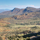
The further you go along the unpaved portion of the trail, the better the view of the Superstition Mountains.

It was a little warm out there, especially with the sun on my very dark blue jeans. There were some gnats, too. Most of them just flew around the brim of my hat. I also seem to have gotten a couple of mosquito bites while out there. They would be my seventh and eighth mosquito bites since moving to Arizona over 9 years ago. I can't figure out how people manage to get West Nile in this state.


I like the way this turned out. Can you tell what's different between it and the last 40,000 or so pictures I've taken?

I finally got to an unobstructed view of Weaver's Needle, about a mile from the trailhead. Shortly after that I came to the overflow parking lot for the First Water trailhead. Since I've seen that area recently, it was time to turn back.


View of Weaver's Needle.

I wasn't on an official trail. There are random trails wandering all over the place out there. I decided to take a different one on the way back, thinking it would re-connect with the trail I had been on before. It quickly became obvious it wasn't going to work like that, though. I was headed well south of where I had been before. I had plenty of water and was in an area where it would be darn difficult to get lost and I could always get to Apache Trail to escape.


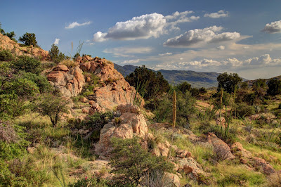
I was almost to Apache Trail when I decided to cut across some hills to get back to the truck. I was doing a lot of pointless ups and downs but there was some interesting scenery along the way.


One of many mining claim markers in the area. These guys aren't Hispanic, or can't spell, or both.


I spotted the truck and was about to descend to a wash when something on the side of the hill up ahead caught my eye. I was tired and it was getting late, but I couldn't resist going to see what it was.


What are those white and black squares all about?

It didn't take much more clambering around to get to it. Turns out it was an old mine shaft, going straight down for 20 or 30 feet.


I hear that there are thousands of these all over Arizona. More numerous than mosquitoes, apparently.

Click below to see all of the pictures.

2012_09_16

Sunday, September 16, 2012

A stroll in Bulldog Canyon

It felt a little cooler yesterday so I decided to go for a short hike. I didn't want to do a lot of climbing so I figured I would wander around a "flat" area in Bulldog Canyon, and maybe climb a small hill.


I've been in that area several times before but I had forgotten lots of details, so it wasn't as boring as I was afraid it might be. It felt like the humidity was still kind of high. There were very few tracks in the washes since they had been wiped clean by recent rains. Termites had covered many sticks on the ground with dirt (to keep them from dehydrating as they munch on the wood).


The ocotillos have fresh green leaves.


Termites at work.

I climbed a small hill. I'm pretty sure I've been on it before. I don't seem to have any pictures there on Panoramio or Google Street View, so maybe it was a different hill. I need to get busy and fill that area with pictures. Click below to see all of this hike's pictures.

2012_09_15

Wednesday, August 29, 2012

Silver Creek

I set out Sunday to get the last photo point pictures of the group on which I'm currently working. It was just two photo points on Silver Creek. I saved them until last because it takes a 3 mile hike to get to one of them (and back) and I would be making that hike in the heat of the day. It turned out to actually be about a 3.5 mile hike.


Fortunately, there was lots of shade.

I started the hike around noon, and I think the temperature was around 100. It's still the wet season, too, so it was a little muggy. The entire hike was in the bed of Silver Creek, which was mostly dry. It had rained recently, though, so the sand was packed pretty good. Made walking a little easier. I walked lightly so as not to break through the sand because that just saps your energy, but so does walking lightly.


These flowers were all over the place. I haven't looked them up in my plant book yet, though.

Shortly after starting the hike, I stepped on what looked like "solid" sand but sank about 3 or 4 inches with no resistance. At first I thought of quicksand, but it wasn't quite like quicksand I've been in before. The surface was too loose and it was easy to pull my foot out. I didn't want to test it any further, though. I stepped in stuff like that a few times, which kept my boots wet.


Bear tracks.


More bear tracks.

I came across bear tracks about half a mile into the hike. Amazingly, I happened to have effective bear protection with me. It would be a last resort, though. I would really have liked to get some pictures of a bear, but I made lots of noise for the rest of the hike. I heard noise in the distance every now and then that might have been a bear or a deer moving away. I saw tracks of both but never the animals.

I was looking for a fence that marks the location of the photo point. I went past the coordinates given on my treasure map, then past the National Forest boundary shown on my GPS receiver map before I found a fence. About all of it that was still standing was the gate.


Found it.

I got the pictures and relaxed for a little while before heading back. It was hot. Really hot. I drank over 2 liters of water in 3 hours. You've got to eat something when you drink (and sweat) that much or your electrolytes get wacky. Amazingly, I was not out of snacks. Having everything I needed made for a pleasant hike despite the heat. I should be prepared more often.

When I got back to the truck I decided to drive up to Bishop Creek. I had been looking at pictures the night before and it looked like I had missed a photo point there. It had rained a few times since the last time I was out there. The road was in much worse shape. It seemed steeper, rougher, more rutted, and there were a few mud holes. I was almost to the creek when I came to a bad spot in the road that I didn't remember at all. One side had a 2 foot drop and the other was tilted at a severe angle. I couldn't drive over the drop and the tilted side looked scary. I decided to go back up the road a few feet where it was wide enough for me to park and hike to the creek. I was on what seemed to be almost level sand. I could barely back up. When I got to solid ground, the back tires kept sliding into ruts that I could not get out of. It looked like there might be enough room to turn around and hit the solid ground going forward, but when I turned the wheel the truck would not move. It just dug in. I was getting ready to push the "I'm OK but I'm stuck" button on my SPOT and hope that Skid would see it and come to my rescue. I decided to try going over the tilted part of the road first, though. If I'm going to be stuck, I might as well be really stuck. It was exciting but all of the tires stayed on the road. Now I was on another mostly level sandy spot. I had backed into a parking spot there before. I tried it again. I could not back up. I was upset. There was a one foot drop in front of me to Bishop Creek with lots of room to turn around, if I didn't get stuck in the sand there. There was also a slight slope to the creek to my left, so I went that way and made it down without bottoming out. I kept moving as fast as I could, afraid I would sink if I slowed down. I got turned around and aimed for my exit from the creek bed. It was bumpy but no problem. I kept my speed as high as I could and aimed for the precariously tilted road. It was bumpy but I made it up easily. I aimed for the only path ahead that wouldn't have my tires stuck in a rut and was going as fast as I dared. I made it up that and slacked off since I was on previously traveled road. My heart was pounding. I parked in the wide spot and was gathering my gear to get the missing pictures when I remembered that I had miss-numbered some photo points on my GPS receiver. Number 5 was not missing. I remembered seeing the windmill there in my pictures. Wow, all this for nothing. I backed back onto the road, put it in drive, and the tires spun. I began to wonder if there were gravel fairies throwing marbles under my tires. I locked the axle and slowly accelerated. Once I was moving, I didn't want to slow down again. That's when I accidentally veered off on where the road used to go. I hoped the "road" I was on would join up with the main road soon, but I didn't get far before I had to back slowly to the main road again. I put it in drive and the tires spun. I backed up a couple more feet and was able to get moving forward. The rest of the drive up that slope was made just slow enough to keep from bottoming the suspension. All this made me think seriously about getting a 4wd truck. The problem with getting a new truck is that I wouldn't want to take it on roads like that because branches might scratch the paint. Still, worrying about paint is probably better than wondering if I could possibly get home in time to go to work the next day. I don't like staying up past my bed time or skipping dinner.

I had been looking at a terrain map of that area a few weeks ago and noticed that there was a huge valley just east of where I had been taking pictures. I drove out there to take a look. It was spectacular. Or maybe it just looked spectacular because I wasn't stuck in Bishop Creek.


A little bit of the view. Four Peaks is on the horizon.


The view looking east. The Verde River is down there.

Click below to see all of the pictures.

2012_08_26

Monday, August 20, 2012

Around the east side of Mt Lemmon

Every now and then in the summer, Sweetums and I go down to Tucson and then drive up Mt Lemmon to escape the heat. It can be 30 degrees cooler in Summerhaven, near the top, than it is down in Tucson. On that drive, we approach Mt Lemmon from the north, go around the west side, and the road up is on the south side. Anyway, for the past couple of years I've been thinking that I should drive around the east side of Mt Lemmon, just to see what's there.


The San Pedro river flows along the east side of Mt Lemmon and has formed this valley.


Here's a super-panorama of the valley.


It's the rainy season, and there were storms around.

You start out going south on Reddington Road. According to Google maps, after a while its name alternates between Reddington Road and N San Pedro River Road. Also, sometimes it's spelled Redington and sometimes Reddington. When it gets to Tucson, the name changes to E Tanque Verde Road. It's a dirt road, but it had been graded recently and most of it was in very good shape (though I still wouldn't drive a minivan on it, and there were a few rough spots).


I saw some Horse Lubber grasshoppers. They are very colorful, so I didn't eat any. Well, I wasn't that hungry anyway.

The road got up around 4000 feet. There was a storm trying to follow me, and with the altitude and the storm's shade, it got down into the 80's. Very nice. I got sprinkled on a few times, usually when I stopped and got out to get some pictures.


This grassy meadow seems out of place. That's the Rincon Mountains in the background.


This place was very pretty, but you had to be moving by to see it all and how everything looked relative to everything else. I couldn't figure out how to take a picture of it.


Approaching Tucson from the southeast.

It was a pleasant, relaxing drive. I want to explore more around the San Pedro River some day. Click below to see all of the pictures.

2012_08_18

Sunday, August 12, 2012

More of Mineral Mountain Road, and fun with Photomatix

I went a little further south on Mineral Mountain road yesterday than I had the last time I was out there. There was a big storm far to the south, but I was hoping I might get into some rain. I was pretty sure that I would at least see some dust.


I went by the petroglyphs on the way out to Mineral Mountain Road. There were puddles full of tadpoles.

There were very few people out there. Too hot, I guess. It was around 108 when I left the pavement.


Tadpoles.

The further south I went on Mineral Mountain Road, the rougher it got. I figured it was OK, though, because it was mostly uphill. If I could go uphill over the rough spots, I would be able to go back downhill. I kept going until I got to a peak. The area looked vaguely familiar. If I was where I thought I was, the road would soon be so bad that it would be difficult to traverse on foot. There was a nice view of a small mountain and I got out of the truck to get some pictures. By the time I got out, though, dust was moving in front of the mountain.


Dust moving in to obscure the view.

I took my time turning around to get pictures of the Superstition Mountains in the other direction because I figured I had plenty of time to do that before the dust got in the way. The dust was sneaking by behind some hills to the east, though. When I turned around, the Supes were about to be hidden by dust. I quickly took some HDRI's.


HDRI made with typical settings. Ho-hum, and the dust hardly shows up.


Playing around with the settings. Now the dust stands out.


Zoomed in some.

I played around with Photomatix settings last night and got some interesting looking pictures.


It's hard to tell that there is dust in this picture, but I like the way it looks.


This is 20 or 30 minutes after the leading edge of the dust storm had gone by. The orange air is dust.

Click below to see all of the pictures.

2012_08_11

Monday, August 06, 2012

Saguaros

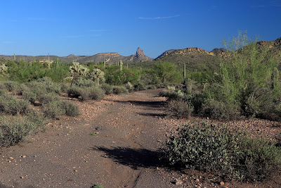
The high Sunday was 108. I needed to go for a hike, and I went out Four Peaks road because I remembered it being not-too-hot the last time I was out there. It was warmer this time, but not unbearable. I think it was only about 102 out there, which is kind of nice if you can get out of the sun. I stopped to rest in the shade of saguaros and paloverdes.


I just wandered around taking pictures of saguaros for a little while. I got back from a week in Texas on Saturday. I had spent the previous week watching the Olympics and eating ice cream. My pants are getting tight.


Well, I wasn't a couch potato the whole time. I spent an afternoon riding a boogie board in the surf. Not enough exercise to make up for a week of eating ice cream.


Click below to see all of the pictures.
2012_08_05

Friday, July 27, 2012

Four Peaks road re-opens

With the occasional shower and the higher humidity of monsoon season, the forest roads are open again. I felt like getting some pictures of saguaros so I drove out Four Peaks road. There were scattered clouds that made the landscape look interesting with shadows.


Four Peaks.


The red stripes are where leftover fire retardant was dumped.

I wanted to get away from the road (even though I didn't see anybody else out there) so I wandered in a northerly direction. I came across a crested saguaro just a few feet from the road. It's a young one.


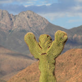
Maybe it's holding it's arms up in surrender to the knuckleheads that tried to cut it down.

I found a couple of "nests" that consist of cholla sticks and cholla balls piled into a mound. I'd sure like to know what built those.


A prickly nest.


There are a lot of nice looking saguaros out there.

The high that day was 110. It felt a little warm when I started out but it wasn't bad. By the time I started back, the sun was low enough that it didn't feel hot. I think maybe I've been hiding from the heat too much this summer.


A very strange looking saguaro. They usually aren't so thick at the bottom.

Click below to see all of the pictures.

2012_07_26