A view of Dome Mountain.
There are only a couple of mountains in Bulldog Canyon OHV area that I know of that have names. Dome Mountain is one of them. (The other is Lone Mountain.) It's also the highest peak there. I've thought about climbing it for years, but not seriously, because every view I had of it made it look like it couldn't be climbed without doing some actual rock climbing. I was just wandering around in October of 2010 and got pretty close to the peak and thought I saw a route to the top, but it hadn't been easy getting as far as I did and the rest of the route looked difficult, so I continued to wimp out.
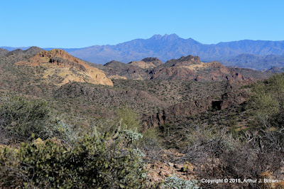
This is a view of Four Peaks from what I consider to be the halfway point. It's as far as I had gotten in 2010.
As usual, I was off work for a couple of weeks over the Christmas holiday. As is not usual, I didn't have anything but hiking planned. I was thinking about climbing Picketpost Mountain again and spending most of the two weeks gearing up to do that. I was going on long (for me) hikes with a lot of elevation gain to prepare and decided to go up to the halfway point again for the exercise. The first time I had been up there, there was a very faint trail. This time the trail was more pronounced and as I approached the halfway point, there were frequent cairns and even some white paint marks.
A cairn and a couple of paint stripes are visible in this photo.
I followed the trail up from the halfway point for a quarter mile or so, but I didn't have enough daylight, water, or snacks to go all the way to the top then. It looked like somebody had marked a trail all the way to the top, though, so I knew it could be done. I decided to concentrate on getting to the top of Dome Mountain instead of climbing Picketpost again because every time I looked at Picketpost I felt dread. Picketpost is a very steep and long hike and I wasn't looking forward to how much I would ache afterwards. I wanted perfect weather when I climbed Dome Mountain; no gloomy clouds. Perfect conditions arose on December 30.
Looking toward the Superstition Mountains from about 3/4 of the way up. There's a little haziness (pollution) in the air and it's the middle of the day, so I blame the blah-ness of the photo on that.

You can see how I really slowed down near the top in this plot of speed and elevation. It was steep and I was gasping for air. I was also going very slow in that area on the way down because it was steep and I didn't want to slip and land on a cholla.
The climb was uneventful except for the very nice views all around. I wandered around the top eating snacks, taking pictures, and relaxing until I was bored. The hike down was exciting as all steep descents on scree-covered rock are. My butt made unintentional contact with the ground only once.
From the halfway point back to the parking spot can be tricky. The cairns and paint are harder to follow in that direction. When I was up there on the 23rd I got off-trail and couldn't see how to get back to where I needed to be. I had to backtrack quite a ways. This is a warning to anybody else that heads up there. Come back in daylight and keep making sure you on on the correct route or you'll be stuck out there in the dark, which won't be so bad as long as you have a blanket and the mountain lion isn't looking for easy prey.
I made a couple of 360 panoramas from the top but they must be too many pixels. None of my viewing software can display them and I can't upload them. I'll put them on my Photosynth page someday.


