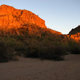
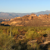
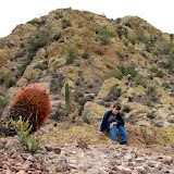
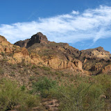
Location: Bulldog Canyon
Time and temperature: Start - 1520, 93
End - 1855, 81
Distance driven 10.6 miles
The numbers:
16 Pictures taken
3 Other people seen
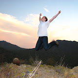
Ramblings: Maybe all I did was ride around today (except for one small side hike), but I'm worn out. I drove down 10, a road through the center of Bulldog Canyon OHV area, on my ATV. I drove down that road once before in my truck and I was very worried that I wouldn't be able to get my truck out of there. Driving down that road today, I was astonished that I had made it in my truck. Maybe it's gotten worse since then, but some spots are just the way I remembered them. I remember standing there thinking, "How the h**l am I going to get past this?" I kept going forward back then because I didn't think I would be able to climb back up some hills I had descended. Even on a nimble little ATV, there were some tricky spots. I'm worn out from all of the jostling and jerking around. My neck hurts from being jerked around. My hands are raw from hanging on with a death grip. It's a good thing I drove real slow. It was well worth it, though. I'd go again tomorrow if it weren't going to be so hot.
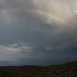
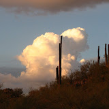
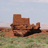
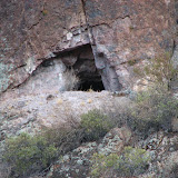
Something unusual happened. Every picture I took turned out OK. Well, you may not like them, but I do. The air was so clear I didn't even have to tweak the contrast on any of them.
On my way out there, I was worried it would be crowded on such a nice day. I didn't see anybody else until I was about to leave, though. All that incredible beauty so close to town, and I had it all to myself for most of the afternoon. That's just mind boggling.
 |
| BC_2007_09 |
P.S.
Since nobody has even gotten reasonably close to guessing the contents of the barrel, and since there are those who are grumbling about this contest being like the "riddle" that Bilbo Baggins posed to Golem to escape his clutches in that deep, dank, dark cave (anybody remember?), I will give two more clues some time in the next couple of days. I already have the clues in mind. I'm afraid it's going to be a dead giveaway, though, so I'll have to put some new rules in place.