Wednesday, December 26, 2018
The Wave Cave
A new trail has appeared in the Superstition Wilderness. It goes to the cave pictured above. I think you can figure out how it got its name.
I'm pretty sure there wasn't a trail up there when I first started hiking in that area about 12 or 14 years ago. The Wave Cave trail splits off of the Carney Springs trail. I was on the Wave Cave trail 2 or 3 years ago. I didn't follow it up to the cave back then because I didn't know it went up there and it wasn't an official trail then so there wasn't any signage.
The Wave Cave is in the canyon just to the right of the Three Sisters. I think the official trail is supposed to start at the Lost Goldmine trailhead on Peralta Road. I parked in a small lot before the Lost Goldmine trailhead that avoids a lot of pointless ups and downs and twists and turns before you get to the trail going up to the Wave Cave. Always capitalizing "Wave Cave" is making me feel a little like Trump (read his tweets). I have this strange urge to build a wall.
My truck is parked behind that black SUV in the small lot at the intersection of the 2 "roads". The hike was less than 4 miles and about 800 feet of climbing. It gets pretty steep towards the end. My GPS tracker says it's a 1000 foot climb but it also says that I was zipping around the mountain at 160mph when I was standing in the cave. Those things just don't work in caves.
Thursday, August 03, 2017
A morning hike
People also like to hike in the morning in Arizona because it's cooler. I've never liked hiking in the morning because it's still hot then and you know it's only going to get hotter. Much hotter. I tried a morning hike recently, though. I volunteered to help put up a sign in Tonto National Forest that depicted the work done to remove salt cedar, an invasive species. We started out at 8 a.m. from the Picketpost trailhead.
I didn't take any cameras. Not even my cell phone. I only carried a backpack full of water. It was a cloudless day with the high forecast to be over 105F (41C). The leader of the group walked faster than I usually do on hikes but I didn't have any trouble keeping up on the way out. After we were done with the sign we hiked a little further to where the salt cedar had been removed. It was a beautiful area and I knew I'd be back to get some pictures when the weather was cooler. We headed back to the trailhead around 10. It was brutal. The sun was too high to find shade under a saguaro. I had to slow down to keep from overheating. All I could think about was the fact that the temperature was only going up and the only escape was my air-conditioned truck. I guess I'm still not a morning hiker.
One afternoon a few weeks later it was a little cooler because there were some monsoon storms around. I drove up the canyon east of Superior the check out the waterfalls and on the way back decided to hike out to the sign we had put up.
It was very cloudy so I still wasn't going to get any good pictures. I mostly wanted to be sure I remembered how to get out there since we had deviated from the official trail. When I got close to where the sign was, I heard lots of water flowing fast.
Sunday, November 16, 2008
Guess where ...
I sat at the base of a cliff taking pictures for several minutes. During that time, my GPS data logger seems to have wandered around by itself. Suzanne said that maybe one of the hawks took it for a ride. The trip statistics say that my average speed was 8 kph and my maximum speed was 5 kph. I don't know how that's possible. Maybe because I was moving so much when I wasn't moving. Also, my minimum altitude was 91 meters below sea level. Blub, blub. Maybe being next to a cliff in a canyon blocked most of the GPS satellite signals.
I used to have the data logger set up to log my position every 6 seconds. I bumped it up to 10 seconds and that seemed to double how long the battery should last. I was thinking that might be because it doesn't write to EEPROM as often, but maybe it's because it shuts down the receiver for longer logging intervals and doesn't get as good of a fix when it comes back on. Anyway, I set it back to 6 seconds and we'll see how it does on my next adventure.
![]() |
| BC_2008_11_16 |
Saturday, November 15, 2008
Back to Bulldog Canyon
I keep saying "we". A friend and coworker went hiking with me today. We used to hike together a couple of years ago, but he got too busy with school to hike for a while. Paul is taking a break from classes now, though.
I was looking at Google Earth a couple of days ago and saw what looked like it might be a route to the top of a ridge I've been trying to get to for a few years. That's where we went today. I don't think we even got halfway up to the top of the ridge, though. That's OK. The view was terrific where we were.
Near the beginning of the hike, a couple of hawks kept flying over us and screeching. I don't know if they were screeching at us or at each other. Here's one.
| From BC_2008_11_15 |
After a while, one of them perched on this rock and watched us for a long time.
| From BC_2008_11_15 |
We stopped climbing when the trail got uncomfortably steep. This is looking up towards the ridge. It looks too steep to walk up.
| From BC_2008_11_15 |
It looks like I could walk up this way, though.
![]() |
| From BC_2008_11_15 |
Or maybe over that way.
![]() |
| From BC_2008_11_15 |
You can see Spooky Hill, Horse Shoe Mountain, Red Mountain, Fountain Hills, and a bunch of other stuff in this picture.
![]() |
| From BC_2008_11_15 |
My GPS data logger seemed to work OK. At least I didn't have any trouble downloading the data this time. My position seemed to jump around a lot, though. I think the military must have been messing with the signals or data.
![]() |
| BC_2008_11_15 |
Sunday, November 09, 2008
Bulldog Canyon is so pretty...
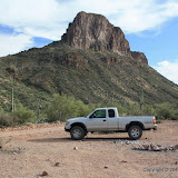
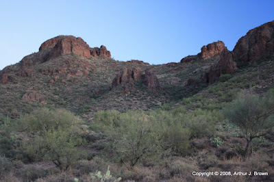
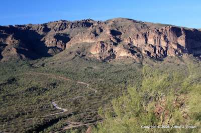
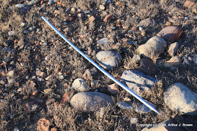
I haven't spent much time in Bulldog Canyon lately, so I decided I would hike up to the first mountain ridge I ever climbed there. I've driven to that general area several times in the past. I headed out there at about 2 in the afternoon. Along the way, there are a couple of rough spots in the road that are difficult to climb. Usually, I just lock the rear axle and drive up. That didn't work yesterday, though. I even tried getting a little bit of a run up. All I did was stir up dust. It doesn't look as steep or rocky in this picture as it does when you are driving on it.
| From BC_2008_11_08 |
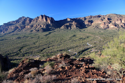
No problem, though. I was within easy walking distance of my destination. I parked and before I even opened the door, I realized that I had forgotten my backpack. Dangit. Can I even go for a hike? Well, I've got 3 bottles of water, and I can carry them in a Walgreen's bag. OK, less water than I had planned on, so I can't go as far, so I can't go to the ridge I was planning to visit. Well, I'll just wander around and maybe I'll see something interesting. As I meandered aimlessly in a generally southward direction, I glanced up here and halfway thought about seeing if I could find a way up there.
| From BC_2008_11_08 |
It wasn't long before I had forgotten about the little hindrances and was enjoying the view.
| From BC_2008_11_08 |
| From BC_2008_11_08 |
I had been cold in the morning so I was wearing a black T-shirt on the hike. It was close to 80, though, so I felt a little warm in the sun. I took advantage of what shade there was.
![]() |
| From BC_2008_11_08 |
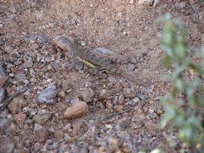
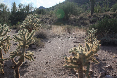
I finally got a picture of the most dangerous animal in the desert (I was attacked by them 3 times on this hike) today. They look so cute and cuddly, but don't be fooled. They lay traps all over the desert, usually in places that you might think you can finally relax, trying to twist your ankles and leave you stranded out in the middle of nowhere. I've seen coyotes, javelinas, deer, wild horses, centipedes, tarantulas, scorpions, gila monsters, and rattlesnakes on hikes. Some of them have warned me away, but none of them have laid traps for me the way this devious little fur ball does.
| From BC_2008_11_08 |
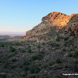
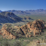
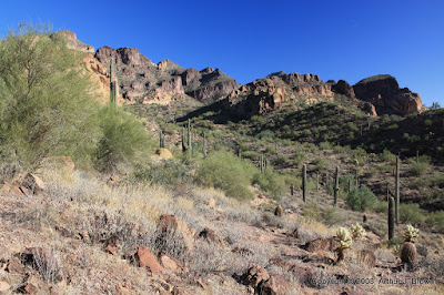
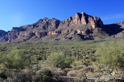
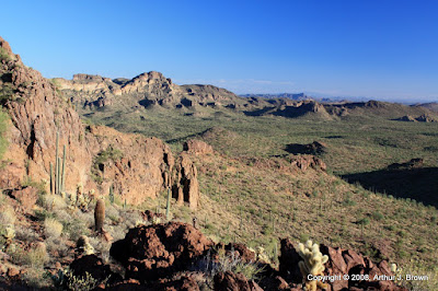
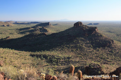
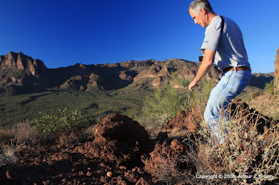
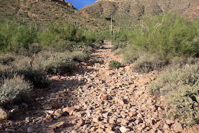
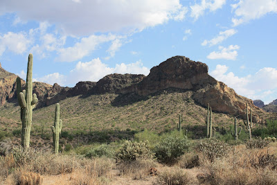
Before long, I found myself at the top of the cliffs I had half heartedly thought about climbing as I started out on this hike. It was so pretty, I got goosebumps as I stood there looking around. I knew I wouldn't be able to get a picture of it, but I had to try.
| From BC_2008_11_08 |
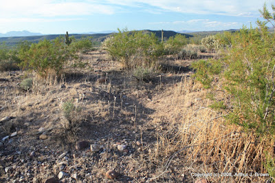
I could have walked along, taking 360 degreee panoramas every 20 or 30 feet, and still not have begun to capture what I saw. With 2D pictures, the viewer can't tell that there's a large rock in the foreground with cliffs behind it. Without something for reference (such as people) there's no sense of scale or distance. I think of saguaros as the standard candle of the desert, but they aren't always where you want them to be, and their height can vary quite a bit.
Once I got to the tops of the cliffs, it was easy to find shade. There was a light breeze up there. At first I avoided the shade, though. As soon as I would step into it, my skin would feel icy cold. Once my sweat dried, though, the shade was comfortable. People that live on the Gulf coast of Texas have no idea what I'm talking about here.
I wandered around up there for about an hour. There are a lot of small "caves" in the rock.
| From BC_2008_11_08 |
The floors of the caves are covered in powdery dirt, and that's where ant lions live.
| From BC_2008_11_08 |
Some rocks look almost hollow.
| From BC_2008_11_08 |
After a while I noticed that the sun was getting low. There would probably be enough moonlight to walk, but not enough to pick a route, and I was in an unfamiliar place. I had to start back. A lot of people that are "lost" in the desert aren't really lost in the traditional sense of the word. They know about where they are, and they know where they want to be. They just can't figure out how to get to there from here. You usually can't go in a straight line. The route you pick may be blocked by cliffs. If you don't have the provisions or stamina to explore for a route, you're doomed. From up on the cliffs, I thought I could see a couple of quick routes back to the truck. Since it would be dark soon and I had no food, flashlight, or warm clothes (all in my backback, in the garage), I had to take the path with no unknowns; the way I came up. Even doing that, I made a couple of wrong turns, but I didn't wander far from my intended route before I figured it out. I got back to the truck before it was dark and still had a bottle of water left.
When I downloaded the pictures I was, of course, disappointed. The pictures look so blah compared to being there. You'll just have to go out there with me some time.
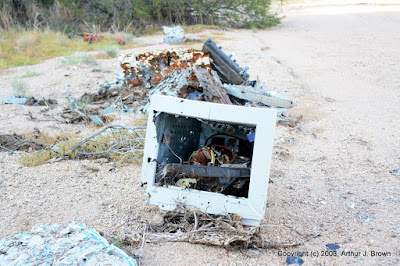
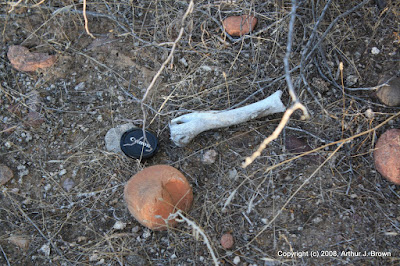
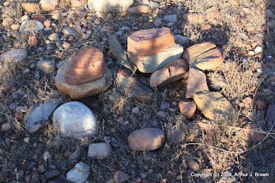
I was planning to make a trip map as I had for my last few hikes, but I ran into problems there, too. I was able to get most of the pictures geotagged, but the @trip PC software keeps crashing when I download the track. I need to write to their tech support. Their software also has a bug that corrupts file extensions of random pictures. At first I thought it was deleting my pictures, but I figured out how to recover them. There were a lot of pictures that I didn't think were worth putting on the web album, but it has 75 pictures anyway.
![]() |
| BC_2008_11_08 |
Sunday, November 02, 2008
Hewitt Canyon Rd
| From 2008_11_02 |
Anybody know what kind of cholla this is?
| From 2008_11_02 |
There are a lot of pretty rocks out there. I only took pictures of this shiny one, though.
| From 2008_11_02 |
Know what's worse than having catclaw acacia grab your forearm? Having it grab your lip after it lets go of your arm and bounces up.
| From 2008_11_02 |
This is Roblas Butte. I'd like to climb it (because it's there, and the view has got to be great up there), but it may not be possible without violating some of my hiking rules, and I'm not going to do that.
| From 2008_11_02 |
There were high, thin clouds and a few puffy little clouds. A polarizing filter and Photomatix made them look pretty good in the pictures.
![]() |
| From 2008_11_02 |
![]() |
| From 2008_11_02 |
![]() |
| 2008_11_02 |
Saturday, October 18, 2008
To the top (well, close enough)
The climbing was easier this week, too. I haven't replaced all those red blood cells yet, but at least I could climb for a couple of minutes before I was gasping for air. Another thing that made it easier is that the humidity is finally dropping. When I stopped to take a couple of pictures, my face was usually dry by the time I started moving again.
Here's a picture of where I went. If you see where some of the pictures are geotagged, you can tell that I didn't get to the very top. In the picture the summit looks like it's surrounded by vertical rock. It looks like that from up there, too.
| From Peralta_2008_10_18 |
The Superstition Mountains look nice from this angle.
| From Peralta_2008_10_18 |
It took about 55 minutes to get to the top. I spent some of that time deciding which way to go, or changing my mind and retracing my steps. There are spots up there that look like trails, but I think they are rabbit trails. You can follow them until they go under a bush. As I approached the top, the wind died completely. I was back out in the sun, too. Closer to the top, I could hear the wind blowing up there. That motivated me to hurry that last 20 feet or so. The breeze was great.
The closer I got to the top, the more determined I was to get there. The curiosity about what the view on the other side was like was driving me nuts. Here are a few pictures of the view from the "top".
| From Peralta_2008_10_18 |
| From Peralta_2008_10_18 |
| From Peralta_2008_10_18 |
| From Peralta_2008_10_18 |
I decided to get a picture of myself up there. I put the camera on the small tripod I carry in my back pack and pushed the shutter and came to a screeching halt when I realized it had already taken the picture. Oops, forgot to set the timer. Pushed the shutter again and didn't even get in front of the camera before it took the picture. Two seconds isn't long enough. I fiddled around with it for a little while trying to change it to 10 seconds before I decided I would just have to move fast. Pushed the shutter and "dashed" to get in position. Didn't make it. It isn't a good picture, but it is sort of funny.
| From Peralta_2008_10_18 |
Click below to see all of the pictures.
![]() |
| Peralta_2008_10_18 |
Monday, September 22, 2008
The other hill
Remember the mines I found on the other hill? Well, I found some copper and gold deposits on this hill. I could see lots of copper, and some of these sets look old enough that their ICs might have gold bond wires.
| From BC_2008_09_22 |
I found some bones on this hill, too.
| From BC_2008_09_22 |
I didn't find any big mines, but I did find this shallow depression that somebody made many years ago.
| From BC_2008_09_22 |
There were other signs that people had been there.
| From BC_2008_09_22 |
I don't think those people drove the vehicle that this (chrome body side molding) came off of up here, though.
| From BC_2008_09_22 |
On the highway side of the hill, there's a memorial to Joyce Ann Devree. When she died, she was two years younger than I am now. Gee, that seems so young.
| From BC_2008_09_22 |
Click below to see all of the pictures, including dead trees, fungus, breathtaking landscapes, and deformed saguaros.
Tuesday, September 09, 2008
A familiar trail
I changed clothes, looked for my cameras, ate a snack, looked for my cameras, put on my hiking boots, looked for my cameras... I was starting to wonder if they'd been stolen. They hadn't. They were right where I put them. I was going to go to a place that I would have a pretty good view of the east valley, which is where the pretty clouds were. By the time I got to the end of Meridian road, though, the east valley was completely devoid of clouds. Nothing but clear blue sky. I figured they'd be back, though.
There are things that my S3 IS can do that my Rebel can't, and vice versa. I've often wished I had the one with me that I didn't have at the time. So I decided to carry both. I bet I looked strange. I felt like I was going to be strangled by camera straps. I did wind up using them both, though.
I moseyed up the trail snapping pictures now and then. I stopped when the sun dipped behind the mountains to the west. I think I got some nice pictures.
I think Mom had plates with this design. Maybe she still does. Peggy?
| From Meridian_2008_09_09 |
Here's a picture I couldn't get with the Rebel, at least not until I get a telephoto lens.
| From Meridian_2008_09_09 |
The upper part of this trail is good ankle exercise. It used to wear me out, but I got better.
| From Meridian_2008_09_09 |
This trail really sparkles, especially at night when there is a bright moon. Here's a picture of some of the sparkly stuff.
| From Meridian_2008_09_09 |
You probably can't tell, but it's broken bottles. This trail is very easily accessible, so people stroll out here and toss their trash. The glass endures. It's especially evident at night, but you can see it all of the time.
The parking lot at the trail head is interesting. During the day there are empty vehicles in it. Around sunset, it empties. Then, after sunset, it starts to fill up again. The vehicles aren't empty now, though. I figure they have high school students in them. In Texas City they used to drive out to the levy at night to "watch the submarine races". I don't know what they call it here.
Click below to see all of the pictures.
Sunday, August 24, 2008
First pictures
I went out this afternoon to try the camera out for the first time (I was determined that the first pictures taken with this camera would NOT be of cats). As I left the house, I saw thunderstorm clouds far to the north (probably near Payson). I decided to find a nice spot in Bulldog Canyon and get some pictures of the clouds from there. I was going to hike up to the shadow on the side of this mountain and take pictures from there.
I was on the other side of the ridge in that picture a few days ago. Anyway, I parked the truck and took a look at the thermometer. 109. That couldn't be right. It was only 107 on the freeway on the way out there. Must be heat from the engine getting up to the thermometer. The operating temperature range of the camera only goes up to 105. Heck, my operating temperature range only goes up to 105. That reminds me, I was reading the owner's manual this morning and read that high temperatures can cause pictures to look grainy. Maybe that's why I've been disappointed with how some pictures turned out this summer.
I parked near a wash and walked along it for a while to where I would start climbing. It was there that I realized I had not locked the truck. I do that now and then, and usually I don't worry about it, but today I had left the S3 in the truck, so I went back to lock it. On the way back, I was trying to keep the Rebel out of the sun so it wouldn't fry. At the truck I got an umbrella to help keep the sun off the camera. I also used it to keep the sun off me.
By the time I got back to the spot to start uphill, I was sweating. Yep, it's really hot today. I'm walking on level ground and there's sweat running down my face. I started uphill and also started to really warm up. The umbrella just wasn't big enough. I always wear denim jeans when I hike, because they hold up well to things like cat claw acacia. Have you ever gotten a pair of jeans out of the dryer in the summer time and put them on and immediately thought, "That's just too hot", and taken them right off again? That's how my jeans felt in the sun. I wasn't about to take them off, though, not with all those sharp things around me. I trudged on up, trying to keep the stinging sweat out of my eyes, hiding in the shade of palo verdes and saguaros.
It isn't a very long hike to that shady spot on the side of the ridge. I'd been up there before on a day when I didn't feel like walking much. When I was about halfway there, I sat in the shade to cool off a little. My water was half gone, and I was just getting to the steep part. I still had my backup water, but it had been in the truck all day and was probably too hot to drink. I noticed that the part of the camera that was against my side was cool compared to the rest of the camera. I was being careful to keep it out of the sun, too. When I'm a heat sink for the camera, it's too darn hot. I decided to take pictures of the storm clouds from the shade of a palo verde. I turned to the north and saw scads of puffy little clouds blocking the view of the storm clouds. Rats. So I sat there for a few minutes taking pictures of the scenery.
After about 20 minutes of sitting there taking pictures, my water was getting very low. Time to head back. By the time I got back to the truck, the water was too hot to drink. A couple of flies got in the truck with me. You know how flies will fly away if you get within about 8 inches of them? I had the A/C going. I opened the window and had to physically push the flies out. I think they liked the cooler air in the truck.
I checked the thermometer. 102. That couldn't be right. It felt way hotter than that out there. Maybe some cooled air got to the sensor while I had the window open pushing flies out.
I didn't have a decent tripod with me (left it in the truck, dangit), and it was too hot to mess with figuring out how to store images in RAW format. I was able to hold the camera still enough (the fact that it takes successive pictures very quickly helps with that) to take some exposure bracketed pictures that I used to make some HDRI's. So all but one of the pictures in this album are highly processed. I didn't upload them at full resolution, either, because they aren't that great. Hopefully I'll have some good pictures soon, though. Click below to see the pictures.
![]() |
| BC_2008_08 |


