Yes, it's a zip code. I enabled the zip code layer (I forget what it's called right now) in Google Earth, and that's what shows up near an area of the Goldfield Mountains that I've been trying to get to for at least two years now. I had always approached it from the west, but that meant hiking a mile or two over rough terrain before I could start hiking where I wanted to be, and I'm just not robust enough to do that. I finally decided that the only way to get there was to wade or use a raft or small canoe to get across the Salt River. Dave told me that usually in December the Salt is pretty low and he has waded across it then. So I was planning to check it out this December. I drove by there on Saturday, though, and the river looked almost dry. Woohoo!

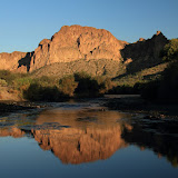
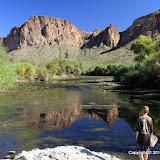
I want to get up there. You can't really tell how low the river is in this picture.

Actually, there's no water where this horse with no name is standing.

I held my camera up and this kid jumped in front of me. I took the picture because more kids were on the way. Maybe they would have made the picture more interesting, but you know me.
So I studied Google Earth carefully and picked the spots on both banks where I would cross. I packed sandals for wading and snacks and lots of water. I brought my hiking stick so I wouldn't be stumbling around in the river trying to keep my balance on the slick, round rocks. I had a plan. I was prepared.

This is the river entry point I had picked on Google Earth. As I suspected, I had to go through a tunnel through mesquites and reeds to get here. I can also see my exit point on the far bank.

My exit point, right where it should be. You can't get in and out of the river just anywhere because of the reeds.
I sat in the sand and put my sandals on and waded in. The cold water felt great. Of course, the distance to the other side was much greater than it looked, especially since I was walking on smooth rocks covered in slippery water grass.

The rocks are dry, but it's wet under them and it stinks.

A really stinky part. This would make a great picture with water in the river.

On the far bank! I'm not across the entire obstacle presented by the river, though.
Getting across the water is the biggest hurdle, but it is by no means the only one. I knew there would be lots of paths through the brush to the river on the right bank because lots of people fish there. I knew from past experience that the left bank wouldn't be as easy.

Thick trees on the left bank.
It was easier to get through the trees on the left bank than I thought it would be. Lots of paths criss-crossed through there. I had to walk in a crouch, though. There were a lot of fresh horse droppings, so maybe they (the horses) made the paths. Soon I was at the final river obstacle; a vertical bank 15 feet high. I knew there would be spots where I could walk up it. I just had to find one I could get to through the trees. It didn't take too long.

Finally, completely across the river. Find the truck!
On Google Earth, you can see a faint trail going from near the river, up into the canyon I was headed for. I was on it after I got across the river, but I missed a turn after I went between a couple of hills and lost the trail for a little while. I knew I would come across it again, though.

I felt like I was halfway to my destination. Boy, was I wrong.

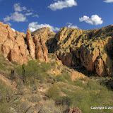
There's my canyon.
After a little while I found myself on a trail of sorts. It seemed too faint to be something that would show up on Google Earth. Maybe the Google Earth picture was taken after a wet spring. I was starting to wonder if I was following some horse trail (there was plenty of evidence that horses use the trail) when I came across a couple of cairns. Horses don't build cairns. I was on the trail.

A couple of cairns marking the trail. This part of the trail is not very well defined.
The trail was easy to follow most of the way. There were a few spots where it was too faint to be seen. Those were also the spots where there were no cairns. In those places I just went the direction that seemed right and it worked. I wanted to follow the trail because I knew that if I didn't, I would probably run into some dead ends.

The trail got very steep in the canyon. Fortunately, there was some shade.

A red tailed hawk screeched at me now and then.

This looks like an easy trail here.

This is what a lot of the trail was like, though.

There were great echoes in the canyon.
Progress in the canyon was slow. It was steep, so I kept stopping to rest and cool down. Stopping was easy. It was nice to stand there and enjoy the beautiful new scenery. Since there was a trail of sorts, I didn't have to push through much brush or dodge many cacti. That helped a lot.

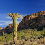
Near the top of the canyon.
As I approached the top of the canyon, I realized I was far behind my planned schedule. It had taken me about 40 minutes just to cross the river. Then it was another 2 hours to the top of the canyon. I had planned on 2 hours to get up there from the truck. I thought it would be easy to get from the top of the canyon to the cliffs overlooking the Salt River. That would involve more climbing, though, and it was quite a distance, and I was getting tired, and I knew that if I started down now it would be dark before I got back to the truck. It's not wise to be on unfamiliar trails after sunset. I wandered around a little up there, looking at all the places I wanted to go from there, and wondering how I could do it. The top of that canyon would be a cool place to pitch a tent. A 2 or 3 day hike would mean carrying a 35 pound backpack up the canyon, though. There is no water up there.

Going out there is more than I can do on this day.
A 360 degree panorama at the top of the canyon.
I got back to the river shortly after sunset. It's a little spooky going through those tunnels in the vegetation in the dark. It was a little spooking walking across that stinky river, too, but the cold water felt wonderful on my aching feet. I was really glad I had my hiking stick with me then. As tired as I was, and in the dark, I would have sat in the water several times without it. Click below to see all of the pictures.


