Thursday, December 20, 2012

Snow on Four Peaks

That's what got me distracted from what I was doing. I was headed for Picketpost Mountain. As soon as I got out of the neighborhood, though, I saw that Four Peaks had some snow on it. I decided to go get some pictures of that instead. I went out Bush Highway and stopped at a place I had stopped about 8 years ago.


There are lots of large boulders out here.

The first time I was out there was in late spring. It was hot. It was also a banner year for gnats. I was hoping to get some pictures of Saguaro Lake. I climbed up a hill expecting to be able to see the lake from the top. Silly me. I saw another hill. I clambered down and then up the next hill, expecting to see the lake. Silly me. By then I was very hot, very sweaty, and sick and tired of *!$#&^@ gnats so I left. I hadn't parked there since, until Sunday.


One more hill and I'll be able to see Four Peaks.

I think it was in the 50's this time, and there was a gentle breeze, and no bugs. I planned a route to take me closer to the lake instead of heading for the peak of the nearest hill. I stopped to take lots of pictures, so I didn't get near as tired. It was a much more pleasant experience.


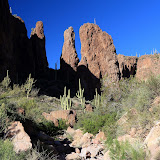
There are lots of interesting rocks and piles of rocks out there.

I came over a hill with a nice view of the lake and the mountain. The breeze had stirred up small ripples on the lake so it did a good job of reflecting the blue sky. By the time I got up there, though, clouds had moved in around Four Peaks.


People are sometimes amazed at how blue the water is in the lakes around here. They ask me if I've edited my pictures. Well, it isn't really that blue, but I don't edit the pictures. Under the right conditions it reflects the blue sky and looks really nice. Otherwise, it looks like brown lake water.

I wandered around for a while up there, taking pictures. I wasn't moving enough to stay warm in the breeze, though. I ambled back towards the truck, trying to get some good pictures of rocks along the way. I always say that being artistic is not my objective, but sometimes I wish I knew how to take a really interesting picture of a rock.


There are a couple of things about this picture that annoy me, but overall I like it.


I found a good spot to get a picture of the Stewart Mountain dam.


Never did get a good picture of Four Peaks.

Click below to see all of the pictures.

2012_12_16

Sunday, December 09, 2012

Another canyon

There's another canyon to explore near where I was last weekend. It's closer to where I park out there, too. It looks like it would be possible to walk the length of the canyon and come out the other end near Byous Butte. I ran out of time and energy before I got that far, though.


There seems to be a lot of Christmas cholla near the road.

I met a couple of guys on horseback at the beginning of the hike. I thought they might be familiar with the area and asked them if they knew anything about the two canyons. Turns out they had just been wandering around out there for the first time themselves. I told them what direction I was headed and they said I shouldn't go that way because it's very rocky. Well, if you're going to hike up a canyon out there, it's going to be rocky.


I'm going in this direction.

A short time later I came across a couple of guys that looked like Duck Dynasty cast members. I wish I had gotten a picture of them. We talked for a while about what might be out there. Turns out that was there first time out there and they didn't know anything about the area.

This canyon also had cairns every now and then. I have decided that's just somebody's idea of a joke.

I got an earlier start and so I got further than I did last weekend. The rechargable batteries I use in my PN-40 are giving out so I've been trying to use either the EveryTrail app or the Endomondo app lately. I used EveryTrail last weekend. Since I didn't have a signal when I finished the hike, I selected "upload later". I've tried several times to upload the track since then and always get an error message that says the internet connection is down. It isn't. I wrote to their tech support. No response yet. So not only can I not transfer pictures from my web albums to EveryTrail trips, I can't even upload trips now. EveryTrail seems to be going downhill. Endomondo isn't much better. It seems that if you do anything with your phone besides run the Endomondo app (e.g., read a text message), the app does unpredictable things like deciding your hike is complete, or not collecting any data for the next hour. I need to buy some more batteries for the PN-40 because it looks like all the smart phone apps are probably useless. The PN-40 only crashes once a year or so.

I checked my SPOT page when I got home yesterday. The canyon didn't seem to be that narrow, but There was over 1.5 hours between a couple of updates. Should be updates every ten minutes. Nobody that I depend on to watch that and send help if I'm incapacitated seemed to notice, though. Maybe they're just confident that I won't be doing anything stupid.


It was pretty in the canyon. There were lots of interesting formations. I took a lot of pictures but pictures taken from the bottom of a canyon just don't look very good.


The further upstream I went, the bigger the boulders in the creek bed got.

It was very quiet in the canyon. Every once in a while a cool breeze would blow through it, and it felt wonderful.


The GPS track from my PN-40 tells a story. On the way up the canyon, you can see that I stopped a lot to take pictures. You can also see that I kept going slower. That's because the boulders were getting bigger and progress was more difficult. My speed slowly picked up on the way back. I wasn't stopping to take as many pictures on the way back, but I realized that I needed to stop and rest now and then or I would stumble around because my legs were tired. I only climbed 500 or 600 feet but I did it by going up 2.1 feet, down 2 feet, up 5 feet, down 4.8 feet, etc. My top speed on the road back to the truck was lower that when I started out. I was tired.

Click below to see all of the pictures.

2012_12_08

Thursday, December 06, 2012

Exploring a canyon

I couldn't find a name for it. It's kind of small, so it may not have one. I first noticed it in November of 2008. I've been meaning to take a closer look since then, but every time I drove by there it was over 100. Too hot to go that far without knowing what was out there.


If you look at this location on Google Earth and turn on the Panoramio layer, you will see that I have a picture placed at this position.

There were at least 2 other places I wanted to go hiking on Sunday but I piddled around until it was too late to go to those places. I do that a lot and I think the reason might be that I just don't like being out in the bright mid-day sun. Makes for not-so-good pictures, too. For example, look at the next 2 pictures.


Looking back at Roblas Butte at the beginning of the hike.


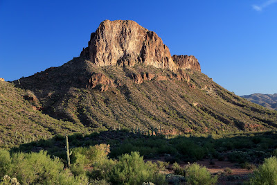
Roblas Butte near the end of the hike. I think this just looks better.

I went to the top of a couple of hills at the beginning of the hike, to see if I could pick a path to the canyon. That didn't help at all. I just went in the direction I wanted to go. Before I had gone very far, though, I came across a cairn and a very faint trail. Cool. The nice thing about following other people's trails is that people are lazy (like me) and so they have probably marked the easiest path.


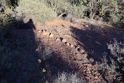
On a trail. A faint trail.

The trail was very faint and difficult to follow, so I just kept going the direction I wanted and noticed a cairn now and then. I took several pictures of the trail and you can see when you look at all of them that there isn't much there. After a little further, a large hill blocked the direction I was headed. The trail went into a creek bed there. I don't like walking in creek beds, but it looked like it might be less work than climbing over the hill. I didn't see many cairns in the creek bed. In fact, I had decided that it was late enough and I had better turn back. I was standing there taking in the scenery, drinking some water and cooling off when I spotted another cairn upstream. Well, OK, just a little further.


Another cairn beckons be onward.

I went a little further, but the creek bed seemed to be getting harder to walk in and it looked like there would be nowhere to go but up, soon. I stopped again to look around before starting back and I saw a large hole in the rock up above.


Zoomed in on the hole. It must be 4 or 5 feet in diameter.

Well, I thought it was cool. Well worth the hike to get out there. Since I had seen something new and interesting, I could head back now.


The trail was easier to follow on the way back. Maybe it showed up better with the sun at a lower angle. I hadn't noticed these borders before.

Click below to see all of the pictures.

2012_12_02