
One of my hiking companions.
I had to go kind to early in the day to be sure that I would have enough light for the hike back. I pretty much know the way now, but the weather has gotten warm enough that rattlers will be out hunting after sundown. Don't want to step on one. Anyway, the pictures look like they were taken in the middle of the day.

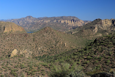
I thought I would be able to see the river by the time I got to this spot, but what I thought was water was a piece of road.
I couldn't see any of the river when I got to the spot from which I thought I should be able to see it. I thought that maybe the hills weren't as steep as I thought right there and that I would probably have to walk almost down to the river to see it. A peak to my left had shade on its east side, though, so I started wandering up there. It was about 95 and there aren't many saguaros along the way, so I had been out in the sun for a while and going uphill. I hadn't been climbing in the shade for very long when I came into view of the river.

The Salt River, looking upstream. Actually, it's more of an extension of Saguaro Lake from that dam up to the Canyon Lake dam.

Downstream view of the river.
From the top of the hill, I could see a little bit of Canyon Lake.

I could also see the Superstition Mountains in the distance.
The river didn't look nearly as interesting as I had hoped. I plan to check out some other views of the river out there if I don't decide it's too hot now. Click below to see all of the pictures.
 |
| 2013_04_28 |


No comments:
Post a Comment