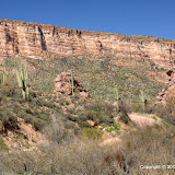
BTW, I found a map of the White Canyon Wilderness area. Wilderness.net has maps of all wilderness areas. It's pretty cool.
Battle Axe Road was rougher than it had been the last time I was on it. Rain water had cut notches through it. Parts of the road that follow a stream bed had changed quite a bit since last time. I parked as close to White Canyon as I thought I could. I didn't want to try climbing the hill out of there and finding out that I couldn't after a long, tiring hike. I could save a mile to a mile and a half of walking by going driving down that hill, though. I'll have to figure out some way of determining if it's too steep.

I was walking by the time I got to here.
The temperature was about 70 when I started out. It was nice, but I got chilled if I sat in the shade of a boulder for too long. There was plenty of shade under boulders, too. There are dump truck size boulders all over the place.
There were waterfalls scattered here and there. I got pictures of a few of them. I also took too many pictures of the stream, because that's what I do. The water is what slowed me down most of the way and eventually stopped my progress. I guess it wouldn't have mattered if I didn't mind being it ankle to thigh deep water, but it was cold. I think the water flows year round, but I think I'll see what it's doing in July. Of course, it'll be too hot to hike then.

This is where I stopped. I might have been able to get around this, but the brush was getting thick and I was tired of pushing through it.
White Canyon is beautiful. There's plenty to explore, too. I need to find a way to get through the brush, though. I wonder if machetes are allowed in wilderness areas. Catclaw grabbed me several times. The time it grabbed my armpit really hurt. That reminds me, near the beginning of the hike, a young couple was behind me. Once, I heard the girl saying, "Ow, ow ow!" I didn't see them any more after that.
Click below to see all of the pictures.
 |
| WC_2010_03_13 |


No comments:
Post a Comment