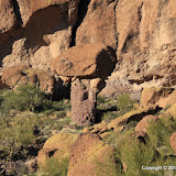
Taken in late 2005 or early 2006. I knew it was going to look bad when I took it, but I didn't have the tools to fix it back then. I estimate that this rock is 30 to 40 feet tall.
On Sunday afternoon I decided I needed to get outside and enjoy the beautiful, sunny day. My ankles were still a little achy from Saturday's hike so I didn't plan to hike, but I took my backpack just in case. At first I thought I might drive out to Superior and see what's happening out there. It's a scenic drive. As I passed through Gold Canyon I decided to drive up Peralta road, and as I drove along that road I decided I would mosey on over to the mushroom rock. I would walk slowly and turn back if my ankles hurt.
It was perfect weather for getting pictures from the uphill side of mushroom rock.
The wind was blowing pretty hard and had blown all the dust out of the valley. The sky was deep blue. I could get great pictures if I could get up to the rock.
Newman Peak was clearly visible. It's 46 miles away.
It was easy to find the mushroom rock. I see it in a lot of my pictures of that side of the Superstition Mountains. My ankles were feeling fine so I started the climb. About half way up I kept thinking that I didn't remember it being this steep. Well, I was younger then. Progress was slow. When I was within less than 500 feet, I saw that I had a deep, steep sided gully to cross or go around. That last 500 feet could take up to half an hour. I checked the time. If I moved as fast on the way back as I did on the way back and started right away, I would get back to the truck half an hour after sunset. It will be cold when the sun sets. As Kenny Whatisname sang, you gotta know when to hold 'em, and know when to fold 'em. I ate a snack and turned back. I didn't reach my goal, but I spent several hours out in a beautiful part of the desert. That's a winner.
Since I wouldn't be able to get a picture from the other side, I made a stereo picture. Crossed eyes method.
Once I was back on the trail, I still didn't want to hurry. I think hurrying is what made my ankles hurt in the first place. Also, the scenery was just too nice to hurry through it.
I like the way this mountain looks.
Soon the setting sun was giving everything a reddish tint. I corrected the white balance in the pictures. The redness you see is what it looked like.
When I got back to the truck it was getting dark and was 54 degrees. I suppose that is warm to some people but if it was 70 when you started out, it feels cold. I was putting stuff where it belonged and noticed some message on my PN-40 about not being able to get a position fix. At first I thought I might not have data for the last few hundred feet of the hike but when I downloaded the track, I found out I only had data for the first few hundred feet. I only geotagged pictures that I was able to figure out within a few feet where I was when I took them.
Oh, you might be wondering why we didn't go anywhere in the Ranger this weekend. It's in the shop. During our last outing the "check engine" light came on a couple of times, so I took it in Saturday morning. The mechanic said there had been some trouble with some wiring breaking on that model and they already had a replacement harness. Haven't heard if that's what my problem was yet, though. Click below to see all of the pictures.
 |
| 2011_01_23 |


No comments:
Post a Comment