Tuesday, February 25, 2014

Out for a stroll

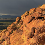
On a sunny day not too long ago, I headed out to Bulldog Canyon mainly because I needed to get some exercise and didn't want to drive very far. I headed for a hill I hadn't climbed for a few years. I had been looking at that area in Google Earth and it looked like there was a prospect just north of the hill.


I saw my first Mexican gold poppy of the season on this hike.


The hill to be climbed is in the foreground on the left; not very big.

On the way up the hill I came across a Gila monster. This is about the fifth one I've seen in the past 11 years. I vividly remember 4 of them and I think there must be a fifth that I'm forgetting right now.


I was trying to get a picture when it had its tongue out. Missed it in most of the pictures.


Google made an animated GIF of the pictures.

I could see the prospect from the top of the hill, which was close enough for me. I think I was at that prospect about 7 years ago.


The prospect. Just another shallow hole in the ground.


This looks tame, but it's exhausting to walk across.


Somebody made a large pile of large rocks near the top of the hill. Then somebody else scattered a few of the rocks.


The usual parade of WWII planes flew over.

I decided to go down to the wash on the south side of the hill and then go upstream. I had seen a desert tortoise there a few years ago so I thought I would try my luck again. When the wash got too bouldery and overgrown to continue, I continued uphill on its left bank. Oh, no desert tortoise this time.


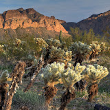
Cholla skeletons are beautiful.

It was a beautiful day, so I just kept walking and taking pictures. It eventually got too steep and rocky for easy walking. It looked like somebody might have marked a trail there. Maybe there's a route to the top. I'll have to go back another day to check that out, though. I didn't have enough water, food, or daylight to do it on this day.


The hill I came out here to climb is that little bump down there on the right.

Click below for all of the pictures.

BC_2014_02_09

Sunday, February 23, 2014

Saguaros and clouds

As I drove home from work one day, I noticed how great the clouds looked. We get a lot of blah clouds this time of year, but these were fluffy and interesting looking. I changed clothes and quickly ate a snack and went out to chase clouds.


Some fluffy clouds.
I thought about what mountains I would like to have in the pictures with the clouds, but that would pretty much limit me to taking pictures in one direction, which would get boring. So I decided to include saguaros in the pictures with the clouds. There are plenty of those around and you can take pictures of them from just about any angle.


The clouds in that direction weren't as good, but they weren't bad.

The clouds didn't look quite as good by the time I got out there, but that didn't slow me down. I left the camera turned on so I wouldn't have to keep setting up the exposure bracketing for HDRIs and wandered around taking pictures of just about everything.


A stick.


An occasional picture like this looks interesting, but they get old fast, too.


Sometimes, good saguaros aren't in positions to allow good pictures.


Sometimes, it's like they're on a stage.


The clouds got less interesting as it got later.


I heard some coyotes howling over there. They were pretty close. Of course, I never saw them.


I kept taking pictures until there wasn't enough light.


Unless you plan ahead, you may not get good saguaros in your sunset pictures.

Click below for all of the pictures.

BC_2014_02_04

Saturday, February 22, 2014

A favorite spot in Bulldog Canyon

There's an area in Bulldog Canyon where I've always enjoyed hiking. The past few times I've been there, though, was during gnat season. The gnats were so bad they drove me out. The other day when I was trying to decide where to hike, I figured I should go out there before the gnats got bad this year.


There was rain to the north, but I had a feeling it wouldn't get close to me.


I'm going up there.


Unfortunately, the clouds would be behind mountains for most of this hike.

It had been so long since I had been out there, I didn't remember the best route. There's only one way to get where I was going, though. The landscape guided me where I needed to go. I just went the hard way.


I've tried to get up there several times. Haven't found a route, yet.


A cliff edge, and the edge of the rain clouds.


The clouds look ominous. I still wasn't worried.


I've taken a lot of pictures of this view over the years.


The rocks have lots of holes up here.

It seemed to be much easier to get up there than it had years ago. I think there are a couple of reasons for that. First, I stop more often to take pictures. Rest helps. Second, I've only been up there before in very hot weather. Hiking in 100+ degree weather in a place where you can't get out of the sun is difficult.


This is a very nice view. I usually relish the breeze that blows through this spot but on this day it felt a little chilly.


I finally know how to get a halfway decent picture of the holes in that rock.


There are fluffy clouds to the south.


That rock looks almost like a mail box.

It was a pleasant, bug-free hike. I think I've climbed higher years ago than I did on this hike. It didn't seem safe to keep going. Maybe I missed a turn I had made before. Click below for all of the pictures.

2014_02_01

Sunday, February 02, 2014

Old mines

I guess you could call them mines. Is there some other name for small holes dug in the ground while looking for something valuable? I think that if they had found anything worthwhile, they would have kept digging.

There are several small mesas at the southeast corner of the intersection of Usery Pass Road and Bush Highway. I was looking for someplace to burn a few calories after work and that area is quick and easy to get to. I've been there several times in the past, but I hadn't been on all of the mesas. I headed to an area I hadn't been to before and was walking along a ridge when I looked across to another mesa and saw what looked like a spot that somebody had been digging.


The Salt River is over there.


The patrol copter.


Somebody has been digging over there.

I wasn't paying close attention when I decided to hike over to the dug-up spot, so I didn't go in quite the right direction and didn't find it. I couldn't spend much time looking because the sun was setting. Click below to open a new window with the pictures from this hike.

2014_01_22

I looked at the pictures when I got home and it was obvious that the ground had been dug up. I memorized a saguaro near the spot to use as a guide the next time I went out there, which was the next day. I easily found my destination saguaro and then the hole in the ground.


The first hole in the ground was very shallow. Yes, first.

From the hole in the ground, I could see another one a little further uphill.


The second hole was deeper and a critter had put a lot of cholla balls in it.

I went to the top of the mesa from there and wandered around a little taking pictures, then headed toward the truck. I had just started going downhill when I found another hole.


Cholla.


Sundog over Red Mountain.


Another hole. This one looks familiar.

The hole I found on the way downhill looked familiar. I was pretty sure I had seen it maybe 7 or 8 years ago. I continued downhill and found another hole that went into the side of the hill and was pretty deep. Now I was sure I had been out there before. For years I had been meaning to go back to this mine when the sun was higher in the sky to try to determine how big the inside was. I could never find it again. The first time I was out there was before I had the stuff to geotag my pictures. I had given up on ever finding it. I still need to go out there when the sun is high in the sky, though.


I think the rock dug out has this channel in it to keep the mine from filling with rain water.

Click below to open a new window with all the pictures

2014_01_23