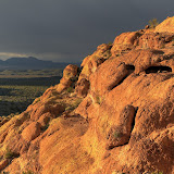
There was rain to the north, but I had a feeling it wouldn't get close to me.

Unfortunately, the clouds would be behind mountains for most of this hike.
It had been so long since I had been out there, I didn't remember the best route. There's only one way to get where I was going, though. The landscape guided me where I needed to go. I just went the hard way.

I've tried to get up there several times. Haven't found a route, yet.

A cliff edge, and the edge of the rain clouds.

The clouds look ominous. I still wasn't worried.

I've taken a lot of pictures of this view over the years.

The rocks have lots of holes up here.
It seemed to be much easier to get up there than it had years ago. I think there are a couple of reasons for that. First, I stop more often to take pictures. Rest helps. Second, I've only been up there before in very hot weather. Hiking in 100+ degree weather in a place where you can't get out of the sun is difficult.
This is a very nice view. I usually relish the breeze that blows through this spot but on this day it felt a little chilly.

I finally know how to get a halfway decent picture of the holes in that rock.

There are fluffy clouds to the south.

That rock looks almost like a mail box.
It was a pleasant, bug-free hike. I think I've climbed higher years ago than I did on this hike. It didn't seem safe to keep going. Maybe I missed a turn I had made before. Click below for all of the pictures.
 |
| 2014_02_01 |


6 comments:
Hi Art. Beautiful spot. I'm new to your Blog. Will be visiting Mesa in April and plan on taking a trip in the Bulldog Canyon mostly due to the great posts you've made about it. If you could recommend one or two areas to focus on hiking in the area - which would they be?
David
David,
Glad you enjoy the blog. There is only one official hiking trail in Bulldog Canyon OHV area that I know of. It goes to the top of Lone Mountain and isn't especially scenic but you can see a lot from up there. If you plan to drive into the area, you will need a free pass that you can get here. My favorite areas are just about anywhere along the northern half of 10 (aka Phon D Sutton) and the Willow Basin area.
Make a drive out to Tortilla Flat while you are here. Very scenic, and there are plenty of places to pull off the road and go exploring.
Thanks Art. Yes, I did get a permit from the Forest Service. I was looking at the north side along the Salt river - maybe hiking up the canyon where you took this shot: (http://www.panoramio.com/photo/43466962). It looks like a fair distance from Phon D Sutton Road though. How long would you estimate to hike to this point from the road? I'm a prairie type - not too good at estimating the speed of travel in desert if you have to bush-crash. Thanks!
I figured it out from the timestamps on photos in your album from that date. I see you approached that canyon by crossing the Salt river. I won't be doing that - too much flow by April. Instead might drive in the Willow Spring side and try getting to Black Glass Canyon - my son wants to find some obsidian. Thanks for the excellent documentation on all your photo excursions!
Sorry about the late reply. I've been traveling. Did you find the blog describing the hike up there?
Black Glass Canyon isn't on any of the maps I've looked at yet, but I haven't looked at all of them yet. I'll let you know if I've been there whenever I figure out where it is.
Found it. I actually started up that canyon a couple of years ago, but it wasn't where I intended to go and I was on a tight schedule, so I didn't explore it much. Looks like I was missing some cool stuff. I'll have to head back there again some day.
Post a Comment