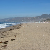
It was pretty windy. It was also surprisingly dry. I didn't know the relative humidity could get down to single digits so close to the coast. We drove up the PCH to Santa Barbara. On the way there the wind suddenly stopped and the humidity went way up. As we did touristy things in Santa Barbara, I kept looking out at the smoke blowing out over the water. I thought it was all from Malibu.
We were heading northeast from Santa Barbara and got into some smoke. It was very dark. I couldn't believe all the smoke was coming from Malibu so we turned the radio on and discovered that there were about a dozen fires burning around LA. Oh, and we were headed right for one of the fastest growing ones. We got past it without incident, and before the roads were closed. We decided to drive on back to Phoenix. I was trying to avoid LA traffic, so we were trying to skirt around the north side of LA. We had to take interstate 15 south for a few miles, though. We got on it after sunset. The road snaked downhill for miles, and it was solid red with brake lights. Yuck. I don't know if the traffic was bad because of the fires or what. We were flying again by the time we got on 215. For about the next 40 miles we were battling some fierce headwinds. Fortunately they didn't pick up much dust. We did get hit by gravel now and then. We heard on the radio that 18-wheelers were getting blown over. I was really nervous whenever we passed one.
 |
| LA_2007_10 |
Video of the Agua Dulce, or Buckweed, fire:
This NASA satellite photo shows locations of the fires. We drove past the two topmost. The Malibu fire is directly below those two.


No comments:
Post a Comment