I thought I could see a trail on Google Earth, and when I got there I found a wide path heading up the canyon. It looked like I could have driven up there. It wasn't too long before I got to some large boulders that my truck could not have gotten over, though. It seemed that somebody must have driven a bulldozer up there at some time, though. The construction of the stock tank involved moving a lot of dirt and rock. I doubt that was done by hand. I did see some large rocks along the way that had been broken into several pieces, probably from a bulldozer going over them. At one point I also saw a tire track in the sand. Somebody had driven a jeep up there not too long ago. Mine were the only human footprints I saw, though.

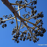
At first, it looked like it would be an easy trail to follow.
This area seemed to be more overgrown than the trail to Apache Leap. Also, there were very few cairns and they were widely space. Most trail markers seemed to consist of green tape tied in bush branches. I think that was put there by jeep drivers.

The trail splits here. I went to the right.
There was a strong breeze blowing down the canyon for most of the hike. And, like last time, I knew I was close to the cliff edge when the wind really picked up. When I got to the stock tank, there were a few cows hanging around there. By the time I pushed through the brush to get down there, I had scared the cows off.

Skittish cows.
Between the stock tank and the drop off (it isn't as much of a cliff here), somebody had built a wall by stacking up rocks. It must have taken a lot of work. Seems like it would have been easier to string barbed wire. There was a barbed wired gate in the middle of it.

Rock wall.
I felt energetic enough to take a different route back to the truck. Also, I wasn't as worried about being out here after sunset. All I had to do was go downhill until I hit the road. The route down started out easier than the route up, but it didn't stay that way. It was very overgrown. I would either have to climb over rocks or push through bushes. Climbing could lead to falling, so I pushed. Oh, there are lots of catclaw acacias out there. I was a bloody mess when I got to the truck. It's not that I got big cuts, or a lot of them. You just don't want to stop and mess with tiny scratches. I don't carry enough water to wash the blood off. So the blood trickles down my arms. When I stop to take pictures, it seems I put my arms against my body, so that gets my shirt bloody. I wanted to get a beer on the way home, but I didn't want to walk into a store looking like I did.
There was an unexpected benefit to taking the other route back. A couple of weeks ago I was thinking that I needed one of those geologist's pick things. You know, the hammer type thing they use for breaking rocks. I found one half buried in the sand. Nifty.

Just what I needed.
Click below to see all of the pictures.
 |
| 2009_06_13 |


No comments:
Post a Comment