Hackberry Mesa, via "back trails"
Map your trip with EveryTrail
I loaded up my backpack with snacks and lots of water and left the house shortly after 10. I wanted to have plenty of time to look around after going to all the effort to get out there again. On the drive to the trailhead, I thought about the fact that most people that go out there go in the morning. Sure enough, the trailhead lot was full. I think the car that got there just before me was the one that topped it off. I was a little miffed, but it turned out to be a good thing. I drove back to the overflow lot. It was at least a quarter mile walk between the two lots, and there would be traffic stirring up dust along the road. I decided I was not going to walk along that road.
An annoying thing about the trail out to Garden Valley (which is next to Hackberry Mesa) is that it takes a long detour around a ridge along the way. It's only annoying if you are in a hurry, though, because it's scenic and a very pleasant hike. While looking at Google Earth, I could see pieces of trail from the overflow lot out to Garden Valley. They aren't official trails. They aren't on maps. They don't look like they go all the way. Anyway, I decided that I would see where they did go, and maybe I would get lucky and get to Hackberry Mesa after all. At least it would be different.

The first half of the trail is in a wash.
Early on, the trail descended into a wash, and stayed there for a long ways. I assumed I was on a trail because there were a lot of footprints in the wash. There are a couple of things I don't like about being in a wash, though. First, you can't see what's around you. You miss some scenery and you can't see navigation landmarks. I could tell from the sun that I was headed in the general direction I wanted to go. Second, the soft bottom drains your energy as you walk. I try to stay on firm ground, but that isn't always possible.

I was on top of that cliff a few weeks ago.

There's an arch at the base of that cliff on the left. I'll have to go check that out some day.
Just before the wash opened up, I met a young guy going the other way. I asked him if this trail went all the way to Garden Valley. He said he didn't know anything about any gardens but assured me that I was on the trail. Not much help.

After a short distance through solid rock, the wash opened up.
I sat in the shade of a large boulder to look at my map and decide which direction to go next. I could go towards Hackberry Spring and then the western side of Hackberry Mesa. It was kind of steep over there, though. Or I could head towards Garden Valley. I knew there were some trails in that direction, but I didn't know how far they would go. I decided to head towards Garden Valley.
While I was sitting by the boulder a couple came along that seemed to be familiar with the area. I asked they guy about getting to Garden Valley or Hackberry Mesa. He said some silly, confusing stuff. I asked where they had parked and he couldn't tell me. Well, if he couldn't tell me where he parked, I didn't want to listen to anything else he had to say. Other than that, they were very nice people. Most people on the trails are.

I sat in the shade of those boulders to look at my map. The boulders are visible on Google Earth.

Hackberry Mesa is on the left, with that black line at the top.

I have a lot of trouble taking decent pictures in the middle of the day.
Before long, I found myself on a very well-worn trail. It didn't seem to be going in the exact direction I wanted to go, but maybe it would head that way, and blazing my own trail would be rough. As I followed the trail, I was thinking that I should be close to where Elephant Trunk Arch (my name for it) is. I looked to my right and there it was.

Elephant Trunk Arch from the other side.

More hikers on the trail. By now I had given up on asking people where the trail went. They looked like they had come from Garden Valley, though.
Now I was sure that the trail would take me where I wanted to go. Along the way I saw side trails that I will have to explore some day. I'm going to have to check out Hackberry Spring. It looks like it's very green in that area. There must be water there year round.

That diagonal white line back there is the trail.

I'm in Garden Valley! Now on to Hackberry Mesa.

Cholla forest in Garden Valley.
Getting on top of Hackberry Mesa from Garden Valley is pretty easy. Well, it's not too steep and you don't have to push your way through trees or bushes. The footing is sort of treacherous. The mesa is covered with angular black boulders (which I suppose is better than round boulders) with lots of grassy stuff coming up between them. Sometimes you don't want to step on the boulders because they look wobbly so you have to step in the grass, but you have no idea what's there. Sometimes it's soft dirt, sometimes it's a pointy rock, sometimes it's a wobbly rock. I lost my balance on that stuff several times and had to do some fancy footwork to keep from falling on a cholla or prickly pear. A walking stick would be handy there.

Treacherous footing.
I found the saguaros I wanted to photograph pretty easily. I wish I was more artistic, so I could have gotten a better picture of them.

They look like they're dancing.

The desert has large patches of what looks like decent soil that are completely devoid of vegetation. I don't know why that is. I wonder if the lack of rocks makes it less hospitable to plants. Maybe it dries out faster. Anyway, I saw a large antler on one of those spots. Well, large in comparison to all antlers I've seen before in the desert.

I sat on the edge of the mesa for a while enjoying the view. I could see places I've been in all directions. Well, maybe just most directions.

I didn't take many pictures of the Superstitions, because that was shooting into the sun.

I didn't take many pictures of Four Peaks, because it was directly opposite the sun. The Canyon Lake marina is visible in this photo.
I took a slightly different route on the way back and followed a wash with a solid rock bottom for a little way. The water has carved some interesting channels in it. I might go back there Sunday if it really does rain this weekend.


This hole is so deep, it still has water in it.
I had a great time on this hike. I wore myself out, though. I plan to spend today resting. Click below for all of the pictures.
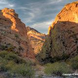 |
| 2009_11_27 |


Pass Mountain, to the south.
Near the beginning of the hike I decided that I would take pictures of Pass Mountain as I ascended. Then I thought about putting dozens of pictures of Pass Mountain (not because it's pretty, but because it's easy to photograph from lots of angles) on Panoramio so people looking at Google Earth would think that either I'm very creative or some sort of nut case. Anyway, the point is that I was stopping frequently to take pictures.

Pass Mountain from further up.
By the time I got to the top, I was tired. Much more tired than I expected to be. Maybe I had too much water in my backpack, or maybe I really am out of shape. My legs got pretty tired on the way down, too, so I think I have been spending too much time in the recliner (or office chair, or whatever).

Pass Mountain from the top of Lone Mountain. You can tell that it's gotten later, too.
The hot, dry summer has resulted in very little grassy stuff in the desert. That's the way it was when I started hiking here so that's what looks normal to me. I've taken the picture below after a wet winter and the benches can barely be seen because of the grass.

No grass to obstruct the view of these benches.
Now that I know that I'm out of shape, I'm not sure what I'll do about it. I'm sure I have more important things to worry about right now.
 |
| 2009_11_25 |

The view at the end of Meridian Road.
I slowly wandered up the side of the mountains. I thought it would be cool to get to one of the peaks, but I was just going to take it easy today. I got pretty close, though.

Lindsey, Shawna, and I were on the other side of that mountain on the left last weekend.
I went a little further than I meant to. I was really dragging by the time I got back to mostly level ground. It was a nice outing, though.

I've been on that peak.
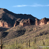 |
| 2009_11_22 |
Earlier this week, I took about 70 pictures of Emily. I wondered if I had drained the battery. I checked the battery level indicator and it said that the battery was fully charged.
Now back to today. I spent a little longer on lunch than I had planned, so when I got out to the Superstition Wilderness I walked quickly to Garden Valley. I only stopped to get out a fresh water bottle and to turn on tracking mode with my SPOT. I didn't take any pictures. I have lots of pictures along that trail already, and it was the middle of the day, too.
I got out to Garden Valley pretty quickly. There's a stock tank on the far side of Garden Valley, and that's where I left the trail. There was a wonderful breeze at the top of the dirt hill on the side of the tank and I stood there for a minute to cool off. The view of Geronimo Head and Battleship Mountain looked nice so I decided to take my first picture, but I couldn't. The battery was dead. Now I know that the battery charge indicator is totally and completely useless. I guess if you can see it, the battery isn't dead and if you can't, it is dead.

Emily has the perfect expression for lots of occasions.
Since I was already all the way out there, I went ahead and went up on top of Hackberry Mesa. The view was very nice. I tried taking a few pictures with my cell phone camera but it's such a lousy camera, I haven't even looked at them. There was one thing that I really wish I could have gotten a picture of. There was a saguaro with arms that had sagged down, and being held in those arms were the crumbling pieces of a saguaro that had been dead for a few weeks. I'd go back tomorrow for a picture of that if my legs weren't so tired (and if I could find it again).
Other than the dead battery, it was a very enjoyable hike. The weather was wonderful and except for the occasional quail (which is always nice to hear), it was very quiet.

The trail is very well maintained and easy to follow.
We started out at about 3:30. The girls complained a little but had almost no trouble with the hike. The weather was beautiful; cool with a light breeze.

The cave is in that shady spot up there.

The Fountain Hills fountain is visible from the trail. Heck, I can't think of a place it can't be seen from.

Lindsey and Shawna relaxing in the cave.
Between rest stops and picture stops, it took us about an hour to get to the top. There were people up there that got there in half an hour, then turned around and went right back down. I guess if you have got to exercise, that's a great place to do it.

We're up even with the stripe.

It isn't much of a cave, so there's a sign to let you know when you've arrived.
Click below for all of the pictures.
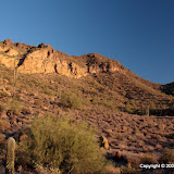 |
| 2009_11_15 |
I went to Bulldog Canyon so I could enjoy the quiet and so I wouldn't stir up the Ufologists (I thought I made that word up, but it's in my spellchecker) with flashes of light. I got everything set up and discovered something I hadn't though of beforehand. I've encountered this before, but I forgot. It's next to impossible to get a camera focused in the dark. The small LED flashlights I had with me didn't provide enough light. The flash was on the other side of the cholla, so it wasn't any help. I did the best I could to manually focus with a tiny flashlight. I'm surprised the pictures came out as good as they did, considering. I didn't know until I got home if any of them were any good, so I only took a few pictures of one cholla on this trip. Next time I'll take along my 2 million candlepower flashlight.

Something funny happened while I was out there. First a little background. I work for a big company that does all sorts of bio-medical stuff. They test their notification system every year or so by calling employee's home numbers to be sure they know how to get in touch with people in case the offices are closed down by inclement weather or something. This years test was today. Being the scatterbrain that I am, I neglected to tell anybody at home. Turns out that Lindsey was the only person at home. She called me around 6:30 or 7:00. I couldn't answer because the phone was in my backpack and I was on my way down a steep rocky slope in the dark. Her message said something like, "Dad, your company keeps calling about some emergency notification, and you're not here and you're not answering your phone. I just hope there isn't some Resident Evil s**t going on." The fact that she was watching The Mist didn't help any, either. So I called back and said, "*gasp* The nanobots ... escaped ... they're taking over! Aaauuugh!" She didn't laugh.
OK, just one more thing. Wow, lots of yakking and just one picture. Anyway, remember that I was taking pictures of a cholla. Of course, I had to walk back and forth between the camera and flash to adjust things a few times. That means I was walking around the cholla a lot. Anyway, I got home and sat down and relaxed a few minutes. Then I unlaced my boots and tried to pull one off and wow those cholla spines hurt. One of them went for at least a quarter of an inch just under the surface of the skin. I could tell by the welt it left after I pulled it out. I had at least 5 spines in my fingers but now I can only tell where one was.
Anyway, the spot where the side trail split off to go to La Barge Canyon was where I thought it was. Since it isn't a real trail, it's a little steep in spots, and difficult to follow (hard to see) in some spots. It enters the canyon about where I thought it would, just a few yards upstream of the lake.

Just around the corner to the right is where I got on Randy's "boat" to get out of the canyon.

Looking upstream from the same spot.
Last weekend, I had thought about backtracking a little ways and seeing if I could find the trail out. It was close to being dark, though. I'm not sure I would have been able to find the trail.

This is where the trail leaves the canyon. Can you see a trail? I can't.

The trail goes up there. I can't see it, though I think I can see a side trail to the side trail.
There was a nice breeze blowing through the canyon, and it was shady, so I hung around in there for a while eating snacks and taking pictures. It's a prettier place when you know the shortcut out.
For most of the time that I was there, there were some quail making quail noises. They make a lot of different kinds of noises but I don't speak quail so I don't know what they were saying. Anyway, I was wishing I had something with me to record them. I'll have to add another gadget to all the junk I carry on hikes.

Nice view of the lake on the way out.
 |
| 2009_11_08 |
The hike starts out on the Boulder Canyon Trail, which leaves from the Canyon Lake Marina parking lot. The trail climbs to the top of a large hill that affords a great view of Canyon Lake and the Superstition Wilderness Area. It slowly descends to the floor of La Barge Canyon as it continues SSE. You then follow La Barge Canyon downstream to where it enters Canyon Lake. Sounds pretty simple.

The Boulder Canyon Trail is through that opening in the white fence.

A popular fishing spot as seen from the trail.
Time for a slight digression. Not too long ago (last weekend?), I had hiked out to Garden Valley, and then across Garden Valley to a stone arch. I mentioned that a backup plan was to hike to the top of Hackberry Mesa. On this hike, I looked to the right and realized that I was looking at Hackberry Mesa from the other side. It looks so smooth from this far away, but I'm sure it isn't. Now I'm even more interested in getting up there, though. OK, now back to our regular story.

Hackberry Mesa, with Garden Valley on the other side.
I've been on the Boulder Canyon Trail a few times. The view is great from the top. I had also continued about half a mile beyond the top once, and got some great pictures of an eastern collared lizard there. I looked for more of those lizards on this hike but didn't see any. As I sat near the spot that I had seen the collared lizard, enjoying the view, the second pair of people I was to see on the trail came trotting by. They were abnormally happy. People like that make me nervous. They may be very nice people, but I just don't like to be around them very long, maybe because they conflict with my old grumpiness. We talked for a few seconds. They were making the same loop as me, but in the opposite direction. The guy asked if I was considering turning back instead of continuing. That was clue number one. I wanted to know why he asked that, but their joyful bounciness was more than I could tolerate. I just wanted them to be on their way. Mistake number one.

From here you can see where Canyon Lake goes a little ways up La Barge Canyon. I see a trail over there. That must be where I'll come out. Turns out it was, but not exactly how I thought I would.

Maybe I should have taken the trail to the right instead of the one to the left. I'm going to check out the trail to the right soon. It might be what I was looking for at the end of this hike.

The view from the top.

La Barge Canyon.
Shortly after the humongously happy couple left, I got out my map of the Superstition Wilderness. I found the trail I was on. I found where it crossed La Barge Canyon. There was no trail following La Barge Canyon back to Canyon Lake. Clue number two. I would be off-trail (no guarantees as to being able to follow a route) in a canyon (more about that later). I decided to continue on my quest. Mistake number two.
Let's go quickly to mistake number three. When I got to the floor of the canyon, I realized I had only two bottles of water left. That might not be enough to hike back the way I came. My legs were tired from the climb and descent, so I didn't want to go back that way. It should be mostly level in the canyon. If I ran out of water, I would be getting to the lake soon. I realize now that those were all silly things to think.

Three cairns mark where the Boulder Canyon Trail crosses the floor of La Barge Canyon. They are in this picture. Can you find the trail?
First of all, I was in deep, steep-sided canyon. There were usually enough GPS satellites visible for navigation. Not that I needed any navigational aid. There was no visibility to the communication satellite used by my SPOT. I put the SPOT in tracking mode when I'm hiking. My position is plotted on a map every 10 minutes. Sometimes 1 or 2 updates will be missing because of visibility issues. There was no position update for an hour and twenty minutes while I hiked through that canyon. What that means is that, if I broke a leg, I would not be able to get a "help me" message out. I would have to wait until somebody missed me and hope that they remembered to check my SPOT page to see where I might be and send help before I starved or died of exposure or bled to death internally or something like that.
"But what could happen on that level canyon floor?" you ask. Well, in a word, boulders. In this area, most were baseball size to dog house size, with a few two-car garage sized ones. You have to be very careful where you put your feet because they can roll or slip and you hurt your foot or leg, or fall and hurt something else. I think your chances of being injured are much higher walking on boulders.

Much of the canyon floor is like this; ankle breaking terrain.

Sometimes the vegetation was so thick, I couldn't see where I was putting my feet.

I didn't think I was going to find a way around this puddle.
I came across several stagnant puddles along the way. Nothing from which I dared to drink. I'm going to do some research on water purification so I'll be prepared in the future. I ran out of water a while before I got to the lake, but it was much cooler by then. I really grew to appreciate my Danner boots on that canyon floor. Despite several mishaps on the treacherous footing, my ankles felt secure. Having those boots on that hike was worth every penny I spent on them.
I encountered several different kinds of obstacles in that canyon that took a while to overcome. I spent most of the time on that hike on what I thought would be the easy part. But wait; it isn't over yet.
By the time I got to the lake, it was almost too dark for pictures. I wasn't in a mood to take pictures, anyway. I could see that there was no way I could follow the canyon along the left side of the lake finger. A little exploring showed me there was no way along the right side, either. Now what? Put my clothes, backpack, and camera in a trash back and swim out? If I got in that water, I'd probably die of hypothermia before I found a place I could get out. I seriously thought about pushing the 911 button. Oh, but that would be soooo embarrassing. Then Randy shows up. Randy was fishing from what I thought was a small boat. He offered to give me a ride to a trail. He was very polite for a person that was probably thinking that I was an idiot. It turns out that his boat was more like an inner tube in the shape of a boat. He wore waders and fins and propelled it with his legs. It's a one-man method of transportation. I wrapped my camera in my poncho and put it in the back pack. I sat on the prow with my legs along the sides, facing the rear as did Randy. It was a surprisingly long way to the trail. Randy said he'd never seen the lake that high and that it had risen a few inches while we were talking. Every time he stopped kicking, the prow sank and my butt was in the lake. My boots were also half submerged and eventually leaked. Still, I think it was better than any other options I had at the time. I gave Randy thirty soggy dollars. He said he didn't help me for money, and I know he didn't, but I'm glad he took it without a fuss.
So I stroll into the house almost 2 hours after sunset. My pants are wet from mid-shin down and the back of them is wet from the waist to the knees. Nobody asks why I'm so late. Nobody comments on me being wet. Nobody wonders why I take a shower right away or why I put my hiking clothes in the washer. I think Emily keeps everybody so busy they don't have time to notice all those little things. I'm just glad I found a way out of that canyon.
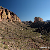 |
| 2009_11_01 |

 Posts
All Comments
Posts
All Comments


