 |
| FR80_2008_ |
Saturday, March 08, 2008
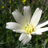
Flowers near FR80
I wanted to go someplace slightly different today, so I went out to FR80. I hadn't been there for at least a year. I had forgotten how much climbing is involved on that trail. I tried to geotag the pictures. It isn't easy, since that part of Google Earth is low resolution. The geotags are only approximate. I was mostly trying to show where the trail is. According to Google Earth, it's about 2.5 miles long one way. No wonder it takes so long. With all the twists and turns, it's probably a little longer than that. Click below for the pictures.
Subscribe to:
Post Comments (Atom)


No comments:
Post a Comment