The day started out with high thin clouds (which are bad for landscape photography), but they cleared away in the afternoon. It was cool. I forgot to check the temperature but it must have been around 60 when I started out. I was trying to hurry because I wanted to get back before sunset. I expected the temperature to drop a lot as soon as the sun was gone. Since I was hurrying, I was dripping sweat all the way up and most of the way down.
By the time I was on the way down, most of the trail was in the shadow of the Superstitions. It felt like it must have been in the 40's, but there was no breeze at all. I was still sweating, but my forearms and hands were so cold I could hardly get the lens cap on and off.
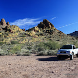
The pictures turned out OK, but I've gotten much better ones out there. I'll blame it on the time of year.
The waterfall at the end of the trail had water pouring over it. I made a short video. If you turn the sound up you will be able to hear the water splashing on the rock.
The map and pictures:
 |
| Massacre_Grounds_2008_12_20 |


No comments:
Post a Comment