For years I've felt frustrated every time I looked at the Superstition Wilderness in Google Earth. I kept asking myself, "Why don't they make the
interesting areas high resolution? Who wants to see a bunch of houses? I could tell that my brother's truck was parked in my driveway (we carpool) when the picture that included my house was taken. But so what? I wanted to be able to follow the Massacre Grounds trail. I wanted to be able to tell where I was standing when I took pictures of agave stalks against the sunset. I wanted to be able to find cool new places to hike. I wanted to be able to tell where the Canyon Lake Vista pullout was. Finally, I can. Well, I've got a lot of that stuff geotagged now, anyway. For the past week I've been looking at trails I've been on and trails I'm going to be on. Check it out.
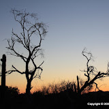
OK, moving on. It's the time of year for watching goatsuckers. No, not chupacabras. Maybe you know them as nighthawks. Also, they are mildly interesting to watch, but the really cool thing is the sounds they make. Sometimes they sound like monkeys in a jungle. I'll have to try to get a recording of them. Suzanne and I went out to listen to them tonight. Bulldog Canyon was full of people. We didn't see (or hear) a lot of nighthawks, either. We'll have to go again. I tried to take a few pictures, but it was dark and landscape pictures just don't work with a flash ;) Anyway, click below to see the pictures.


1 comment:
Congratulations. I can relate to your excitement. The exact same thing happens where i live in Alaska. Every once in a while i'm overjoyed to find out that a new valley in the mountains nearby is finally visible, or i can finally see the ACTUAL terminus (instead of the 1980 terminus) of a glacier i'm interested in visiting, and whether or not there's a lake or some other obstacle there.
Post a Comment